
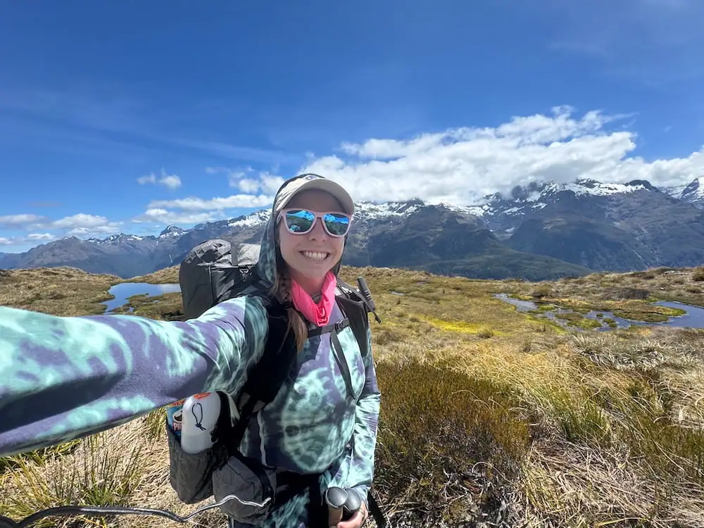
Routeburn Track in 2 Days From Te Anau: My Solo Hiking Guide

Most people hike the Routeburn Track over 3 days from Routeburn Shelter on the Glenorchy side to The Divide on the Te Anau side, but I had to do it differently.
Given how difficult it can be to get bookings on this track, I jumped at the chance when I saw availability at one of the huts. The problem? I couldn’t get a second hut booking, which meant hiking the Routeburn Track in just two days instead of the standard three.
My itinerary included one very long day with 14.5 miles (23.3 km) and 4,358 ft (1,328 m) of elevation gain. Yikes!
I remember thinking, is this actually possible? Am I completely crazy for attempting this on such a tight timeline?
To make things even more nerve-wracking, I planned to walk in the opposite direction of many people. I wasn’t sure if the climbs would be more challenging this way and worried I might be making a big mistake.
I scoured the internet searching for stories from others who had done the Routeburn Track like this but didn't find anything. Thankfully, a few hikers in Reddit threads and Facebook groups reassured me it would be ok.
And well…they were right! Walking in two days is absolutely doable, but it's not for everyone.
Was it exhausting? Absolutely. Was it worth it? Hell yea it was!
If you’ve struggled to get the ideal hut bookings for the Routeburn Track and are wondering what it's like to walk in two days, then this guide is for you. I’ll walk you through exactly how I planned it, what the long day actually felt like, and tips to keep in mind if you plan to walk over two days.
Track Overview
Here's a quick overview of the Routeburn Track:
- Total distance: 20.5 miles (33 km)
- Average days to complete: 3 days
- Total elevation gain: Approximately 4,844 ft (1,476 m)
- Campsites and huts available: Lake Mackenzie Hut and Campsite (50 hut spots, 18 campers), Routeburn Falls Hut (48 hut spots), Routeburn Flats Hut and Campsite (20 bunk spots, 30 campers)
- AllTrails map and track guide
- Department of Conservation track info
The Routeburn Track takes you through breathtaking landscapes in two of New Zealand's largest national parks: Fiordland and Tititea/Mount Aspiring. This point-to-point track can be walked in either direction, with one end located near Te Anau along Milford Road and the other end close to Glenorchy.
Along this track you can expect to see some stunning scenery as you spend several hours above the tree line with views of mountains all around you and a river valley below. If you're lucky, you might see New Zealand's notoriously cheeky alpine parrot, the kea flying around.
You'll also pass by a number of lovely waterfalls and swimming holes, including Earland Falls, Lake Mackenzie, Routeburn Falls, and Forge Flat.
I've done over half of New Zealand's Great Walks now, and I'll admit: the Routeburn is by far one of my favorites. If you only have time for one Great Walk in New Zealand, this is definitely one to consider.
Tips for Walking the Track Over Two Days
If you plan to walk the track over two days, here are my tips to help you through the journey:
- Book either Lake Mackenzie Hut or Routeburn Falls Hut. Either of these options will help break up the journey the best.
- Avoid camping! The less stuff you have to carry with you the better.
- Think carefully about your tentative walking time and look into shuttle schedules before you decide which direction to walk. Personally, I think it's best to save the shuttle pick-up for your shorter day so you aren't as stressed trying to reach it in time.
- Take lots of breaks along the way. Sitting down and taking your pack off every so often can help so much. During these breaks, drink lots of water, take in some electrolytes, and eat a snack.
- Keep an eye on weather–you can check it for Harris Saddle here. If the weather forecast looks sketchy, especially for the exposed alpine section between Lake Mackenzie Hut and Routeburn Falls Hut, you may want to reconsider your plans. The last thing you want is to be out hiking in terrible weather for your long challenging day.
- However, be prepared for any weather conditions even if the forecast looks good. You'll be very exposed on this hike so want to have plenty of sun protection as well as rain gear and warm clothing just in case.
Is it Safe to Walk the Routeburn Track Alone?
It's generally safe to walk the Routeburn Track alone, even as a woman, assuming:
- You walk during the Great Walks season for the route (November 1 – April 30)
- You are prepared for the alpine environment and have the right kind of gear for any kind of weather conditions
I walked the Routeburn Track solo in January of 2026 and felt safe the whole time, even though I was walking in the opposite direction as many other hikers.
It helps that New Zealand is one of the safest countries in the world, and there aren't any land animals that can kill you there either. You might just have to watch out for the kea that may be tempted to steal (or even destroy) your belongings.
Your biggest safety risk when out on a multi-day hike like the Routeburn is the weather. Even in summer, temperatures can drop and you should be prepared to encounter all four seasons. This is especially true on the South Island and when you're hiking in an alpine environment like this.
And while it may be tempting to try and do the walk outside of the Great Walks season if you can't get a booking, I'd strongly recommend against it unless you have extensive winter alpine, river crossing, and avalanche assessment skills. About a decade ago, a Czech couple attempted this track in winter and one of them unfortunately passed away.
Safety Tips for Doing a Great Walk Solo
Of course even if you walk in summer, you should take some extra precautions to mitigate risk any time you plan to hike alone in the wilderness. Here are some of my tips for walking the Routeburn Track solo:
- Tell someone your plans. Make sure they know when you're leaving and when you plan to return.
- Check that you have everything you need. This includes a water filter, enough food for your walk (plus some extra!), a first aid kit, and essential safety items.
- Think about carrying a satellite communication device or personal locator beacon (PLB). I always carry the Garmin inReach Mini 2 so I can get search and rescue help if needed, pull weather forecasts, and let loved ones know I've reached my destination. If you don't want to purchase something like this, then check with the Department of Conservation visitor center in Te Anau or Queenstown to see if you can rent one. Macpac in Queenstown should offer rentals as well.
- Be prepared to encounter all kinds of weather. You can experience all four seasons in a day in New Zealand. Weather can be hard to predict, so you need to make sure you have everything you might need with you for sun protection, rain, and cold weather.
- If you've never hiked solo before, consider trying it out on a more chill hike first to boost your confidence. You might want to try an easier Great Walk, or you could even just do a day hike like the iconic Roy's Peak.
Planning Your Walk
Planning your walk on the Routeburn Track can be a bit more logistically challenging than some of the other Great Walks. I've been there myself struggling to figure out how I should plan this and running way too many different scenarios through my head to try to sort it out.
Now that I've done it myself, I can confidently share some tips and information to help.
How Hard is it to Get a Booking?
The Routeburn Track is one of the most popular Great Walks and one of the hardest to book.
I made my booking in August for my walk in January. Even then, I was only able to book one night on the track.
If you really want to do this walk, then it might be best to make your booking whenever they first open up for the season, which is usually sometime in May. Just be prepared to be in a long queue. See the Department of Conservation website here for updates.
You can also keep a close eye on the booking website for cancellations. I met someone who booked the Routeburn Track just a week beforehand because she was able to snag a cancellation.
I did this when I booked the Milford Track (the hardest Great Walk to book). I was surprised to see so many cancellations every day. It may be difficult if you have a big group, but if you're going solo, it's absolutely possible.
If you can't get a booking at all, you may consider walking a portion of the track as a day hike (more on that below). Or you could even consider doing the entire track in a day; however, I wouldn't recommend that unless you're a very experienced hiker or trail runner.

When's the Best Time of Year to Walk?
It's best to walk the Routeburn Track during the Great Walks season from November through April.
If you want the best chance of good weather (and clear views), I recommend aiming to walk sometime between January and March. Those days tend to be warm and have fewer days of rain.
February looks to be the best month on average with 9 days of rain per month and an average highest temperature of 82 °F (28 °C) and lowest temperature of 30 °F (-1 °C).
Outside of the Great Walks season, New Zealand's Department of Conservation says:
“You are strongly recommended NOT to attempt this track between early May and late October (outside the Great Walks season). The winter environment in Fiordland and Mt Aspiring National Park is very cold and wet, with ice, snow, avalanches and short daylight hours.
DOC is unable to manage any hazards outside the Great Walks season. Bridges are removed, as floods and avalanches occur on these tracks during winter.
To attempt the track in winter conditions, you need to be very experienced in backcountry winter navigation, have river crossing expertise and appropriate alpine skills and equipment. Hut facilities are greatly reduced – with no cooking gas, a limited water supply and no hut wardens or emergency hut radios.”
Which is Better: Camping or Staying in the Huts?
Your decision to camp or stay in huts really comes down to personal preference. Here are some things to consider for each option:
Camping
Campsites are sometimes easier to book than the huts on the Routeburn Track. While there are fewer spots in the campsites than the huts, most walkers prefer to stay in the huts.
Camping will provide some additional privacy too since you have your own space instead of sleeping in a bunk room with dozens of other hikers.
And if you're on a budget, camping is much cheaper than staying in the huts, so that's something to consider too.
I'm sure you'd be fine, but one thing that would worry me a little bit on the Routeburn Track with camping would be the kea. They love to investigate anything new and may want to chew through your things. I'd definitely make sure you have room in your tent to keep your pack.
My dad camped on the Routeburn and found the campsites quite nice. He did meet a cheeky kea that tried to steal his shoes though.
It's worth noting that the campsites are spaced out slightly more than the huts, which means you'll have one day that's a little bit longer.
Huts
The huts on this track will provide a bit more comfort compared to camping since you'll have a normal mattress and more shelter from the elements. All the huts on this track also have flush toilets, sinks, and gas cooking ranges.
It's also nice not having to carry as much with you if you stay in huts. There's no need to bring a tent, sleeping pad, or even a cooking stove and gas.
I always appreciate getting to hear from the Department of Conservation hut warden on the Great Walks too. Each night in the huts, the warden will give a hut talk sharing information about what to expect on the trail, weather, and some details on the flora and fauna.
Which Direction Should You Walk?
You can walk the Routeburn Track in either direction. I recommend walking in the direction that makes the most sense for you based on your plans afterwards:
- If you plan to travel to Queenstown, Wānaka, the West Coast, or Mount Cook afterwards, start from The Divide Shelter on the Te Anau side
- If you plan to travel around Te Anau and Fiordland, Stewart Island, Dunedin, or the Catlins afterwards, walk in the opposite direction starting from the Glenorchy side
Many people walk starting from the Glenorchy side since that's the way the Department of Conservation suggests. I ended up walking the other way because it made more sense for me with my travel plans afterwards. I also didn't want to feel rushed trying to catch an afternoon shuttle on my long hiking day.
Elevation-wise, if you start from the Te Anau side, you have a bit more elevation gain upfront but then more time walking downhill. Whereas if you start from the Glenorchy side, you have a longer more gradual elevation profile.
Ultimately, either direction is fine, and if you're only able to get a booking for your less preferred direction, I say still go for it!
How Much Does Walking the Routeburn Track Cost?
For two days on the Routeburn Track, you can expect to spend around $197-287 NZD. This includes:
- Round-trip shuttle to and from the track: $155 NZD (price varies depending on your exact shuttle package)
- 1 night in a hut on the track (international adult, high season): $132 NZD
- OR 1 night in a campsite on the track (international adult, high season): $42 NZD
This does not include additional expenses like your gear, food, or any accommodation before or after your walk.
Track Logistics
The Routeburn Track is one of the more logistically complicated Great Walks considering it's a point-to-point walk with the ends separated by about 4.5 hours of driving.
However, this track is so special and absolutely worth the extra hassle of the logistics in my opinion!
Thankfully, with this track being so popular, there are many services available to help track walkers like you.
Note: If you're up for a bigger challenge, you could consider turning the Routeburn Track into more of a circuit, combining it with the Greenstone or Caples Track. This makes the logistics much easier as you can organize transport in and out of Glenorchy.
Getting to and From the Track
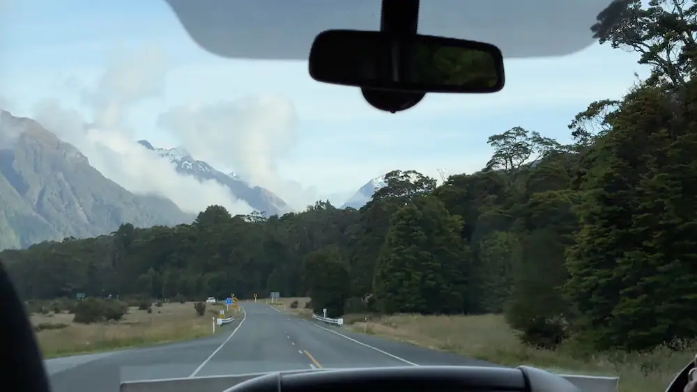
After you book your Routeburn Track walk, the first thing I recommend sorting out is your transportation to and from the track.
Most people walking the Routeburn Track choose to book shuttle transportation to take them to the start and pick them up from the end.
For this service, I recommend using Tracknet. I used them myself for both the Routeburn and Milford Tracks and had a great experience.
I decided it would make the most sense for me to leave my car in Queenstown, so from there I:
- Took a shuttle to Te Anau and spent the night there (about 2.25 hours)
- Took a shuttle the next morning to The Divide Shelter end of the Routeburn to start my walk (about 1.25 hours)
- Got picked up the following afternoon from the Routeburn Shelter end of the Routeburn Track and returned to my car in Queenstown (about 1.25 hours)
Tracknet also has shuttle services out of Te Anau.
For a more convenient option, you could also look into a car relocation service. This service will move your vehicle from one end of the trail to the other so it's there waiting for you when you finish and you don't have to worry about finishing at a certain time to make a shuttle.
A car relocation service is of course much more convenient, but it comes at a premium price, typically over $300 NZD.
Accommodation Options in Te Anau and Queenstown
You'll likely want to spend at least one night in Te Anau and/or Queenstown before or after your walk. Here are a few places I recommend:
Te Anau
📍Budget and Mid-Range Options: Te Anau Lakefront Backpackers offers affordable shared dorm and private rooms in a hostel setting. This is my go-to place to stay when I visit the area.
Te Anau Lakeview Holiday Park & Motels is another affordable place to stay in the area with a range of options from unpowered tent sites to cozy studio apartments. My dad and I enjoyed our stay here in one of their cabins.
📍Luxury Option: Radfords on the Lake is considered one of the nicest hotels in Te Anau. It's located right on the waterfront and close to the center of town. Guests rave about the spacious and comfortable apartment-style rooms.
➡️ Read more about my favorite places to stay in Te Anau.
Queenstown
📍Budget Option: Haka House Queenstown Lakefront is my favorite hostel I've stayed at in the city. It's super clean, cozy, and private with curtains on each bed while still having common areas to socialize. It's also located just close enough to the city center while being far enough removed that you don't have loud bar music blasting nearby when you're trying to sleep and parking is slightly easier too.
📍Mid-Range Option: Nomads Queenstown isn't anything flashy, but if you're looking for an affordable private room and bathroom in the city, this is often your best option. My dad and I stayed here and had a fine stay. It's in a super convenient location but note that it can be quite noisy in the area on some nights.
📍Luxury Option: If you want to really treat yourself before or after your walk, check out Hulbert House. This 8-bedroom luxury boutique lodge is located in a restored Victorian villa with elegant rooms and beautiful views of Lake Wakatipu and the surrounding mountains and gardens. Guests rave about how the staff here really go above and beyond to help make their stays special.
Purchasing Food and Gear for Your Walk
If you need to purchase any food or gear (or even rent some gear) before your walk, here are a few places where you can do so in Te Anau and Queenstown.
Te Anau
For food, the FreshChoice grocery store is the largest in town. They have a fairly large stock of dehydrated backpacking meals and other food items you might like on your trek.
Personally, I love the peanut butter slugs (individual peanut butter packets) and some of the cheese and cracker options that you can find there.
You can also find some food and gear at the Fiordland National Park Visitor Center there and Outside Sports. At Outside Sports, you can also rent gear like backpacks, sleeping bags, cooking pots, and more. I met some folks on one of my Great Walks who did this.
Queenstown
If you have a car, you may want to drive out of town a bit near the airport to the PAK'nSAVE. This is considered New Zealand's most affordable grocery store and usually has a decent selection of backpacking dehydrated meals.
If you don't have a car, don't worry. There's a Four Square in the town center that you can easily reach on foot. The selection may be more limited, so you might need to check out some other places for dehydrated backpacking meals (as well as gear) like Macpac, Kathmandu, Outside Sports, or the Queenstown Visitor Center.
You can rent gear from Outside Sports and I'm sure from a handful of other sports stores in town.
Packing for the Routeburn Track
Here's a high-level packing list for the Routeburn Track with links to some of the gear I use myself:
- Sleeping bag or quilt–If you go with a quilt, then I would also bring a sleeping bag liner if you stay in the huts.
- Sleeping pad (if camping)
- Tent (if camping)
- Food for all the days you're walking plus one extra day–Popular dehydrated meal brands in New Zealand are Real Meals, Back Country Cuisine, and Radix.
- Cooking pot
- Cooking stove and lighter or matches (if camping; optional for huts)
- First aid kit
- Safety items–make sure you have the 10 essentials
- Headlamp–I've linked the one I use, which is highly rated, but I wish it had a brighter red light for looking for kiwi birds.
- Pillow (optional)
- Set of thermal underwear
- Pair of dry socks for sleeping
- Pair of shorts (optional)–These are for the hut if it's warm inside and/or for keeping your pants from getting too muddy.
- Rain gear
- Warm layers
- Extra pair of shoes for camp/huts
- Earplugs and eye mask (optional)
- Power bank and charging cords (optional)
- Toiletries (don't forget sunscreen and bug spray)
Walking the Routeburn Track in 2 Days
So what's it like to walk the Routeburn Track in just two days from the Te Anau side to the Glenorchy side?
I'll walk you through my journey here so you can know what to expect. However, know that you don't have to follow this exact itinerary. Feel free to adjust it to fit your needs.
Day 1: The Divide Shelter to Routeburn Falls Hut
Total Distance: 14.5 miles (23.3 km)
Estimated Elevation Gain: 4,358 ft (1,328 m)
Approximate Walking Time: 9-11.5 hours
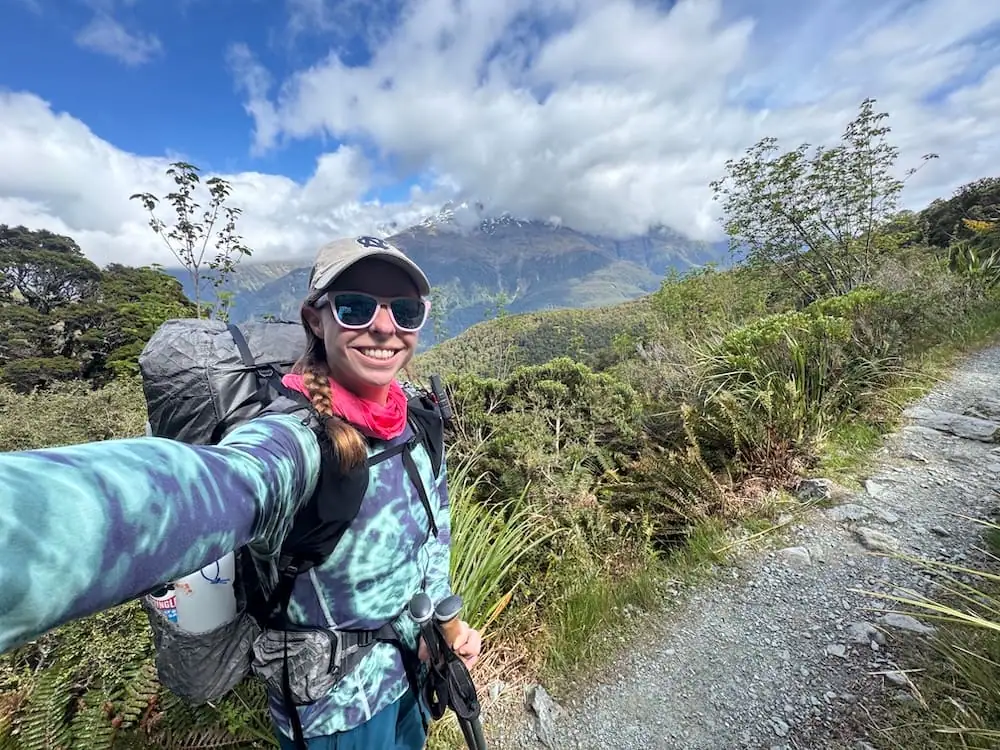
As you leave The Divide car park, you enter into forest and start your slow journey uphill. Along the way, you'll be treated with the occasional views through the trees that get better and better as you continue your ascent.
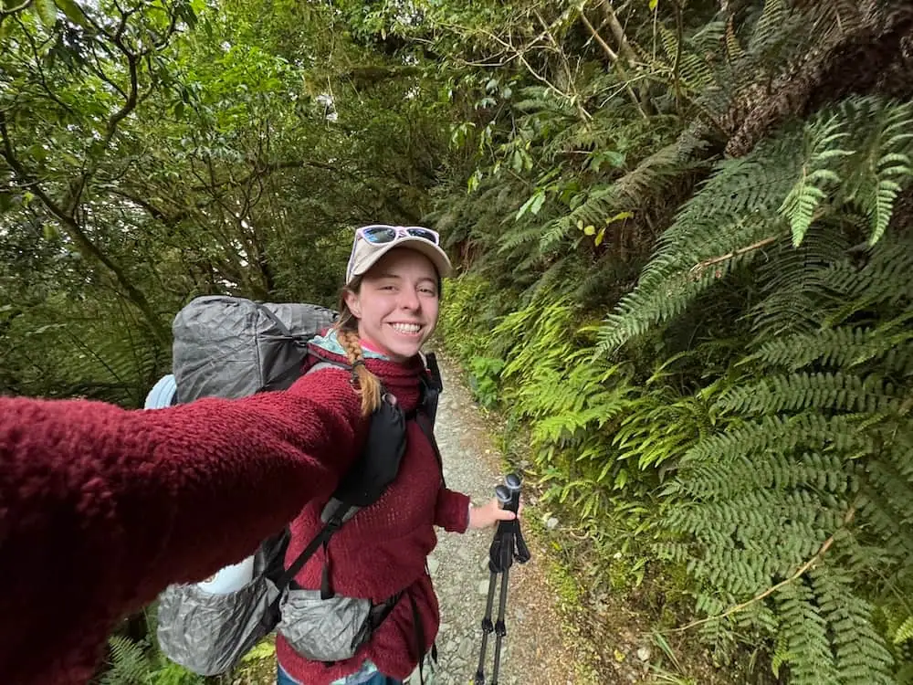
To me, this start of the journey felt pretty calm and relaxed. I found myself a little out of breath at times, but the inclines weren't too bad.
Optional Side Trip to Key Summit
About an hour or so into your journey, you'll reach the turn off for Key Summit. This is an optional side trip that offers spectacular views if there are clear skies.
I opted out of the Key Summit hike since it was such a long hiking day, but I returned later and really enjoyed it. I didn't find it to be too strenuous of a journey, but it does add about 1-1.5 hours to your trip.
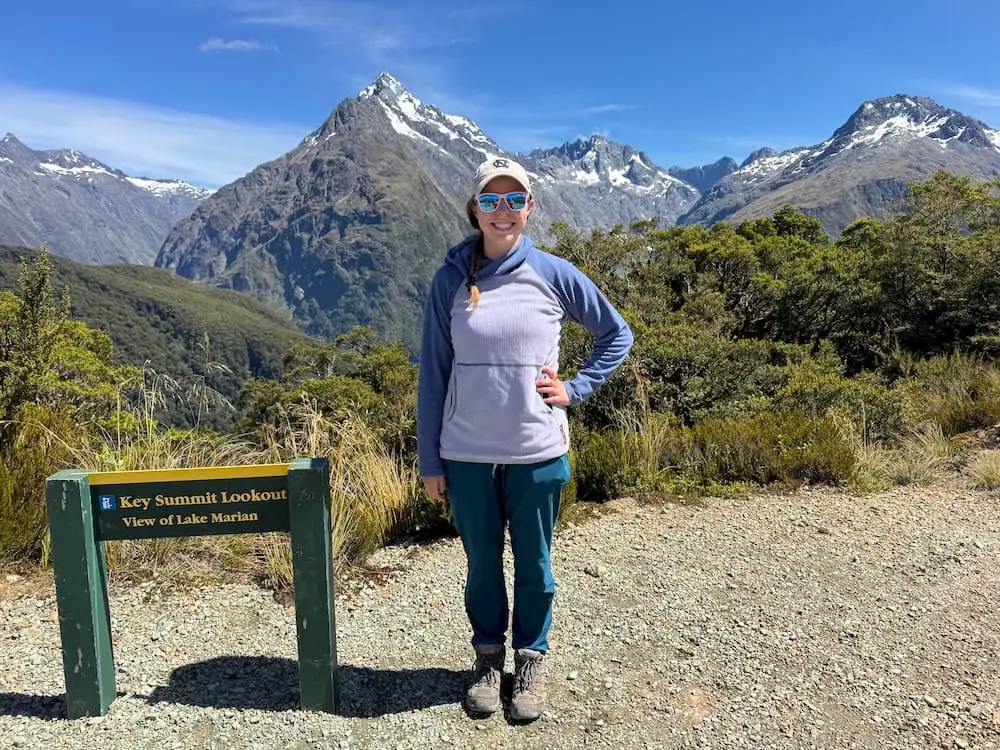
From the top of Key Summit, you get 360 views of Firodland's mountains and you can even see Lake Marian in the distance.
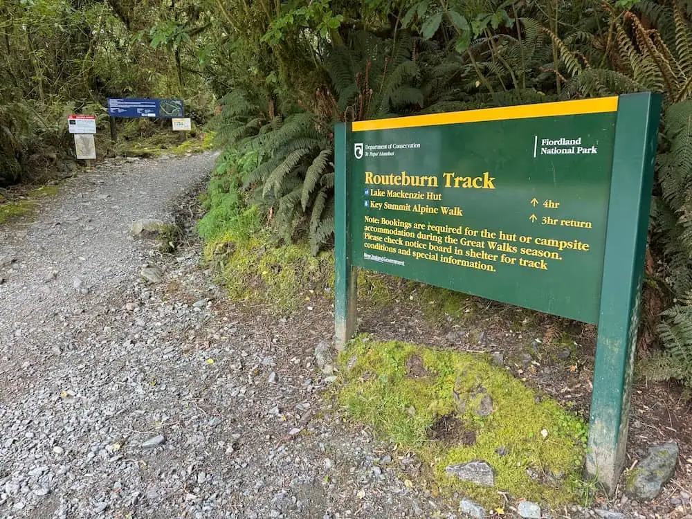
Taking a Break at Lake Howden
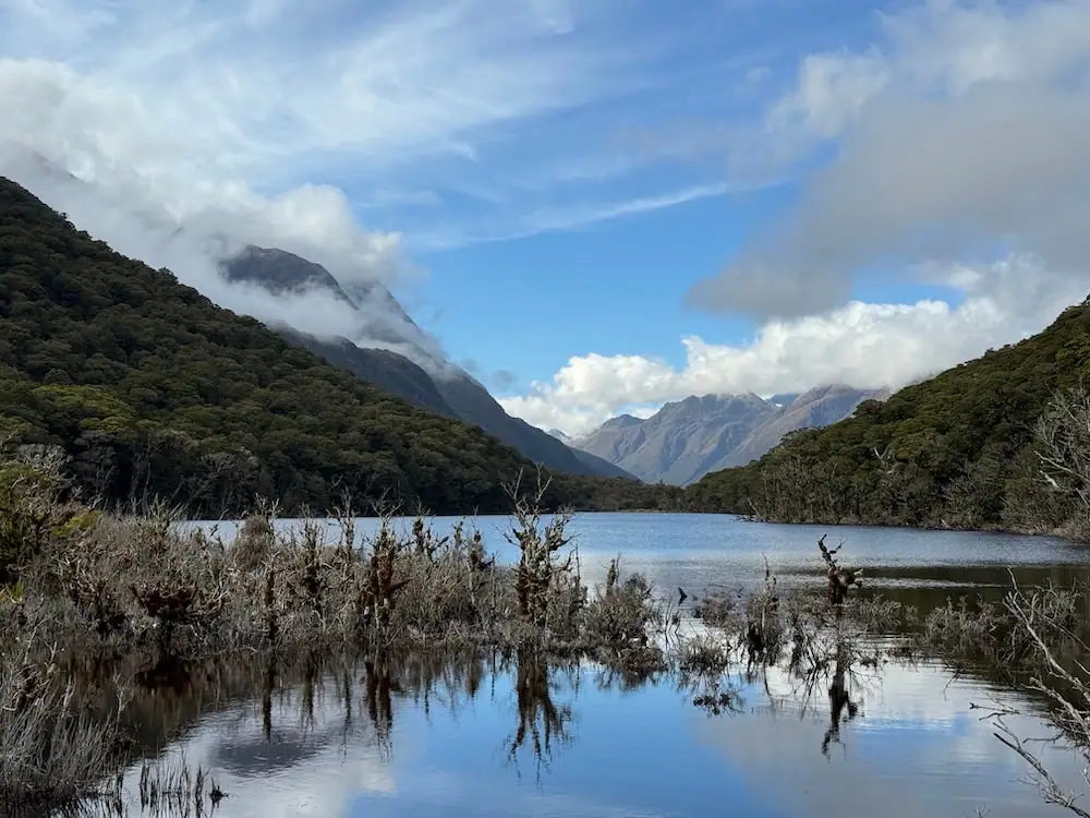
Shortly after the Key Summit turn off, you'll reach a clearing with Lake Howden, a shelter, and a pit toilet. This is a great place for a quick break before continuing onward.
Note that beyond this point from May to October there is often a serious risk of avalanche and the route can become impassible due to winter conditions.
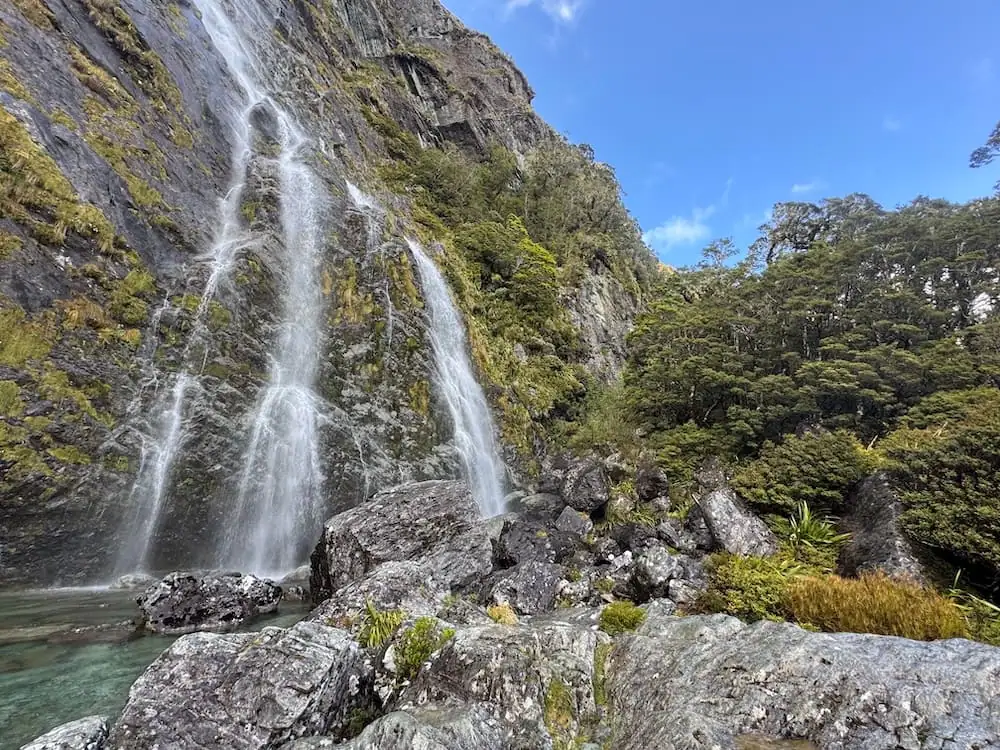
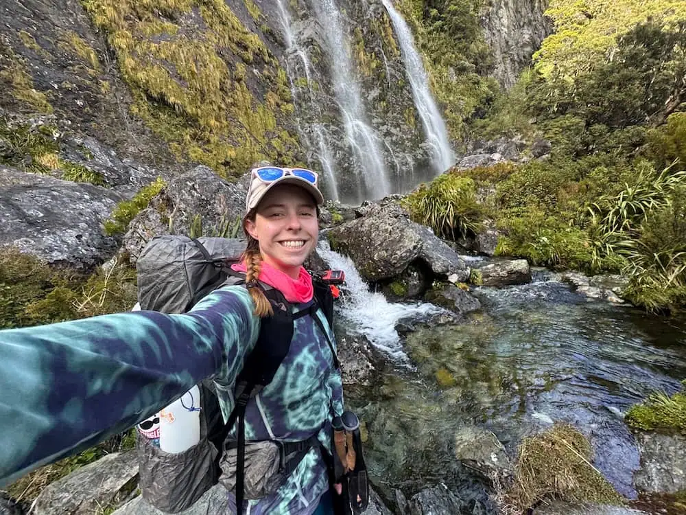
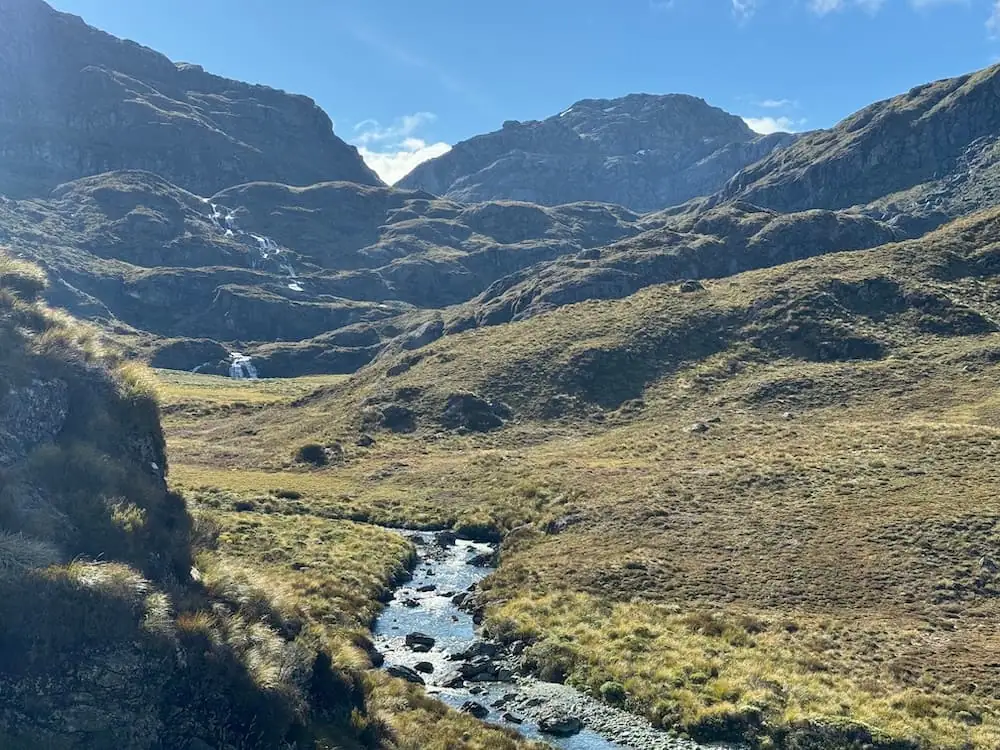
Earland Falls
From Lake Howden, it's about another 3 hours or so until you reach Lake Mackenzie Hut, much of the way through forest.
A highlight on this stretch is getting to see the spectacular Earland Falls. I was amazed at how close you can get to the falls as the track runs quite close to the base of them.
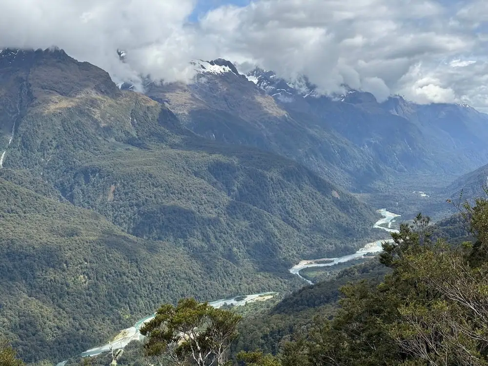
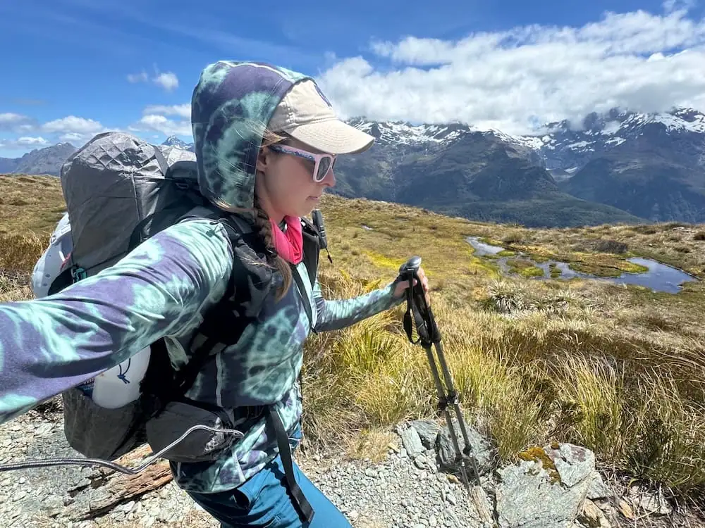
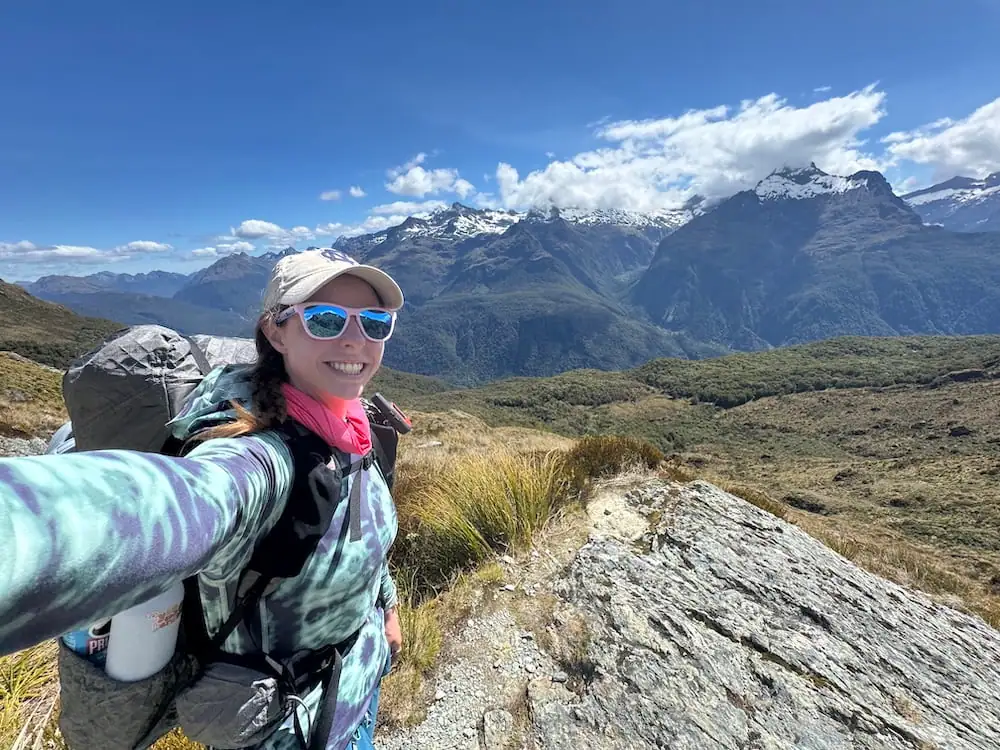
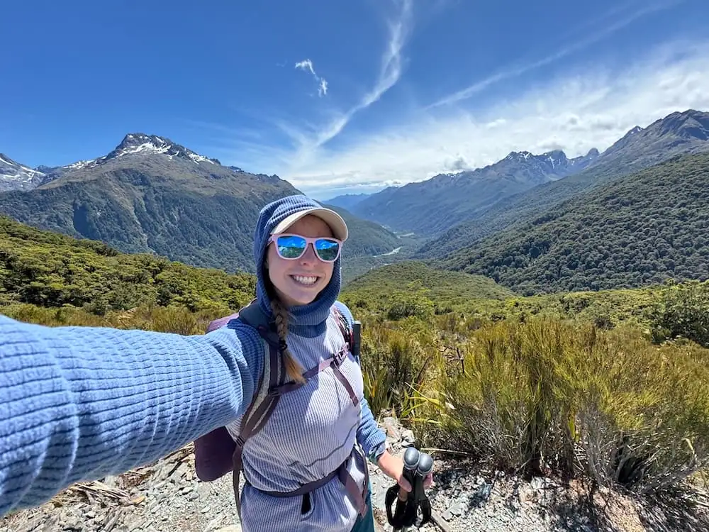
As you leave the falls and continue your climb up, you start to get fantastic views of the surrounding mountains and Hollyford Valley below. These views really kept me going as I started feeling a bit tired and just ready to reach this first big stop on my journey.
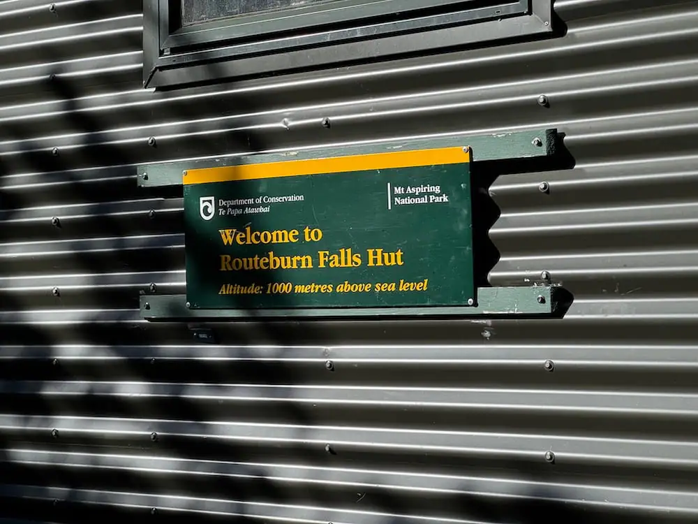
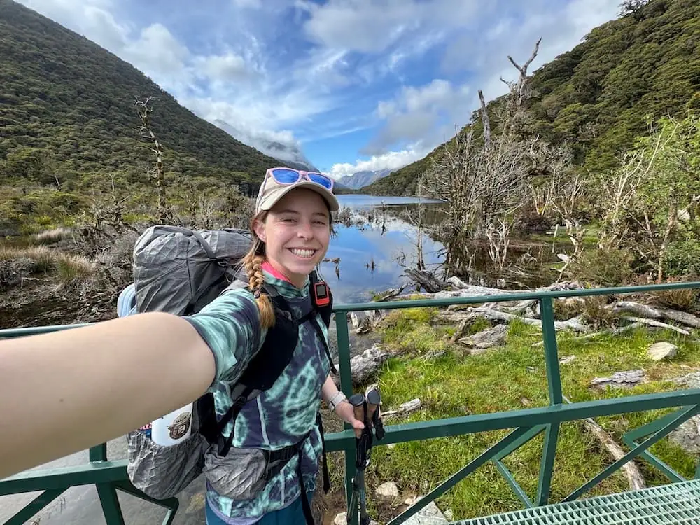
Lake Mackenzie Hut
After a total hike of 7.5 miles (12 km), you'll reach Lake Mackenzie Hut. Situated next to the vibrant blue-green waters of Lake Mackenzie with mountain views all around, this hut looks like a lovely place to stay.
I enjoyed sitting by the lake for a bit and admiring the views while eating my lunch. I saw a little weka walking around the camp, but thankfully it didn't seem too interested in me and my food. I wish I could say the same for the weka in Abel Tasman…
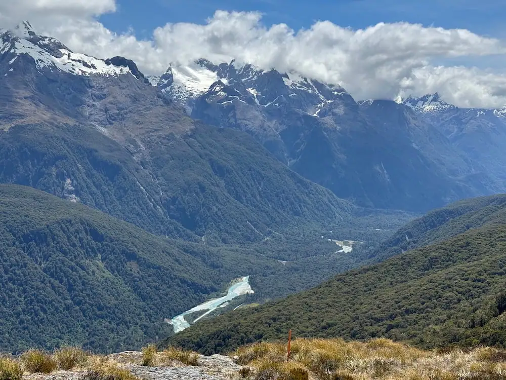
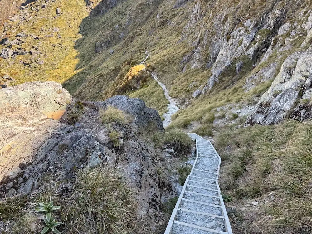
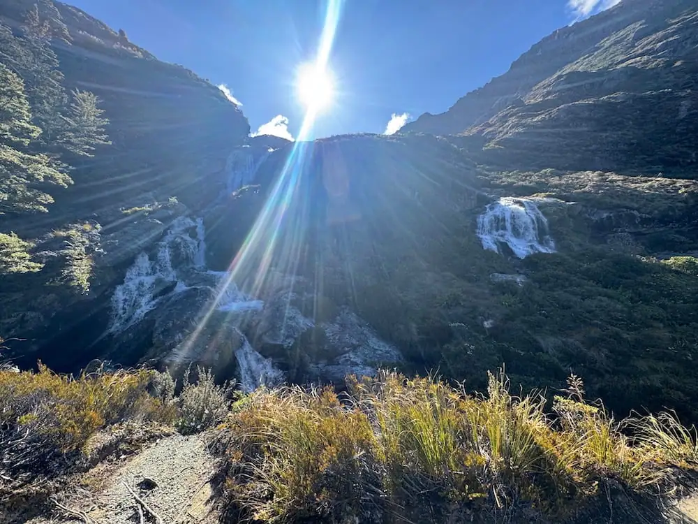
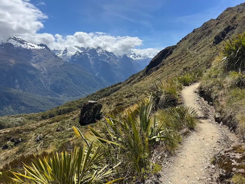
The Climb to Harris Saddle
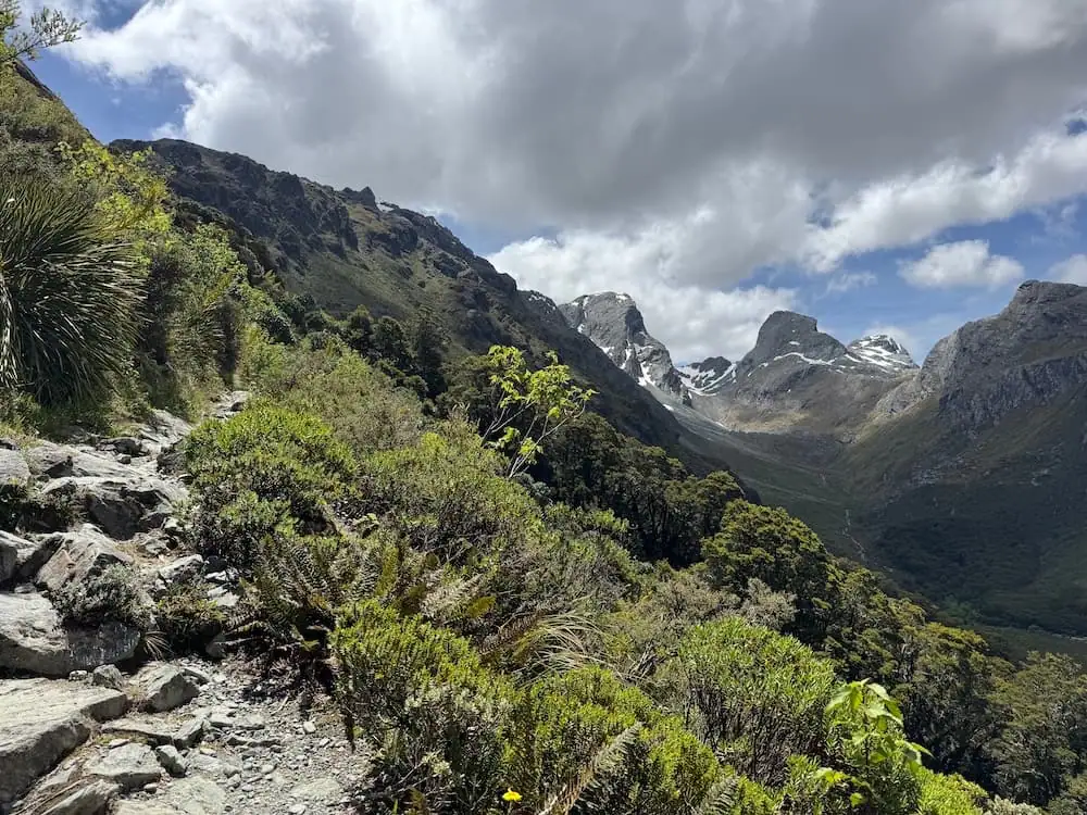
From Lake Mackenzie Hut, the ascent gets much steeper and more challenging. I found myself moving much more slowly during this part of the hike.
To be fair though, I also stopped to take a million photos because this is the best part of the Routeburn Track if you ask me.
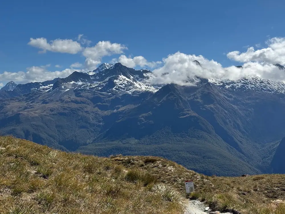
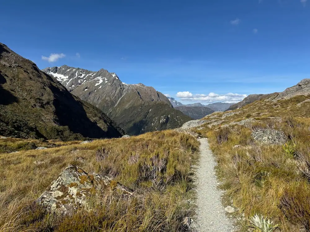
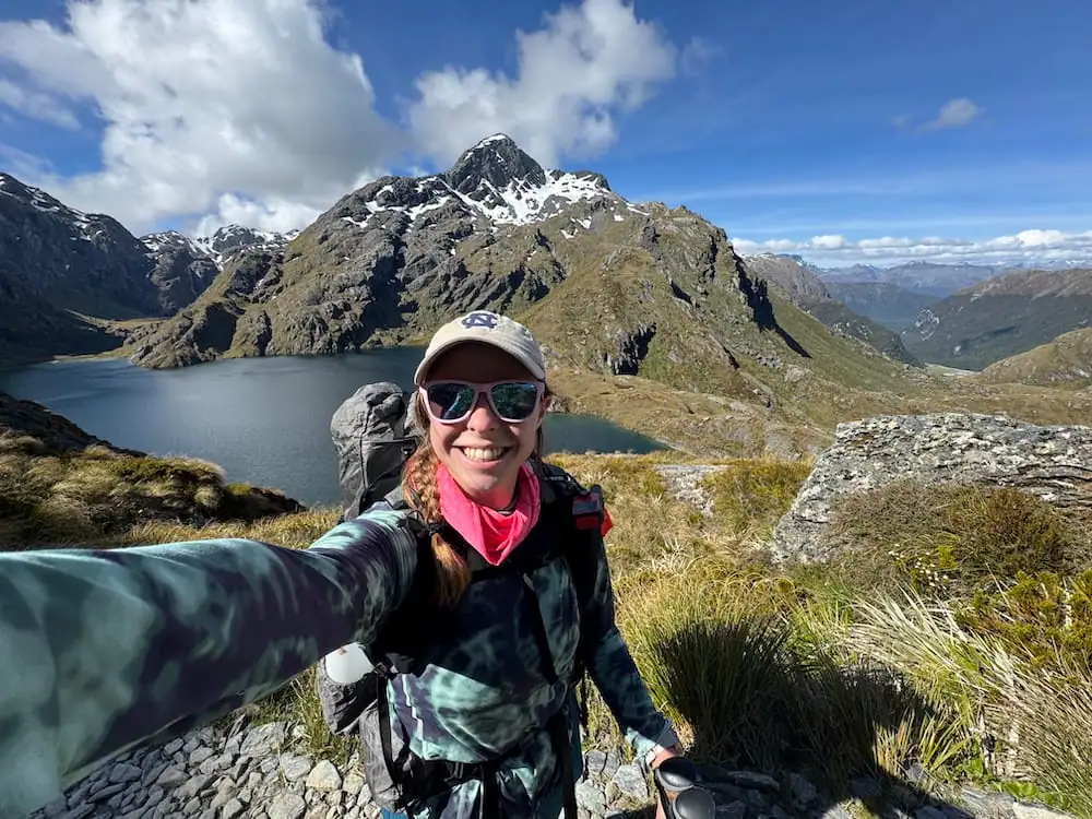
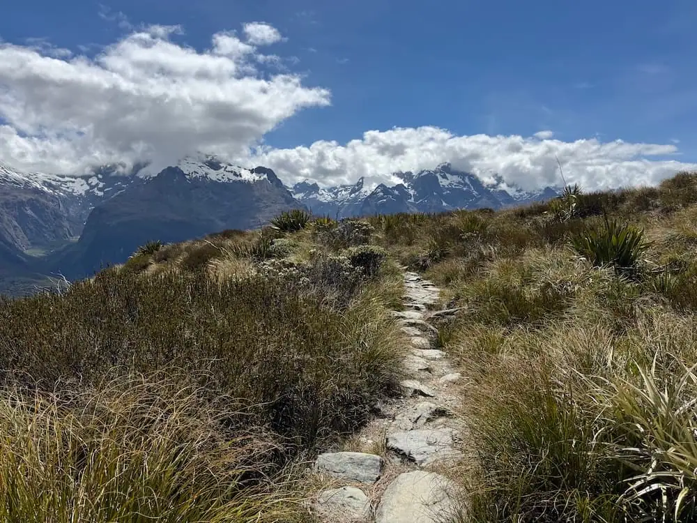
If you have a clear day, this entire stretch between Lake Mackenzie and Harris Saddle offers some of the most amazing views I've seen on any of New Zealand's Great Walks.
At the start of this stretch, you get a cool view of Lake Mackenzie and the hut down below. As you continue onwards, the trail wraps around the side of the mountains and you get more views of the Hollyford Valley and surrounding Darran Mountains.
I felt myself in absolute awe during this walk. I kept thinking to myself, THIS is why people love this country so much. THIS is why I came to New Zealand.
That said, as I continued along this stretch for a while, I really started feeling ready to be done for the day. It didn't help that it was super sunny and hot too.
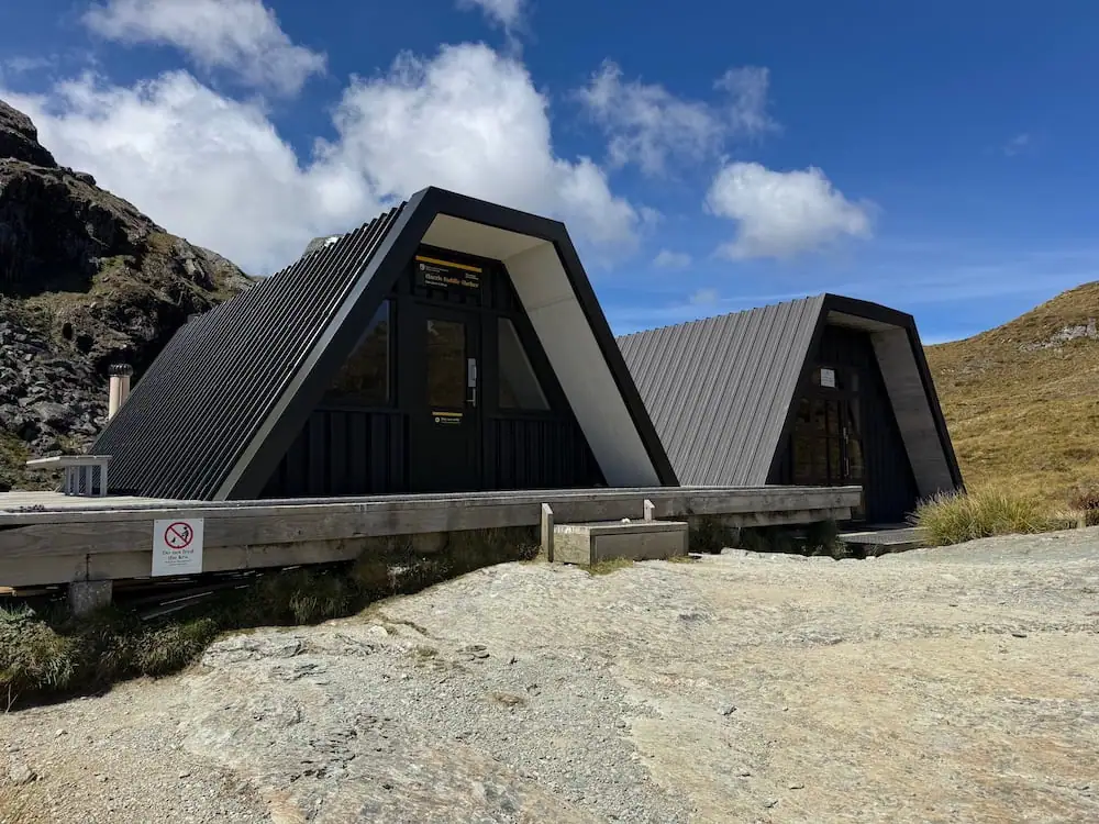
Harris Saddle Shelter
Finally, after almost eight hours since my journey began, I reached the Harris Saddle Shelter. I was happy to finally get to sit and take cover from the sun for a bit so jumped inside one of the shelters for a quick rest and a snack.
As I popped out, I heard the iconic call of New Zealand's alpine parrot and saw a kea flying high above me.
This shelter is really just for day use and emergency overnight use only. It's a good place to stop before you start your descent down from the saddle.
On a clear day, I've heard the Conical Hill side trip from here can be quite nice. It adds about 1.5-2 hours though, and I definitely didn't have that kind of energy or time. I took one look at the towering stairs of that track and felt immense relief when I realized they were for the side trip.
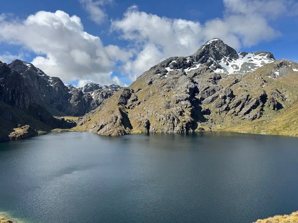
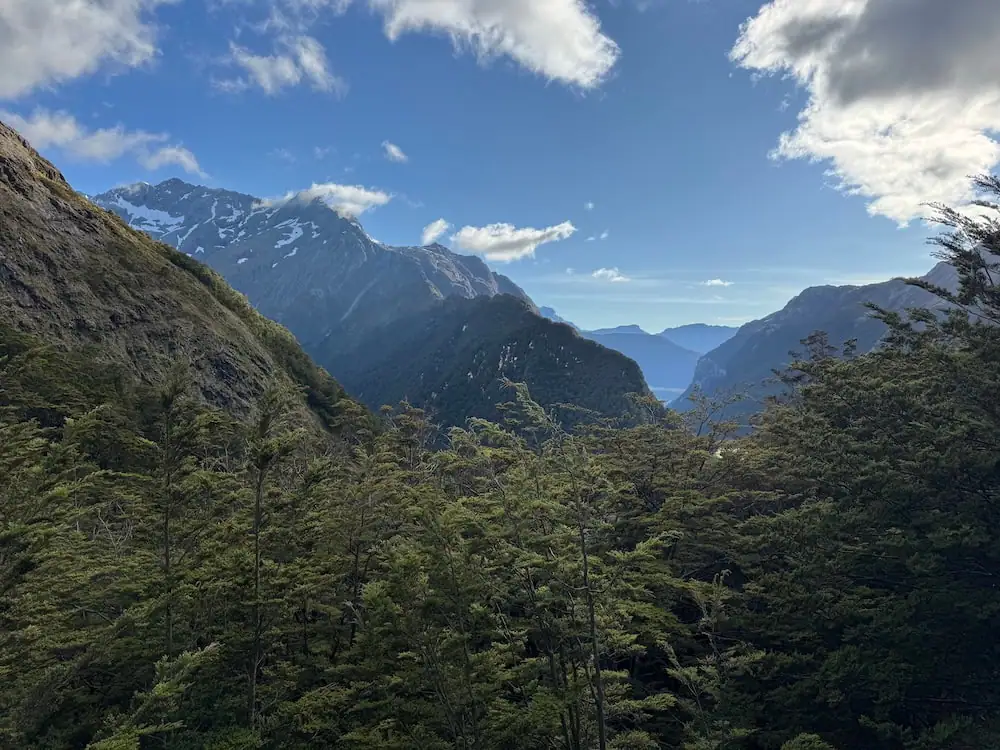
The Descent to Routeburn Falls
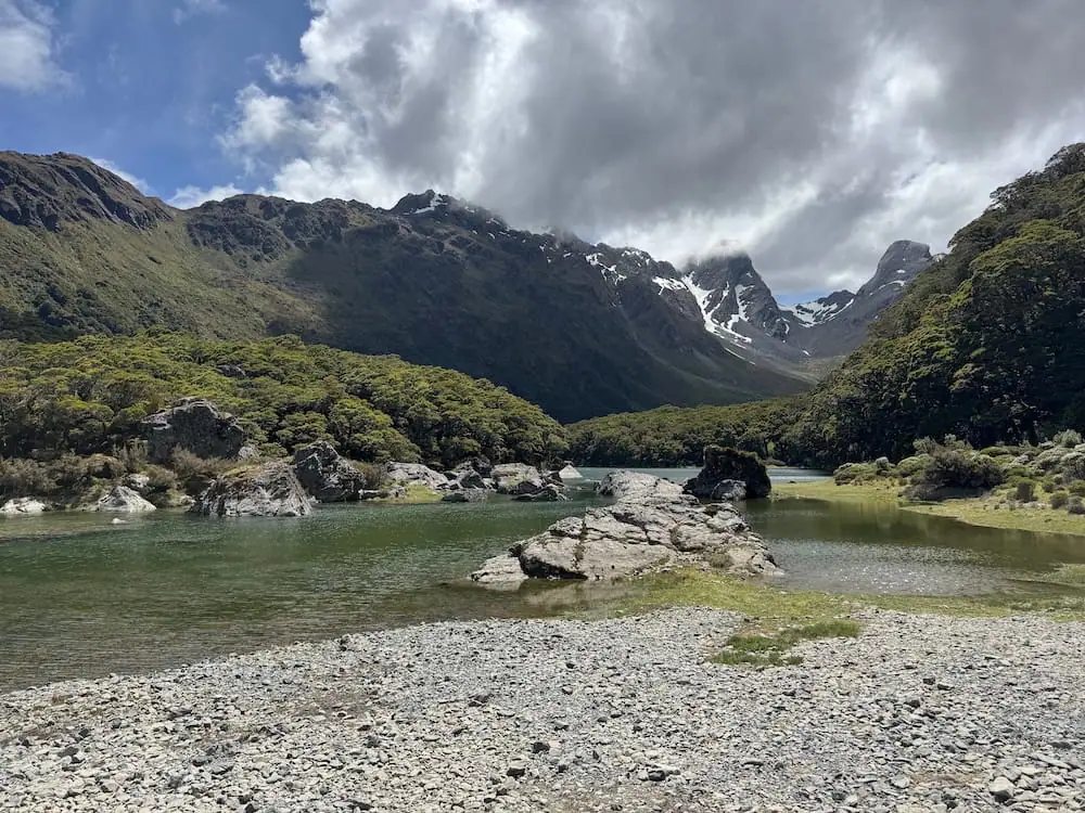
As you leave the shelter, you get lovely views of Lake Harris. Fortunately for me, the downhill wasn't too bad either as there are lots of steps built into the trail that make it a bit easier.
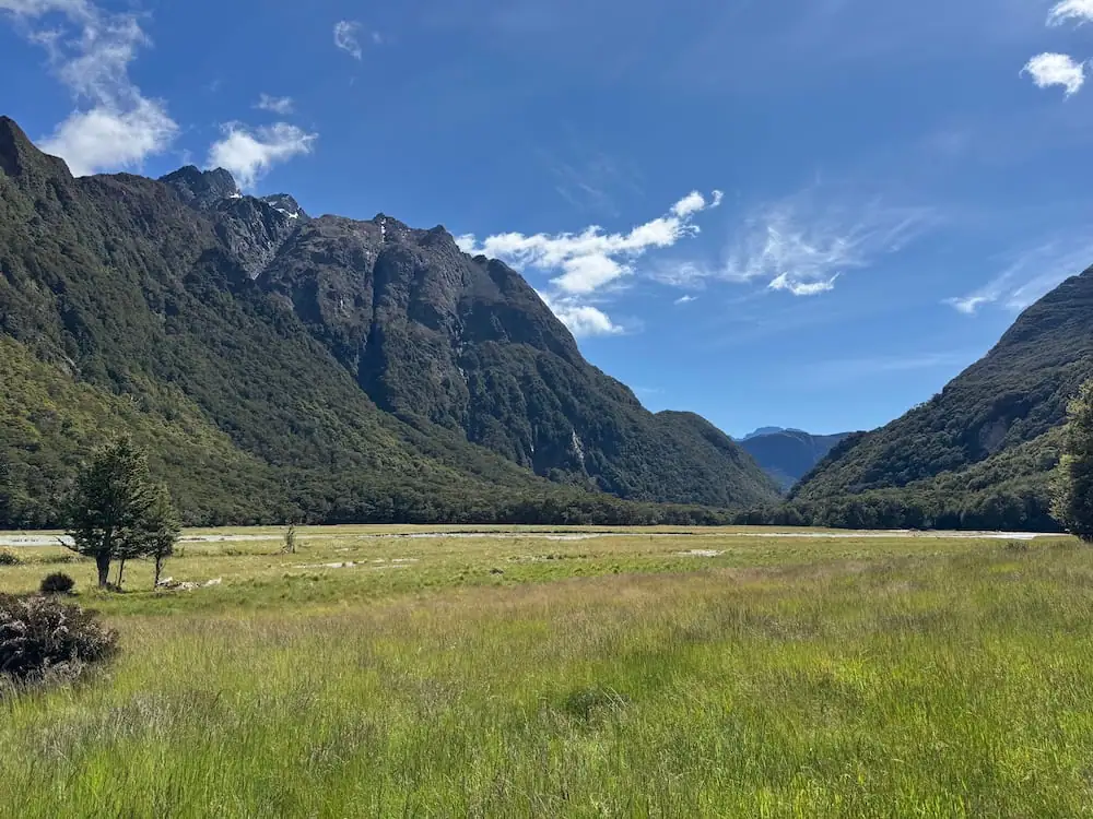
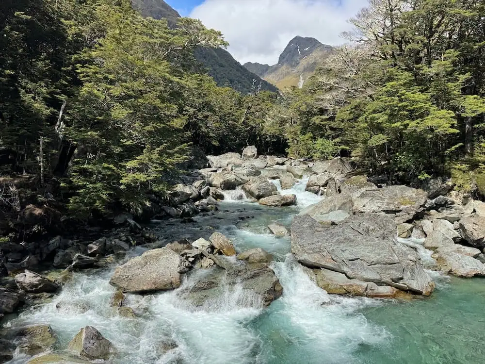
You'll continue your walk through a bit of a grassy clearing near a branch of the Route Burn, a river passing through the region for which the trail got its name.
There are some smaller waterfalls on your way down until you reach Routeburn Falls and Routeburn Falls Hut, located 7.0 miles (11.3 km) from Lake Mackenzie Hut.
I took a moment to appreciate the power of the falls before finally checking in to the hut a little over 10 hours after starting my walk. I don't know if I've ever felt happier to finally reach a hut after a long day of tramping.
I was the last one to arrive so didn't really have the time, or frankly the energy, to make friends. I just appreciated finally getting to rest, eat some food, enjoy the views, and go to bed early.
Day 2: Routeburn Falls Hut to Routeburn Shelter
Total Distance: 6.1 miles (9.8 km)
Estimated Elevation Gain: 486 ft (148 m)
Approximate Walking Time: 3-4 hours
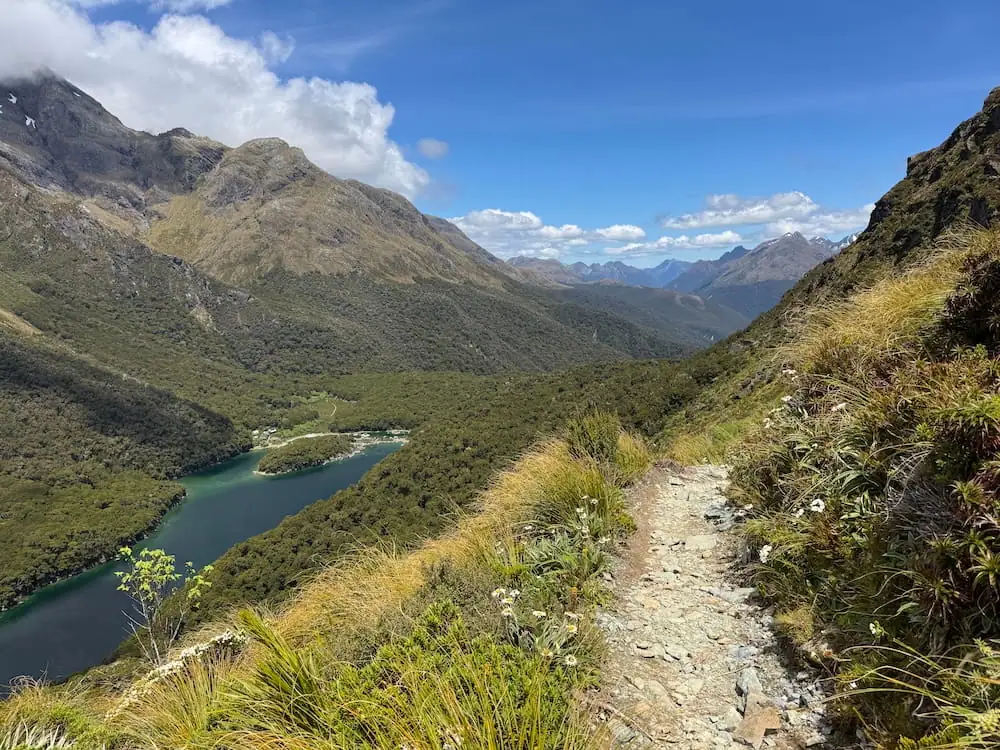
Waking up on the second day, I still felt pretty tired but was excited and happy to have a more chilled walking day ahead.
That said, with the most exciting parts of the track behind me, this day didn't feel like as much of an epic adventure. This stretch just doesn't have much of that jaw-dropping scenery that you find on other parts of the track.
Views from the Slip
The track starts in the forest with a fairly gentle downhill. Not long into your journey, you'll reach an area where a massive slip (landslide) occurred in 1994. At this point, you can get incredible views due to the clearing in the trees.
It's so wild to me to see here just how slowly the forest takes to recover from something like this. I mean that slip happened before I was born!
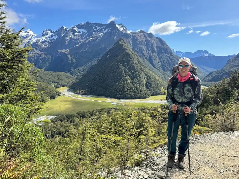
Routeburn Flats Hut and Campsite
After about 1.4 miles (2.3 km), you'll reach the Routeburn Flats Hut and Campsite. This is a good area for a break.
This hut and campsite is often the easiest one to book on the Routeburn. I wouldn't recommend it necessarily if you only plan to walk over two days, but if it's your only option and you think you can handle it, it's something to consider.
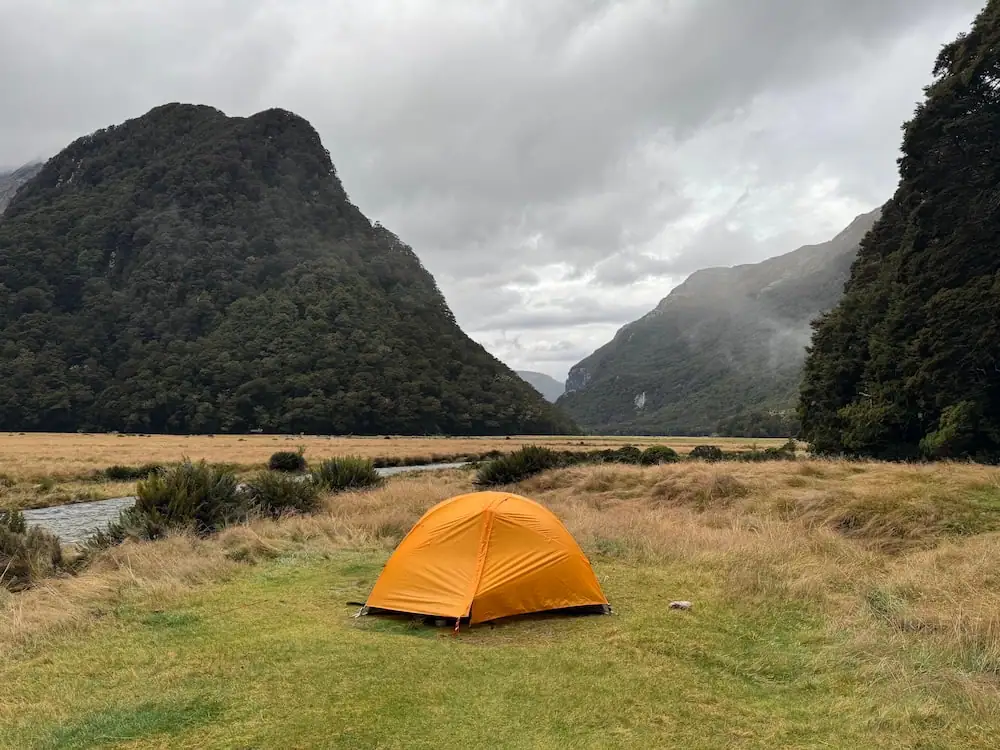
My dad camped here, and from his photos, it looks like an amazing place to spend a night.
Following the Route Burn to the End of the Track
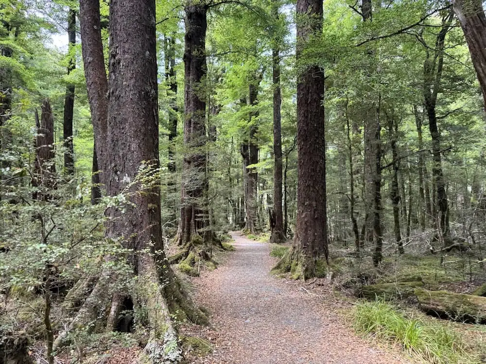
You'll continue walking through the mature red beech forests for a while and soon get views of the powerful Route Burn down below.
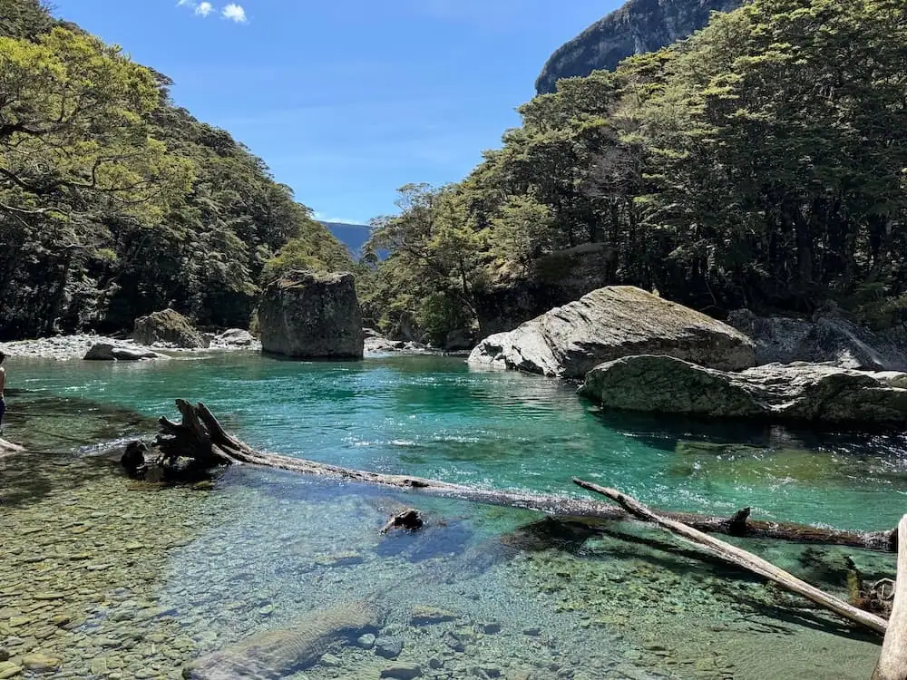
Not far from the end of your journey, you'll reach a turn for Forge Flat. This is a lovely spot to swim, so bring your bathing suit (or togs as they say in New Zealand) and make time for a little break here.
I hadn't known about the swimming spot so unfortunately didn't have my bathing suit with me. Even so, I felt so tired I was eager to just get to the shelter and get on my shuttle back to Queenstown.
As you get close to the shelter and car park at the end, you'll have the choice to continue on the official track or take the Routeburn nature walk to the end. I don't quite know how the two tracks differ, but I opted for the nature walk and quite enjoyed it.
Final Verdict: Do I Recommend Walking in Two Days?
If this is the only way you can walk the Routeburn Track, then absolutely, yes, do it in two days as long as you feel physically capable to take on the challenge.
However, if you are able to get hut bookings for two nights, then that's what I would recommend. While it's totally doable to walk it in two days if you're fairly physically fit, having one day that's so long makes it a bit harder to fully enjoy the journey I think.
For me, I also found that having such a long first day made it harder to connect with other people. By the time I got to the hut, folks had already made their friends and I didn't even really have the energy to socialize anyways. The other downside to such a long day was that I didn't have time for the optional side trips, which are both lovely if you can fit them in (and if weather cooperates).
While I was able to visit Key Summit at a later point as a day hike, Conical Hill would be quite far and difficult to do on a day hike, so I'll have to save that for whenever I hopefully do the Routeburn again one day.
Personally, I would consider walking it in two days again, but I'd rather try it again over three days so I can have more time to enjoy the scenery. That said, I'm also thinking about amping up my running game and even trying it in one day!
P.S. Want to know what some of the other Great Walks are like? I'm on a mission to hike all 11 of New Zealand's Great Walks this year. Subscribe to my YouTube channel, Instagram, or Tik Tok to follow along with my journey.
Routeburn Track Day Hikes
Can't do the full Routeburn Track? No worries. Here are two of the best day hikes to consider instead:
- Key Summit (5.2 miles/8.4 km out and back from The Divide Shelter) – This is a moderate hike with stunning views of Lake Marian and the surrounding mountains. I did this one as a day hike myself and enjoyed it. I found it pretty chill–enough so that I may take my mom on it and she's not really much of a hiker.
- Lake Harris and Harris Saddle Shelter (16.6 miles/26.7 km out and back from the Routeburn Shelter) – This is a much more challenging day hike that takes you to some of the best views on the Routeburn Track. If this one feels like too much, you could always just do part of it!
Other Things to Do in Te Anau
As the gateway to Milford Sound and the main base for Fiordland National Park, Te Anau has much to offer visitors. If you have some time before or after your trek on the Routeburn, it's worth staying here a bit longer and checking out some of the other top things to do in the area.
Here's what I recommend:
- Milford Sound Tour: You can't visit Fiordland without visiting New Zealand's #1 tourist attraction. This majestic fiord offers stunning views of Fiordland's mountains, waterfalls, and (if you're lucky) wildlife like dolphins and seals. This attraction is super popular, so I recommend booking a small-group tour like this one and booking early.
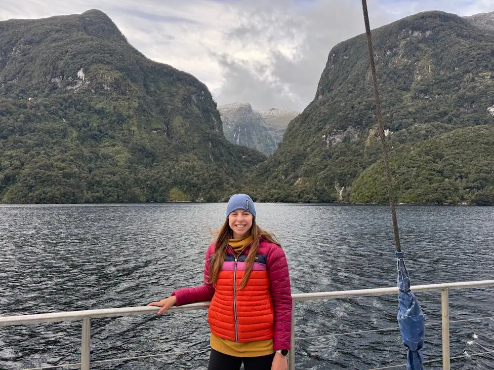
- Doubtful Sound Overnight Cruise: If you have more time to explore the region, you might also consider treating yourself to an overnight stay in the quieter Doubtful Sound. On the ship you'll get great food, commentary from a nature guide, and the opportunity to explore via kayak or tender boat. I recently did this with my dad and it's been one of my favorite experiences here!
- Glowworm Caves Tour: Te Anau is one of the best places in New Zealand to see glowworms, so if you're already in the area, I highly recommend checking out this tour. During the experience, you'll take a boat across Lake Te Anau before you enter the edge of a cool cave system where you'll see the glowing little guys.
- Bird Sanctuary Visit: Don't miss this small bird sanctuary on the edge of town. While it doesn't have much going on, it's home to one of New Zealand's rarest birds that was once thought to be extinct: the takahe. It's a cool bird and you'd be remiss not to go see them, especially since entrance to the sanctuary is free.
- Other Hikes in the Area: Of course staying near Fiordland National Park offers opportunities for loads of great hikes aside from the Routeburn Track. Some of my favorite day hikes in the area are the Lake Marian Track (moderate) and the Gertrude Saddle Route (hard). Te Anau is also a good base for two other Great Walks: the Kepler Track and the Milford Track.
Frequently Asked Questions
Here are some answers to frequently asked questions when it comes to the Routeburn Track.
How long does it take to walk the Routeburn Track?
It takes most people three days to walk the Routeburn Track but some people walk in as little as one day.
Is the Routeburn Track difficult?
The Routeburn Track is fairly difficult. You need to be prepared to walk over steep alpine terrain while carrying a heavier pack with all the food you'll need for a few days.
Where does the Routeburn Track start and end?
The Routeburn Track has endpoints at The Divide Shelter that's about one hour from Te Anau and the Routeburn Shelter that's about one hour from Queenstown and close to Glenorchy.
Which is harder, Milford or Routeburn?
The Milford Track is arguably harder. While the Routeburn Track has a steeper elevation profile, the Milford Track is a longer distance and often has more challenging conditions, including flooding on the trail. However, as Great Walks, both of these tracks are generally well-maintained and can be completed by most physically fit people.
How much does the Routeburn Track cost?
The Routeburn Track typically costs around $300 NZD at a minimum for one night on the track in a hut for an international adult during the Great Walks season. Expect to pay more if you plan to spend multiple nights on the track.
Start Booking Your Walk on the Routeburn Track
Since it can be difficult to get bookings for the Routeburn Track, I recommend you start trying to plan your trip as soon as you can. That way you have plenty of time to keep an eye on dates and see if any cancellations come through if needed.
Get started planning your walk on this iconic trail with these links:
➡️ Book Your Campsites/Huts on the Great Walk Here
➡️ Book Accommodation for Te Anau Here
➡️ Book Accommodation for Queenstown Here
➡️ Book Your Shuttle Transport Here
➡️ Don't Forget to Book Your Milford Sound Tour Early Here!
Read More About New Zealand Travel Essentials
- 40 Must-Know New Zealand Travel Tips for a Smooth Trip
- Driving in New Zealand: Tips from a Once-Nervous American
Read More About the Great Walks
- NZ Great Walks Packing List for Women (What I Pack)
- Routeburn Track in 2 Days From Te Anau: My Solo Hiking Guide
- Kepler Track in 3 Days: My Solo Great Walk Itinerary
- Te Anau Accommodation: Hotels, Hostels & Camping
- Rakiura Track Guide: 3 Days Camping on Stewart Island Solo
- Stewart Island Accommodation: Where to Stay for Every Budget
- 8 Best Things to Do on Stewart Island I Actually Loved
Read More About South Island Travel
- 11 Things to Do in Te Anau: More Than Just a Milford Gateway
- Te Anau Accommodation: Hotels, Hostels & Camping
- Fox Glacier Heli Hike Review: Is it Worth It in 2026?
- Roy’s Peak Sunrise: A Bucket List Hike Worth Waking Up For
- 8 Best Things to Do on Stewart Island I Actually Loved
- Stewart Island Kiwi Tour Review: Is it Worth it?
- How to Get to Stewart Island: I Tried the Flight & Ferry
- Stewart Island Accommodation: Where to Stay for Every Budget