
How to Combine the Central & Coastal Camino Portugués

Can’t decide between the scenic ocean views of the Coastal route or the traditional inland charm on the Central route of the Camino Portugués? You don’t have to choose just one.
If you're torn between the two main routes on the Portuguese Way, consider combining them—you're not alone. I met so many pilgrims doing just that.
But how exactly can you blend them? And which stretches are the best?
Whether you're a first-time pilgrim or planning your second Camino, combining routes can feel overwhelming—but it's absolutely doable.
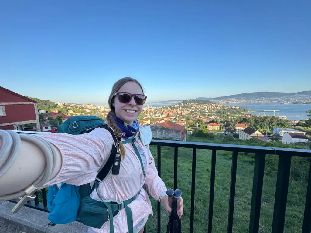
I hiked both routes solo from Porto in 2025 over 25 days, and in this post, I’m sharing my first-hand experience to help you decide what's best for you.
Keep reading to find out how to combine the Central and Coastal Camino Portugués routes, including my suggested itinerary with some of the most scenic and peaceful stretches you won’t want to miss!
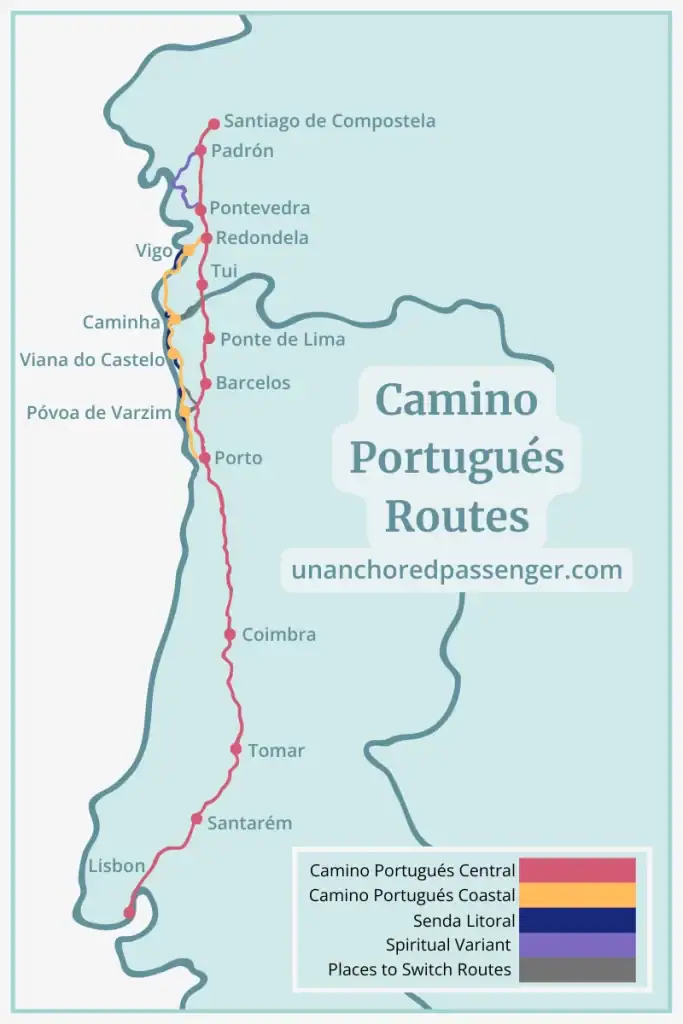
What are the Routes on the Portuguese Way?
Before we jump into all the ways to mix and match routes on the Portuguese Way, it's important to understand the different routes available:
- Camino Portugués Central: When comparing the two main routes, this is the more traditional. It runs more inland, passing through rural landscapes and quiet villages. It took me 10 days to hike this route from Porto.
- Camino Portugués Coastal: This route primarily follows the coastline and passes through more built up towns along the way. I would have walked this way in 12 days if I hadn't taken a rest day or done the Spiritual Variant.
- Senda Litoral (Litoral Way): The Senda Litoral follows the Coastal route for much of the way, but it splits every so often to more closely follow the coastline at times when the Coastal route moves more inland.
- Variante Espiritual (Spiritual Variant): This is an alternate route towards the end of the Camino that gives you the opportunity to follow the same path by boat that legend says the remains of Saint James made on their return to Galicia.
- Places to Switch Routes: With the two main routes running fairly close to each other, there are a few places where you can switch between them along the way.
Throughout this article, when I talk about switching between routes or the two main routes, I'm referring to the Central route and the Coastal route.

Traditional Points for Switching Between the Main Routes
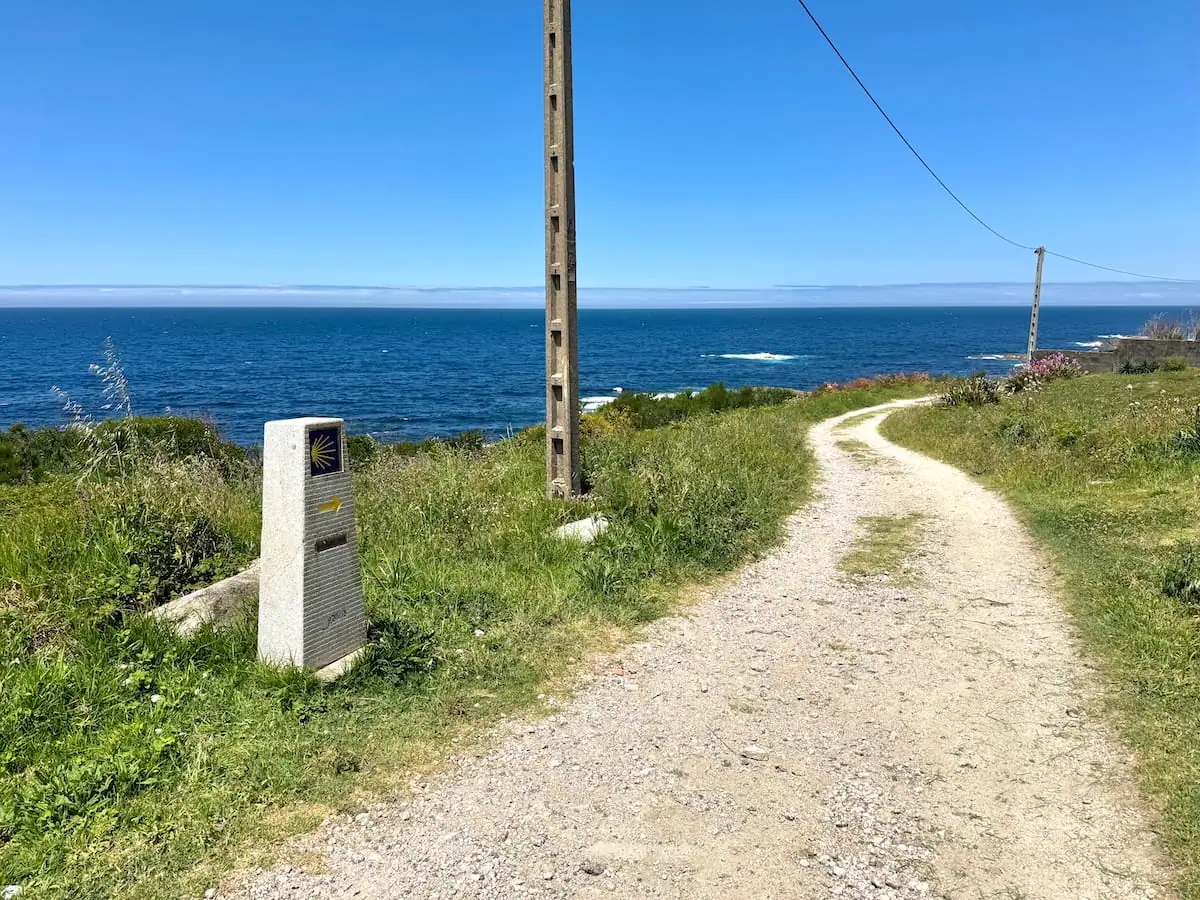
There are a few places where pilgrims typically switch between the Central and Coastal routes on the Camino Portugués. Note that for many of these paths, there are no arrows to guide you, so you'll want to have an app with a map like Wise Pilgrim that you can use to navigate.
Vila do Conde to São Pedro de Rates (Coastal to Central)
This is a common place to switch early on in the Camino Portugués not far from Porto. Many pilgrims, even if they want to primarily hike the Central route, prefer to leave Porto via the Litoral Way before joining the Coastal route.
The Litoral Way out of Porto is much more scenic than the Central route. Pilgrims taking the Senda Litoral follow the river out to the ocean whereas pilgrims on the Central route walk through more urban areas.
The walk from Vila do Conde to São Pedro de Rates is approximately 8.9 miles (14.3 km). I personally met a lot of people who did this and seemed happy with their decision to make the switch here, so it's a good option to consider.

São Pedro de Rates to Fão (Central to Coastal)
Alternatively, if you start out on the Central route and decide to switch to the Coastal, you can also do so at São Pedro de Rates. There's a path that travels northwest for about 9.1 miles (14.7 km) to Fão on the Coastal route.
I wouldn't recommend planning on going this way since the beginning stretch on the Central is mostly walking along streets (many of them quite busy) versus the much more scenic views you get walking along the river and ocean on the Senda Litoral that connects with the Coastal route.
But if you start out on the Central and decide you actually want to switch to the Coastal, then this is one way to do it. I haven't met anyone who has done this and can't find information online about it so can't speak to how it is.
Caminha to Valença (Coastal to Central or Vice Versa)
Pilgrims who want a more equal mix of the two main routes routes typically switch here. Instead of taking the boat from Caminha to continue on the Coastal route, they walk to Valença to switch to the Central. I probably met a dozen or so people who had done this.
It's not quite as common, probably because it includes some slight backtracking, but you could switch from the Central to the Coastal here if you walk in the opposite direction.
I've heard this is a lovely trail that follows a river between the two towns. It's about 18.6 miles (29.9 km).
Connect with Other Women Hiking the Camino
Join my free Facebook group! We're building up a community of women who have hiked or are planning to hike the Camino there. You can also get personalized support from me!
Combining the Central & Coastal Camino Portugués via Public Transportation
What if you decide to switch routes but don't want to wait until you reach one of the points noted above? Don't worry! Portugal has pretty good public transportation options.
Here are a few potential public transit options that you might consider to switch between the routes.
Public Transit From the Central to Coastal Route
- Barcelos to Vila do Conde by bus
- Barcelos to Póvoa de Varzim by bus
- Barcelos to Esposende by bus
- Barcelos to Viana do Castelo by train
- Ponte de Lima to Viana do Castelo by bus
- Valença to Caminha by train
Public Transit From the Coastal to Central Route
My Favorite Sections of Each Route Based on my Experience
Ok but which sections are the best on each route?? It's nice knowing you can switch between the routes more easily, but which sections are worth seeing?
After hiking both routes from Porto, here were my favorite sections along the way.
Central Route
- Barcelos, Portugal: This city sits along a river with mountains nearby. It's home to a supposed miracle that took place, which led to the rooster becoming a national symbol in Portugal.
- Ponte de Lima, Portugal: The town is considered Portugal's oldest and has a charming old town and medieval bridge.
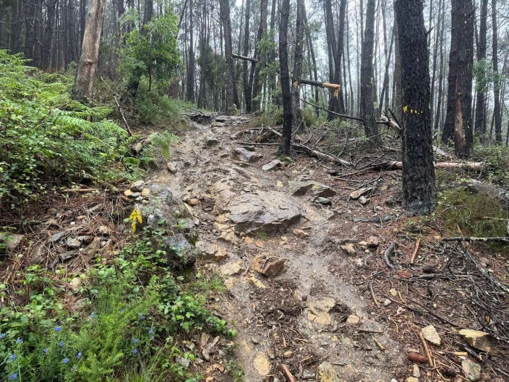
- Hike into Rubiães, Portugal: This stretch of the Central route takes you through the woods and up some steep hills along proper hiking trails as you climb up to the highest point on the route.
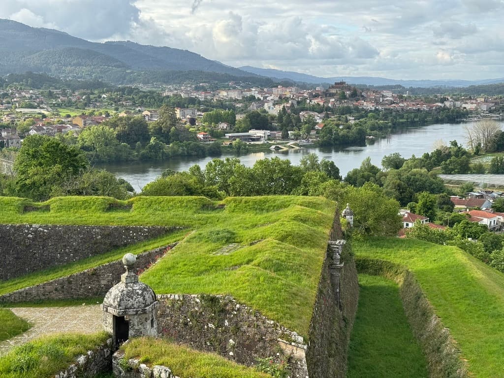
- Valença, Portugal: There's a medieval fortress here that encloses its old town. Exploring the fortress and staying within its walls was my absolute favorite part of this route.

Coastal Route
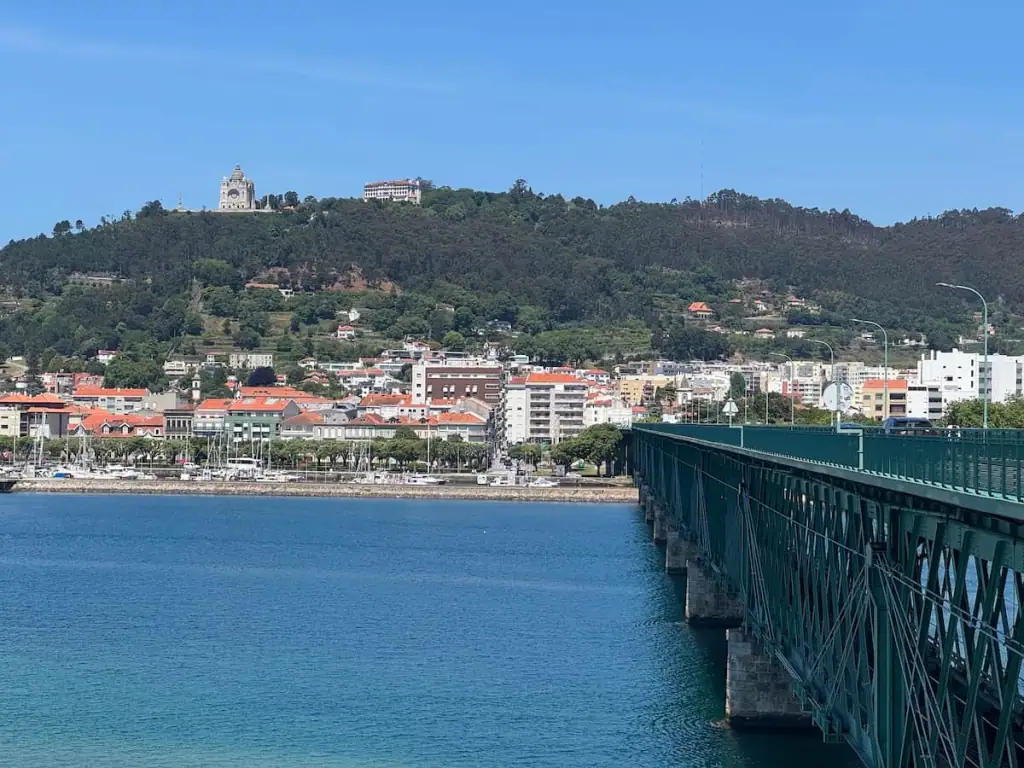
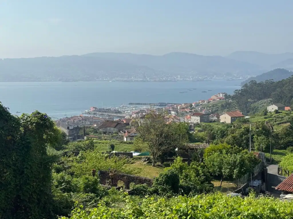
- Viana do Castelo, Portugal: I really wished I had more energy to explore this city with its church sitting atop a high hill looking over the city and water all around.
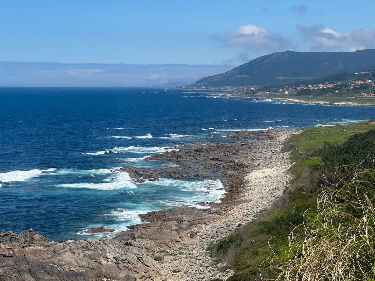
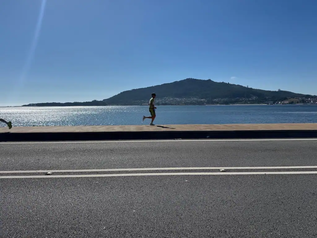
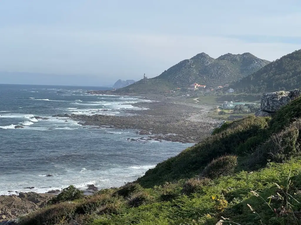
- Hike along the coast of Spain after taking the boat from Caminha: This stretch of the Coastal route was absolutely stunning and my favorite views on all of the Portuguese Camino routes. You spend much of this stretch hiking up high in some hills looking down at the ocean not far below.
- Baiona, Spain: This was my favorite stop on the Coastal route with its charming old town and fortress jutting out into the ocean.
- Vigo, Spain: Vigo is one of the largest cities in Spain and has great views of the water and nearby Cíes Islands.
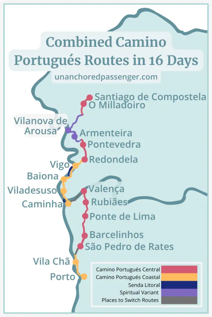
Sample Itinerary for Combining the Central & Coastal Camino Portugués from Porto
As you can see, there are SO many options for how you hike the Camino Portugués. Unlike routes like the Camino Francés, the Portuguese Way really allows for you to customize your walk in so many ways.
While this is nice in some ways, it also makes the journey ahead feel all the more daunting.
That's why I've put together a sample itinerary for you. This is based on my absolute favorite parts of each Camino after hiking them both in 2025. If I were to do the Portuguese Way again, this is the itinerary I would choose for myself.
Of course don't feel like you have to do this exactly. Heck, you don't even have to start in Porto if you don't want to. Porto is a lovely city to visit though if you have the time to start there!
Many people only switch between the routes once, but based on my experience, I think it's absolutely worth it to switch twice.
Let's dive in!
You'll see II've kept the descriptions for each stage fairly high-level, but check out my other posts for more details:
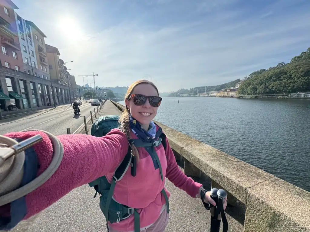
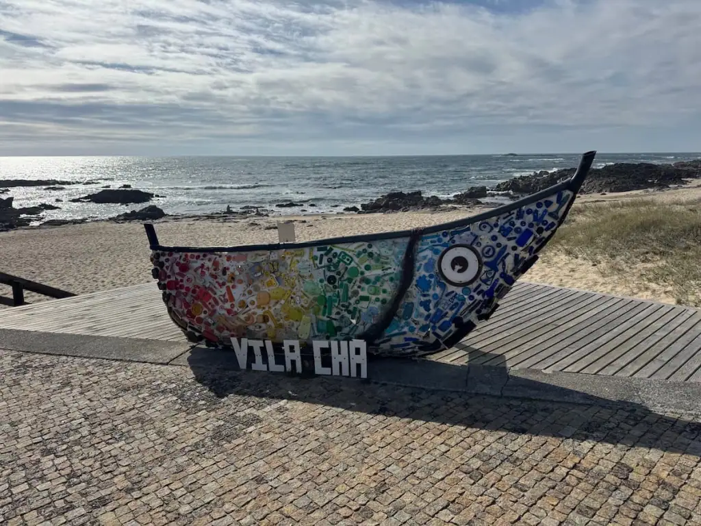
Stage 1: Porto to Vila Chã (Start on the Coastal Route)
Distance: 16.2 miles (26.0 km)
Without a doubt, leaving Porto via the Litoral Way and joining the Coastal route is the best way out of the city. While any way you leave the city can be quite busy following roads with lots of traffic, the Litoral Way offers lovely views as you follow the Douro River and then the ocean.
If you want to shorten the number of days of this itinerary, you could consider hiking stages 1-3 in two days as follows:
- Porto to Vila do Conde (21.0 miles/33.8 km)
- Vila do Conde to Barcelinhos (18.5 miles/29.8 km)
Stage 2: Vila Chã to São Pedro de Rates (Switch to the Central Route)
Distance: 13.6 miles (21.9 km)
From Vila Chã, hike north until you reach Vila do Conde. From there, you'll turn inland to switch to the Central route, hiking to São Pedro de Rates.
From what I've heard, the trail to switch routes is not very well marked, so make sure to download some kind of Camino app with a map. I personally use Wise Pilgrim, but I know others who use the Buen Camino app.
Stage 3: São Pedro de Rates to Barcelinhos
Distance: 9.6 miles (15.4 km)
From here you'll have a short walk to Barcelinhos (or you can go to Barcelos). These two towns are right next to each other. They have lovely views of a river and mountains in the distance.
Plus, Barcelos is important to Portugal as it's home to an important miracle with a rooster. If you see any rooster symbols in Portugal, those are because of the miracle that allegedly took place here.

Stage 4: Barcelinhos to Ponte de Lima
Distance: 21.1 miles (34.0 km)
From Barcelinhos, you'll head to another one of my favorite stops on the Camino Portugués Central route, Ponte de Lima. This town is also known as the oldest in Portugal. Along the way, you'll walk by picturesque vineyards, small villages, and farms.
Another option would be to hike to Lugar de Corgo so you can stay at Casa da Fernanda. People say this is one of the best albergues among all the Caminos, but note that it fills up well in advance. You can call them here to make a reservation: +351 914 589 521
If you choose to stop there, here's a suggested alternate itinerary:
- Barcelinhos to Lugar de Corgo (12.5 miles/20.1 km)
- Lugar de Corgo to Rubiães (19.8 miles/31.8 km)
Stage 5: Ponte de Lima to Rubiães
Distance: 11.1 miles (17.9 km)
The walk on this day was one of my favorites among both of my Portuguese Caminos. You get on a proper hiking trail in the woods and get some lovely views as you reach the highest point on the Central route.
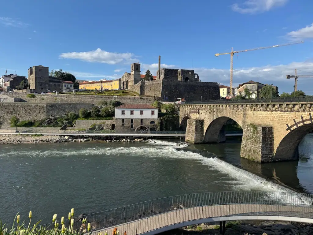
Stage 6: Rubiães to Valença
Distance: 10.3 miles (16.5 km)
Valença was one of my absolute favorite stops on either Portuguese Camino. The city's old town has a medieval walled in fortress protecting it. It's so fun to explore, and you can even stay inside of it!
The nicest albergue I stayed in on either Camino is here, and I highly recommend it: Hostel Bulwark.
Stage 7: Valença to Caminha (Switch Back to the Coastal Route)
Distance: 18.6 miles (29.9 km)
I've heard this is a lovely stretch where you get to walk along the River Minho to get from one city to the other.
Stage 8: Caminha to Viladesuso
Distance: 13.0 miles (21.0 km)
This was my absolute favorite stretch of either of my Portuguese Way Caminos. The views of the coastline were spectacular and unlike anything I've seen before.
First off, you have to take a little boat across the water. From there, I recommend taking the Litoral Way, sticking to the coastline until you reach A Guarda where it joins the Coastal route.
Connect with Other Women Hiking the Camino
Join my free Facebook group! We're building up a community of women who have hiked or are planning to hike the Camino there. You can also get personalized support from me!
Stage 9: Viladesuso to Baiona
Distance: 8.3 miles (13.3 km)
The views on this day were similarly amazing. Plus, Baiona was my favorite stop on the Camino Portugués Coastal.
With its old fortress jutting out into the water, nice beaches, and lovely views of the water, Baiona is worth a stop. Even if you don't spend the night there and decide to walk farther, I highly recommend walking around the fortress.

Stage 10: Baiona to Vigo
Distance: 16.8 miles (27.1 km)
There are a number of ways to enter Vigo. I recommend cutting West once you reach a river outside of Samil. From there, follow the coastline up to Vigo.
Stage 11: Vigo to Redondela
Distance: 8.1 miles (13.0 km)
You can do Vigo to Pontevedra in one day, but there is a LOT of elevation gain and loss. I did it in one on a really hot day and regretted it, so here I thought I'd recommend you split them up.
Much of the uphill starts as you get out of the Vigo metro area. You're rewarded with amazing views, but it is a bit of a challenge and there aren't really any places to stop.

Stage 12: Redondela to Pontevedra
Distance: 12.6 miles (20.2 km)
No matter which way you choose, you have to walk this stretch from Redondela to Pontevedra. The good thing is, it has some of my favorite parts of the path too!
You'll walk over a medieval bridge, hike up through the woods and get some epic views, and pass alongside some farms and vineyards. It's a lovely walk aside from some of the sprawling urban areas around Redondela and Pontevedra.
Once you're in Pontevedra, be sure to do some exploring to check out the historic old town. I've written a guide to Pontevedra if you want to learn more about this special stop on the Camino.
Stage 13: Pontevedra to Armenteira (Switch to the Spiritual Variant)
Distance: 12.7 miles (20.5 km)
After hiking both the Spiritual Variant and the regular way via the Central route onto Santiago de Compostela, I can confidently say I much prefer the Spiritual Variant.
Why? It's much quieter, has mix of scenery that reminds me of my favorite parts of both the main routes, and offers a unique experience with the boat ride tied so closely to the origin of the Camino.
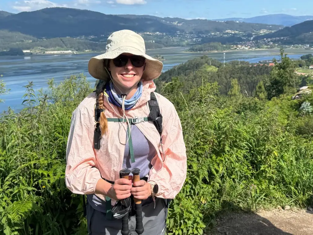
Stage 14: Armenteira to Vilanova de Arousa
Distance: 14.7 miles (23.7 km)
This second day on the Spiritual Variant was one of my favorites. You spend much of it walking along a stream through a forest and then through vineyards before reaching the coast.
Stage 15: Vilanova de Arousa to O Milladoiro
Distance: 12.7 miles (20.5 km)
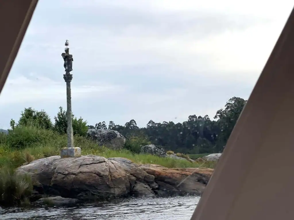
For your second-to-last-day, you'll start off with a boat ride that takes you just south of Padrón. The boat follows the same journey that legend says a boat took to bring the remains of Saint James back into Galicia after he was martyred.
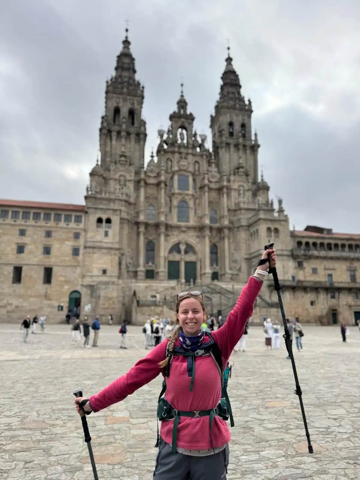
Stage 16: O Milladoiro to Santiago de Compostela
Distance: 4.2 miles (6.7 km)
This short last day allows you to get to Santiago de Compostela early and make the most of the day without having to push through exhaustion. There are some really cool places to stay in the city too, so it's nice to have more time to enjoy them if you can.
That said, if you're tight on time you can combine this with the day prior to save a day. Just be prepared for a long day.
Conclusion: Combine the Central and Coastal Camino Portugués
There are SO many ways to walk the Camino Portugués. It's ultimately up to you to find out which way is best for you and if you really want to combine the Central and Coastal Camino Portugués routes.
I'm here to help! As you keep planning, check out these resources:
Get More Details on the Routes of the Portuguese Way
As you plan your Camino Portugués, check out these articles with more details on stages for the Central route, Coastal route, and Spiritual Variant. In each of these articles, I've included more information on what the walk is like each day, stops along the way, tips on where to stay, and more.
Camino Portugués Stages PDF
Download this free itinerary for a condensed version of my recommended Camino Portugués Central, Coastal, and Spiritual Variant stages that you can print out.


