
Portuguese Camino Central Route Stages from Porto for 2026

Planning your Camino can feel overwhelming with so many options on where to stop throughout your journey. Where are the best places to spend the night? Where is it safe to stop as a solo female traveler?
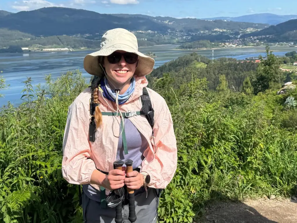
As someone who planned this solo, I know how crucial it is to have realistic, safe, and inspiring daily stages.
In May 2025, I spent 10 days walking the Camino Portugués Central route solo from Porto to Santiago de Compostela. This article details my daily Portuguese Camino walking stages, including what you can expect to see along the way, tips on where to stay, what to do, and more.
Everything I recommend in this guide is somewhere I've vetted myself or that other pilgrims have recommended.
Know that you don't have to follow these walking stages exactly. If you want longer or shorter days, you can absolutely do that. Use this breakdown as a guide to help you start thinking about how you want to approach your walk and plan your perfect Camino, no matter what you're looking for.

Camino Portugués Central Route Overview
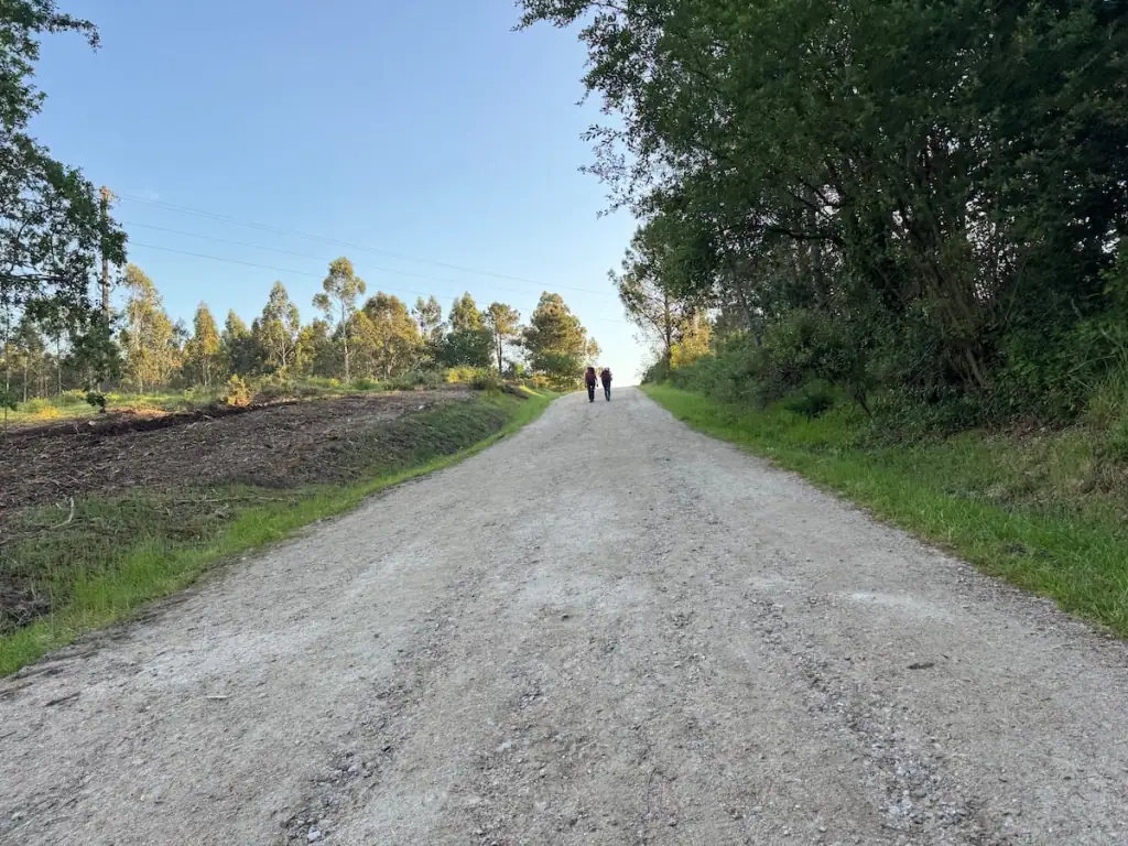
The Camino Portugués Central route was the second most popular Camino de Santiago route in 2024. The route provides a social experience while allowing you time to yourself too. There's a lovely mix of scenery with the route traveling through forests, quiet villages, vineyards, and even up some small mountains.
Here's an overview of the Central route:
- Total distance: 151 miles (243 km) from Porto
- Average days to complete: 10-14 days from Porto
- Total elevation gain: 17,106 ft (5,214 m) from Porto
- Number of pilgrims who finished this route in 2024: 95,453 (19.5% of all pilgrims)
- Most popular starting points: 1) Tui (38%), 2) Porto (29%), 3) Valença (18%)

Portuguese Camino Central Route Stages Map
Here you can see a map showing the Central route of the Portuguese Way from Porto divided into 10 walking stages split evenly between Portugal and Spain. These are the exact stops I made on my way to Santiago de Compostela.
Videos of the Portuguese Central Route
If you're looking to visually see more of what the Portuguese Central route is like, check out my series of videos from my time on the route. Here's the first one, but you can check out the full playlist on my YouTube channel here.
Starting Point for the Camino Portugués Central
While the Central route of the Camino Portugués officially starts in Lisbon, very few pilgrims start there. The majority of pilgrims who want a longer walk start in Porto.
Almost everyone I've spoken with who has done the stretch from Lisbon to Porto said it lacked a lot of infrastructure (e.g., accommodations, places to eat) and involved a lot of road walking. Most people say the stretch from Porto north is significantly better.
I met a couple women who started in Lisbon and they ended up taking the bus to skip some sections before Porto because even the locals told them it would be better to do so.
I myself started in Porto, so this article will dive into the stages I took from there all the way to Santiago. You can start the Camino anywhere you want though! If you think you'll start farther along the route, feel free to scroll down to your starting point.
How to Get to Porto
Porto's airport is fairly well connected, so I recommend flying there if you can. That said, Lisbon has a bigger airport, so you may want to look at flights there instead and consider taking the train or a bus up to Porto.
I personally have taken a bus up to Porto from Lisbon before and it was pretty easy and comfortable!

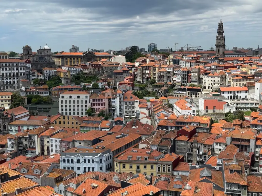
Where to Stay in Porto
With so many places to stay in Porto, it can feel overwhelming trying to find somewhere to stay. Here are some options I recommend:
📍Budget Option: Albergue de Peregrinos Porto is a popular albergue on the edge of Porto along the Central route.
📍Mid-Range Option: Porto Wine Hostel offers both shared dorms and private rooms in the heart of the city. I stayed here before my last Camino, and it's my favorite place I've ever stayed in the four times I've been to Porto.
📍Luxury Option: Torel Avantgarde was rated by CN Traveler as the best hotel in Porto for views of the river. It's a highly-rated 5-star hotel and is sure to be a treat before starting your Camino!

Where to Get Your Pilgrim Passport
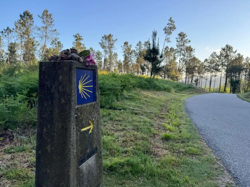
During your Camino, you'll want to carry a credencial, also known as a pilgrim passport, to get into pilgrim-only hostels and collect stamps along the way if you want a Compostela certificate at the end.
You can get your pilgrim passport in Porto at the Sé do Porto cathedral. Look for a line and you'll need to wait and buy the passport at the cathedral entrance ticket desk. It costs just 2 euros.
While there, you can buy a scallop shell for 2 euros at the ticket desk as well if you'd like. Many pilgrims affix these shells to their packs as the scallop shell is a historic symbol of the Camino and indicates that you're a pilgrim.
If you have the time, I recommend you visit the inside of the cathedral while you're there. It's one of my favorite activities in Porto and costs just 3 euros. The painted blue tiles called azulejos inside are spectacular!
Note that the line at the cathedral can sometimes be quite long, so buffer in some time to wait to be safe. A couple times when I just needed to buy things, I arrived within an hour of closing and didn't have to wait very long.
Here are the cathedral hours:
- November to March: 9 a.m. to 5:30 p.m.
- April to October: 9 a.m. to 6:30 p.m.
- Daily mass at 11 a.m.
- Tower access closes 30 minutes before the cathedral closes

What to Do with Extra Baggage
If you're doing much traveling before or after your Camino, you likely have extra baggage with you. If that's the case, you will either want to store your luggage in Porto if you'll be returning or ship it ahead to Santiago de Compostela.
For luggage storage, I recommend Radical Storage. They have locations all over the city, so you can find one that's most convenient for you. I used this luggage storage service myself when I was in New Zealand, and it was a great experience.
➡️ Book luggage storage in Porto here.
For shipping ahead to Santiago de Compostela, I highly recommend Pilbeo. You can coordinate with them over WhatsApp: +34 670 64 80 78.
I shipped a huge suitcase and small personal item-sized bag with them and it cost me €104.54 in May/June 2025. They picked them up from my hotel, held them for about a month in Santiago de Compostela, and then dropped them off at my hotel there. The process was really easy!

Portuguese Camino Central Route Stages Itinerary for 10 Days
Now let's dive into my 10 day-itinerary for the Camino Portugués Central route. Here you'll find a breakdown of exactly where I walked each day, the distance, stops along the way, where to stay, and more.
As you read this, remember there are no “best Portuguese Camino Central route stages.” What's best for everyone looks different. Instead of using this as your Bible for your Camino, instead think of it more as a guide.
While there are a number of places you can stop on the Portuguese Camino Central route, there aren't quite as many when you compare it to the Francés, so you don't want to assume that you can stop everywhere. I've noted throughout some other options I recommend for spending the night if you choose to adjust this itinerary.
Also keep in mind that it is possible hike a combination of the Central route and Coastal route, so that could be a good option for you if you're considering a mix of both routes.
Of course you're welcome to follow these stages exactly if you choose, but don't fret if you think you want to do something different! I always say it's best to stay flexible on the Camino and avoid making any super concrete plans when it comes to your route.
I myself made a tentative plan before starting my Camino, but then I changed it up a bit as I went along!

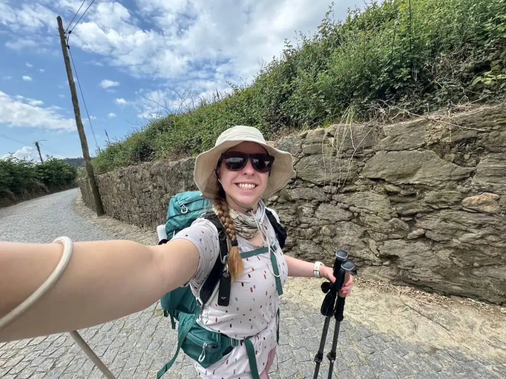
Stage 1: Porto to Vairão
Official Distance: 15.7 miles (25.2 km)
Elevation Gain: 1,164.7 ft (355.0 m)
Elevation Loss: 1,179.9 ft (359.6 m)
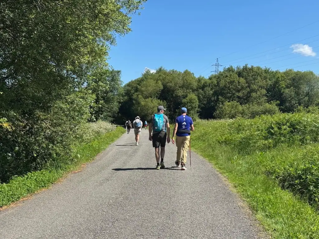
Many people will tell you not to take the Central route to leave Porto because it’s heavily urban and there’s a lot of road walking. Many pilgrims take the Coastal route for the first few days instead before switching to the Central.
Leaving any city on the Camino typically involves walking along roads and suburbs for a while. I was used to it from when I hiked the Camino Francés, so maybe that's why I didn't find the walk out of Porto to be too bad.
You'll trek through a series of suburbs, but as you get farther out of the city, it gets quieter. If you want to skip some of the urban and industrial areas leaving Porto, you could consider taking the metro to somewhere like Vilar do Pinheiro.
As a solo hiker, it did feel a little eerie on this day because there weren't very many pilgrims around me, but given many locals were out and about along much of the way, I felt safe.
Many guidebooks suggest staying in Vilarinho, but I chose to stay in Vairão instead. Why? Vairão has a large municipal albergue that has plenty of room for walk ins whereas Vilarinho only has a couple smaller albergues that typically book up in advance.
I’m so glad I stayed in Vairão because that albergue ended up being one of my favorites between the two Portuguese routes. The albergue is in a lovely monastery that's over a century old!
Stops Along the Way*
- Cedofeita (1.2 miles/2 km from previous stop)–I had a great pastel de nata (Portuguese custard tart) from Confeitaria Aliança just before this suburb of Porto.
- Gondivai (4.5 miles/7.3 km from previous stop)
- Araújo (0.2 miles/0.3 km from previous stop)–Carvalho Santo is a cafe here right next to the church. It's a good place to stop for breakfast on your way out of Porto.
- Moreira (2.2 miles/3.5 km from previous stop)–This is right by the Porto airport. AirPorto Hostel here is highly rated.
- Barranha (0.9 miles/1.5 km from previous stop)–From here onward, the roads started to get a bit quieter.
- Vilar do Pinheiro (0.5 miles/0.8 km from previous stop)
- Mosteiró (0.9 miles/1.4 km from previous stop)–Casa dos Caminhos de Santiago albergue is highly rated.
- Gião – Joudina (2.4 miles/3.8 km from previous stop)–Gião has its own stamp sitting out alongside the road for pilgrims. Doce Gião is a nice cafe with sandwiches, soups, and more.
- Igreja (1.2 miles/2 km from previous stop)
- Tresval (1.2 miles/2 km from previous stop)
- Crasto (1.2 miles/2 km from previous stop)
After Crasto, it's 0.6 miles/1.0 km to Vairão.
*Note that throughout this article, I've listed all the places you'll pass through according to the Wise Pilgrim app (Apple | Android). This does not mean every town will have a place for you to necessarily stop and spend the night or get food.
Guide to Vairão
- Where to Stay: Albergue de Peregrinos do Mosteiro de Vairão (municipal albergue–shared and private rooms)
- Where to Eat: Snack Bar D. Miguel for dinner, Mini Mercado for snacks and drinks

Stage 2: Vairão to Barcelinhos
Official Distance: 17.6 miles (28.3 km)
Elevation Gain: 1,639.0 ft (499.6 m)
Elevation Loss: 1,780.8 ft (542.8 m)
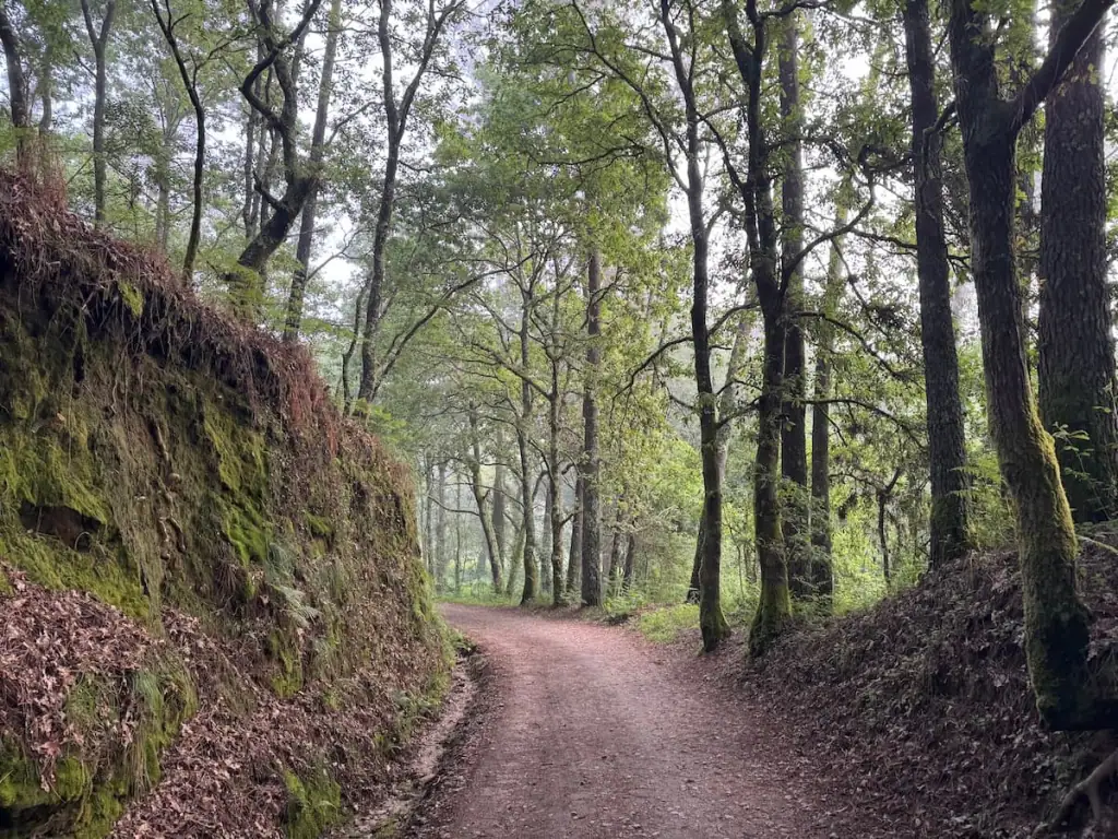
This stretch along the Central route continues to be a little urban but less so than the first day. While there are some sections of road walking, you'll spend some time walking in tranquil forests and through small villages.
Many guidebooks suggest staying in Barcelos, but I found more albergue options in the nearby Barcelinhos. It's a good idea to book ahead there as there aren't loads of places to stay.
The two towns are right next to each other, so feel free to look at accommodation options in each. No matter where you stay, I recommend spending some time walking around both places.
You'll often see a rooster symbol throughout Portugal, and that symbol originates in Barcelos. It turns out there was a supposed miracle where a pilgrim was wrongly accused of theft and sentenced to death. He predicted that a roasted rooster would come to life and crow to affirm his innocence.
As the man was hanged, the rooster did exactly that. It was discovered that the man survived the hanging due to a poorly made knot, and he was freed.
Stops Along the Way
- Vilarinho (0.9 miles/1.5 km from previous stop)–Casa da Laura albergue is highly recommended if you can get a reservation.
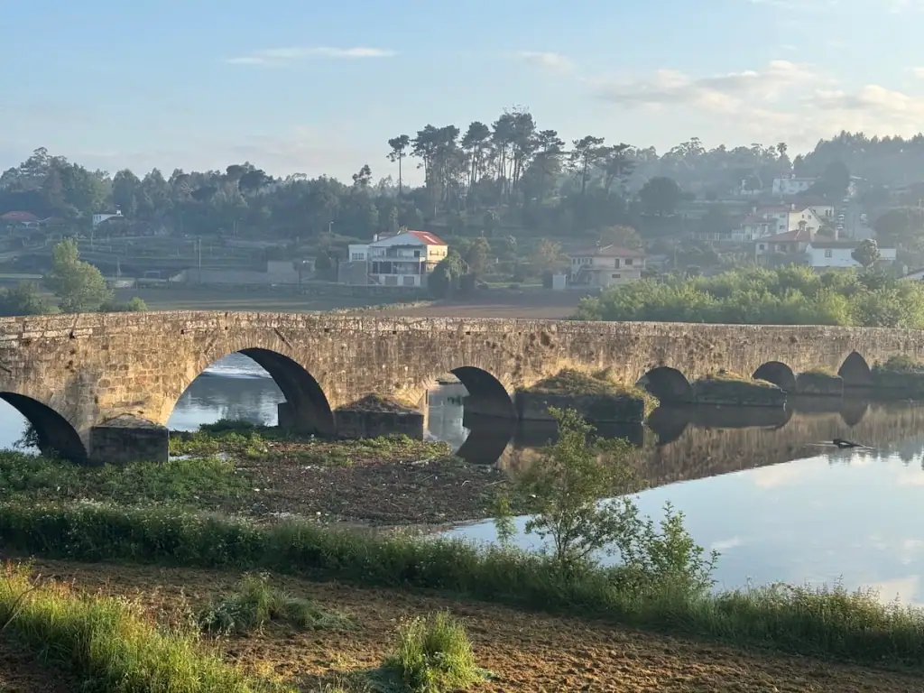
- Puente de Ave (1.1 miles/1.7 km from previous stop)–Here you cross a river over a stunning stone bridge that's at least 800 years old.
- São Mamede (2.4 miles/3.8 km from previous stop)
- São Miguel de Arcos (1.6 miles/2.5 km from previous stop)–Café Barbosa is a great place to stop for breakfast. It was the first cafe I saw open when I hiked this stretch.
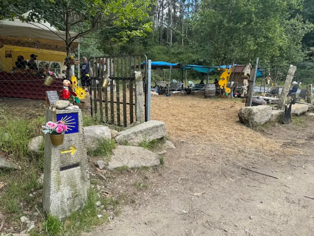
- São Pedro de Rates (2.1 miles/3.4 km from previous stop)–This is where some pilgrims switch from the Coastal to the Central route and vice versa. The Albergue de Peregrinos here is well rated. After leaving the town, keep an eye out for the Parque Santiago Macieira de Rates with its large rooster statue and picnic tables for a place to rest.
- Pedra Furada (4.0 miles/6.5 km from previous stop)
- Góios (1.1 miles/1.7 km from previous stop)–This town is a bit bigger and has a pharmacy, supermarket, and some restaurants. It seemed pretty busy when I walked through.
- Pereira (1.2 miles/1.9 km from previous stop)
- Carvalhal (1.4 miles/2.3 km from previous stop)–This town has a supermarket and a pharmacy.
- Chapel of Santa Cruz (0.8 miles/1.3 km from previous stop)
After the Chapel of Santa Cruz, it's 1.1 miles/1.7 km to Barcelinhos.
Guide to Barcelinhos
- Where to Stay: Diora Hostel/Casa das Pombas (private albergue–shared and private rooms), Amigos da Montanha (private albergue–shared rooms), Top'Otel (hotel–private rooms)
- Where to Eat: Cantinho do Peregrino for a pilgrim's menu, Borlopes Pizzaria for great pizza, O Som das Palavras for a quick bite at a cafe
- Things to Do: Check out the Museu Arqueológico de Barcelos ruins of a former duke's palace, walk along the river and around the towns

Stage 3: Barcelinhos to Ponte de Lima
Official Distance: 21.1 miles (34.0 km)
Elevation Gain: 1,871.5 ft (570.4 m)
Elevation Loss: 1,791.2 ft (546.0 m)
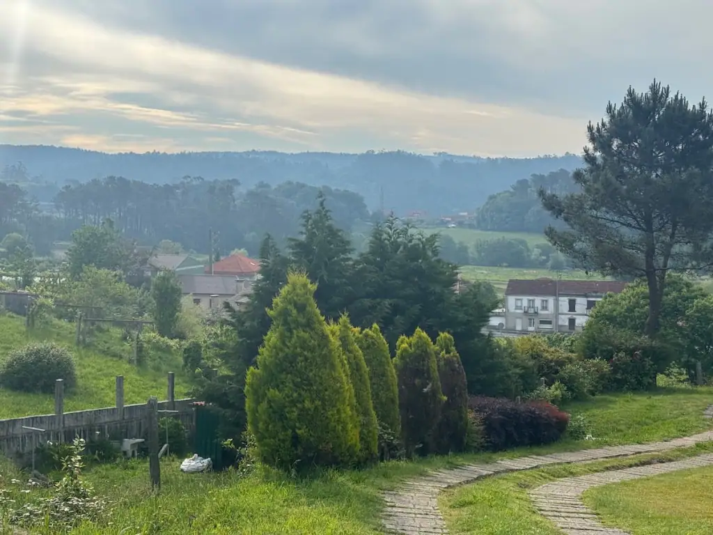
This is the first day on the Central route where the scenery really starts to get less urban and much more picturesque in my opinion. You walk by many vineyards, small villages, and farms. There are views of mountains in the distance at times.
Ponte de Lima is considered Portugal's oldest town. It's beautiful sitting along a large river with a medieval Roman bridge and a tree-lined walkway as you enter the town. It could be a good place to take a rest day if you have the time and want to take a break.
Stops Along the Way
- Barcelos (0.5 miles/0.8 km from previous stop)–There are a few hotels here. Hotel Bagoeira and Flag Hotel Barcelos are some of the more affordable hotel options.
- Vila Boa (1.7 miles/2.8 km from previous stop)
- Lijó (1.5 miles/2.4 km from previous stop)–Café Arantes is a nice place to stop for breakfast or a snack.
- Portela de Tamel (2.6 miles/4.2 km from previous stop)–Casa da Recoleta/Albergue de S. Pedro Fins is a highly rated municipal albergue here.
- Aborim (0.8 miles/1.3 km from previous stop)
- Quintiães (1.1 miles/1.8 km from previous stop)–Check out the bakery Rosa Cintilante for breakfast or a snack.
- Puente das Tábuas (0.8 miles/1.3 km from previous stop)
- Balugães (0.7 miles/1.1 km from previous stop)
- Lugar do Corgo (2.7 miles/4.4 km from previous stop)–I highly recommend staying at Casa da Fernanda if you can get a reservation. It's known as one of the best albergues on all the Caminos. You may need to call weeks or even months in advance to book it: +351 914 589 521.
- Vitorino Dos Piães (1.5 miles/2.4 km from previous stop)–Casa Sagres is a nice albergue in town. I almost stayed here until I decided to continue farther to stay with my friend.
- Portela (0.6 miles/0.9 km from previous stop)
- Facha (2.2 miles/3.6 km from previous stop)–The Wise Pilgrim app acts like visiting this village adds extra distance, but this is the way I went when following the arrows. It's beautiful, so it's worth it even if it truly adds extra distance!
- Sobreiro (1.1 miles/1.8 km from previous stop)
- Paço (1.8 miles/2.9 km from previous stop)
- Pedrosa (0.2 miles/0.3 km from previous stop)–In this small village, I passed a house that had a stamp and some drinks and snacks with an honesty box for pilgrims.
After Pedrosa, it's 1.7 miles/2.7 km to Ponte de Lima.

Guide to Ponte de Lima
- Where to Stay: Old Village Hostel (private albergue–shared and private rooms), Hotel Império do Norte (hotel–private rooms)
- Where to Eat: Restaurante Mercado for a pilgrim's menu or menu of the day
- Things to Do: Visit the Paço do Marquês de Ponte de Lima castle

Stage 4: Ponte de Lima to Rubiães
Official Distance: 11.1 miles (17.9 km)
Elevation Gain: 2,034.8 ft (620.2 m)
Elevation Loss: 1,608.3 ft (490.2 m)
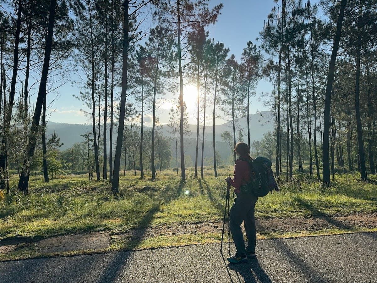
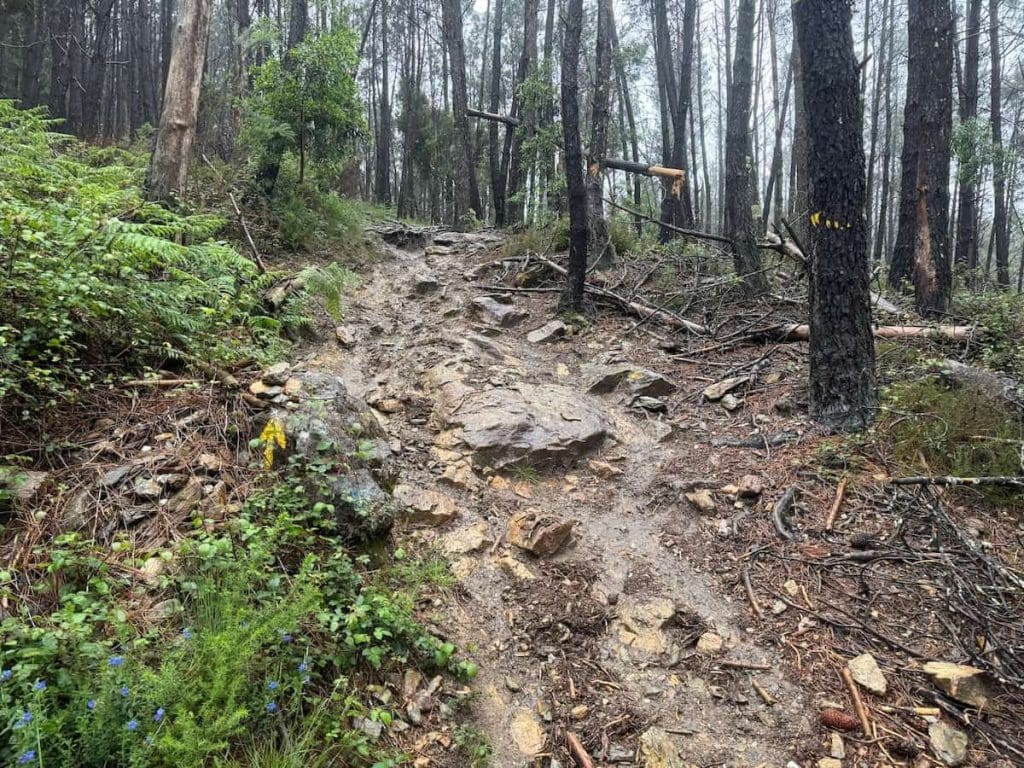
The hike from Ponte de Lima to Rubiães is arguably the most beautiful stretch on the Camino Portugués Central route, but it's also the most challenging. It's the first day where you get to walk on a proper hiking trail in the woods for a while as you approach the highest point on this route.
The trail gets quite steep and rocky in some sections, so keep that in mind. If you're putting together your packing list for the journey, then I definitely recommend bringing hiking poles.
The challenge is doable though and honestly a little fun. If it hadn't poured rain when I walked this section, then I think it would've absolutely been my favorite day on this Camino.
Stops Along the Way
- Arcozelo (2.0 miles/3.2 km from previous stop)–Café Veiga is known to have a great breakfast.
- Ponte da Geira (0.6 miles/0.9 km from previous stop)
- Arco – Revolta (2.3 miles/3.7 km from previous stop)
- Labruja (1.4 miles/2.3 km from previous stop)–Some people stay in this town. This is the last place to stop for a bite to eat until after the big incline, so keep that in mind. The cafe called Início Subida Labruja on Google Maps is quite popular.
- Bandeira (0.4 miles/0.6 km from previous stop)–Shortly after this village, the path turns into a proper hiking trail with some rocky sections and steep inclines in a forest.
- Alto da Portelo (1.3 miles/2.1 km from previous stop)–This is the highest point on the Camino Portugués Central route. To reach this point, you hike up over 1,000 ft (300 m) of elevation gain.
- Agualonga (1.6 miles/2.5 km from previous stop)–Stop at Roulote Bar for a snack or a drink on your way down from the Alto da Portelo.
- São Roque (0.7 miles/1.2 km from previous stop)
After São Roque, it's 0.7 miles/1.2 km to Rubiães.
Guide to Rubiães
- Where to Stay: Ninho Albergue – The Pilgrim Nest (private albergue–shared and private rooms), Albergue Constantino (private albergue–private rooms), Albergue de Peregrinos de S. Pedro de Rubiães (municipal albergue–shared rooms, very basic)
- Where to Eat: Restaurante Bom Retiro for a pilgrim's menu, Café São Sebastião for a quick bite at a cafe

Stage 5: Rubiães to Valença
Official Distance: 10.3 miles (16.5 km)
Elevation Gain: 837.8 ft (255.4 m)
Elevation Loss: 1,214.1 ft (370.1 m)
Much of this hike goes through tranquil forests and alongside farms and vineyards. As you approach Valença, it starts to get more urban.
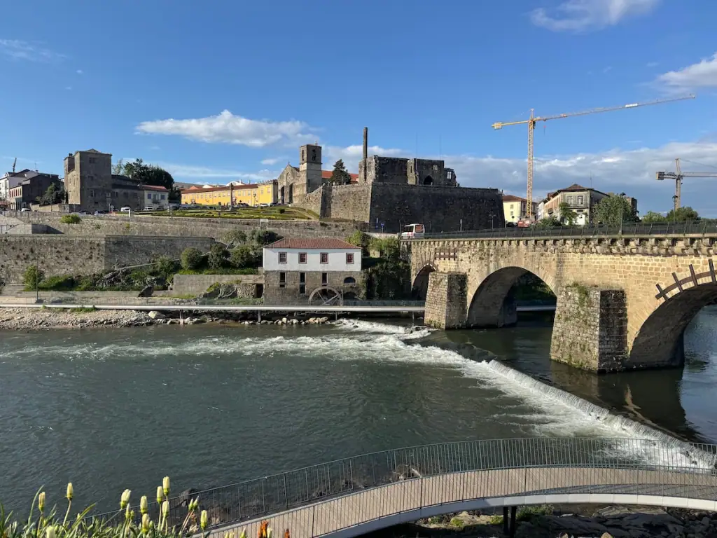
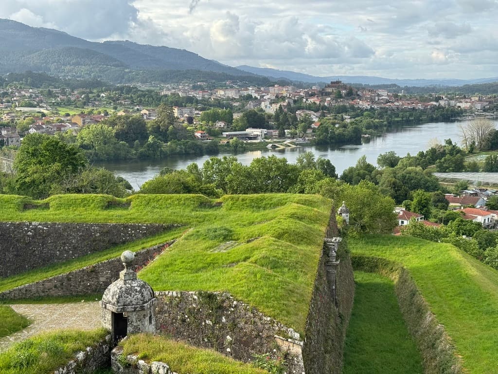
If you're planning on walking farther than Valença, make sure to take a detour west on your way out through the city so you can see its spectacular old fortress–it's one of the coolest stops along this Camino and you don't want to miss it! There's a Camino route that passes through it, but the main route bypasses it.
The fortress was built in the 17th and 18th centuries. The Portuguese used it back in the day to protect the town and keep an eye on their enemy–Spain–right across the river.
Many people continue on to Tui, but Valença is worth considering for your stop instead because of its unique old town within the fortress. I personally really enjoyed having extra time to explore in Valença, and I LOVED my albergue there.

Stops Along the Way
- Ponte Romano (0.6 miles/0.9 km from previous stop)–Here you cross over a cool bridge originally built by the Romans.
- Pecene (1.6 miles/2.6 km from previous stop)
- São Bento da Porta Aberta (0.4 miles/0.7 km from previous stop)–Visit Café Castro for divine pastel de nata and other breakfast food. There's a beautiful church here too, but it wasn't open when I passed through.
- Gontumil (0.8 miles/1.3 km from previous stop)
- Fontoura (1.1 miles/1.8 km from previous stop)–There are a few cafes, places to stay, and an ATM here.
- Paços (1.4 miles/2.2 km from previous stop)–People say Albergue Quinta Estrada Romana here is one of their favorites.
- Ponte da Pedreira (0.6 miles/1.0 km from previous stop)
- Tuído (1.4 miles/2.3 km from previous stop)–North of town, A Toca is a popular spot to stop for a quick bite or a drink.
- Arão (0.9 miles/1.5 km from previous stop)–Contrasta is a good spot to stop for a quick bite.
After Arão, it's 1.4 miles/2.2 km to Valença.
Guide to Valença
- Where to Stay: Hostel Bulwark (private albergue–shared rooms), Alojamento da Vila (hotel–private rooms)
- Where to Eat: Fatum for a pilgrim's menu, Muralha Valenca for a pilgrim's menu, Mocata for a quick bite at a cafe
- Things to Do: Explore the old fortress
Stage 6: Valença to Mos (Crossing Into Spain)
Official Distance: 15.9 miles (25.6 km)
Elevation Gain: 1,308.4 ft (398.8 m)
Elevation Loss: 1,224.9 ft (373.3 m)
As you leave Valença from the old town, you'll pass through the old fortress walls and then walk on a bridge inspired by the Eiffel Tower to cross over the river into Spain. Walk on the right side of the bridge for the best views.
Keep in mind that Spain is an hour ahead of Portugal, so you're going to experience a time change that may feel a little jarring. My cell phone time actually changed early while I was still in Valença, which was a little confusing.
After crossing the bridge, you'll walk through Tui, including its old medieval center. You'll get a little time in nature after that, but then there's a stretch where you're walking alongside a road for a while before the trail enters the woods.
Note that after reaching Tui, you're supposed to collect at least two stamps per day if you want to get a Compostela certificate at the end of your journey.
Most hikers walk to O Porriño or Redondela, but I recommend you consider stopping in Mos instead. It's a charming little mountain village and helps break up the hills on the way to Redondela.

Stops Along the Way
- Tui (1.6 miles/2.6 km from previous stop)–This is the first stop in Spain.
- Virxe do Camiño (2.0 miles/3.2 km from previous stop)
- Ribadelouro (2.5 miles/4.0 km from previous stop)–Before entering the town, you'll see a marker memorializing where San Telmo, patron saint of Tui, allegedly passed away during his pilgrimage in 1251. In the town, Café/Bar Xarden is a lovely spot to stop for breakfast.
- Orbenlle (0.8 miles/1.3 km from previous stop)–The trail splits here. I recommend taking the left route as it goes more through the woods whereas the other path is very urban and industrial for about 3 miles/5 km).
- Centeáns (2.2 miles/3.5 km from previous stop)
- O Porriño (3.0 miles/4.9 km from previous stop)–There are a bunch of accommodation options and some people stop for the night here. Restaurante Paso a Nivel is a good cafe for a quick bite to eat in the city center. Cafe Bar Pasiño a Pasiño north of the city looks good too.
- Ameirolongo – Fonte do Chan (1.1 miles/1.8 km from previous stop)
- Veigadaña (1.0 miles/1.6 km from previous stop)
After Veigadaña, it's 1.7 miles/2.7 km to Mos.

Guide to Mos
- Where to Stay: Albergue de Peregrinos Santa Baia de Mos (municipal–shared rooms),
- Where to Eat: Bar Restaurante Tapería Flora for dinner, Pazo de Mos for a quick bite or drinks at a cafe
- Things to Do: Visit Bo Camiño store for Camino souvenirs
Stage 7: Mos to Pontevedra
Official Distance: 18.3 miles (29.4 km)
Elevation Gain: 2,057.0 ft (627.0 m)
Elevation Loss: 2,230.6 ft (679.9 m)
This is another one of my favorite stretches along the Camino Portugués Central. There's a lot of uphill, but it pays off with spectacular views of the nearby river as you walk through the woods. You also hike through some lovely towns, cross over a medieval bridge, and pass by homes with handmade Camino goods for sale.
There is quite a bit of road walking for portions of this stage, but many of the roads tend to be fairly quiet.
You may notice the path gets busier after you reach Redondela. That's because the Camino Portugués Coastal route joins the Central here. However, most folks who walked the Coastal route will be starting from Redondela, so if you reach the city later in the day, you might miss most of them.
If you want to avoid crowds from this point onward, I recommend staying more off stage or taking the Spiritual Variant after Pontevedra. Staying off stage means staying in places that aren't recommended stops in guidebooks and, thus, tend to be a bit quieter.
Stops Along the Way
- Santiaguiño das Antas (1.9 miles/3.1 km from previous stop)
- Saxamonde (1.7 miles/2.8 km from previous stop)–As you approach Saxamonde, you'll get some beautiful mountain views. Be careful as you approach Saxamonde as the road into town has a really steep downhill. For a nice breakfast, check out Cafe Corisco.
- Redondela (2.1 miles/3.3 km from previous stop)–Many pilgrims spend the night here after Valença/Tui or O Porriño. This is where the Coastal route meets the Central route, so you can expect it to get busier. Don Vinarius good spot to stop for a quick bite.
- Cesantes (2.2 miles/3.5 km from previous stop)–After leaving Cesantes, you'll get to a point where you have to cross over a major highway at a crosswalk. After a short while, you'll turn onto a side road and there's a nice park called Parque Loureiro with picnic tables and shade.
- Arcade (2.4 miles/3.9 km from previous stop)–This is a lovely town by the water that could be a nice place to spend a night. Sunset Bar and Coffee is a good spot to stop for a quick bite or a drink. On your way out of the town, stop in the Camiño dos Soños store–they have one of the coolest Camino stamps and sell drinks and items to help you remember the Camino.
- Pontesampaio (0.9 miles/1.5 km from previous stop)–You get to cross over a cool medieval bridge to enter this town. As you walk through the town, keep an eye out for tables residents have set out to sell Camino shells, pins, and more.
- Cacheiro (1.2 miles/1.9 km from previous stop)–On your way to Cacheiro, the path gets a bit rocky and has some uphill sections. Take a break at a stop with some tents in the woods called A Parada do Camiño. They sell drinks, snacks, and some Camino items there, and if you're lucky, you'll get to meet their sweet little dogs Frida and Leia.
- O Pobo – Santa Marta (3.2 miles/5.2 km from previous stop)–South of O Pobo, you can take a short detour off the route for Bar Casa Fermín, which has great bocadillos and other food options. Shortly before you reach O Pobo, the trail splits–the left option is longer but much lovelier as it follows a stream through a forest for much of the way to Pontevedra whereas the other way follows semi-busy roads.
- Casal do Río (0.2 miles/0.4 km from previous stop)
- Lusquiños (0.6 miles/0.9 km from previous stop)
- O Marco (0.4 miles/0.7 km from previous stop)
After O Marco, it's 1.4 miles/2.2 km to Pontevedra.

Guide to Pontevedra
- Where to Stay: Bulezen Urban Hostel (private albergue–shared rooms), Hostel Charino (private albergue–shared and private rooms), Albergue Virxe Peregrina (municipal albergue-shared rooms)
- Where to Eat: Kamelia Taberna
- Things to Do: Visit the Igrexa da Virxe Peregrina church and attend pilgrim's mass (Monday-Saturday at 7:30 p.m., Sunday at 1 p.m.), explore the Ruínas de San Domingos old ruins
Check out this guide to learn even more about this special city on the Portuguese Way.
Stage 8: Pontevedra to Caldas de Reis
Official Distance: 13.0 miles (21.0 km)
Elevation Gain: 3,361.2 ft (1,024.5 m)
Elevation Loss: 4,165.7 ft (1,269.7 m)
Note: Shortly after leaving Pontevedra, you have the option to continue along the Central route or divert onto the Spiritual Variant, also known as the Variante Espiritual.
The Spiritual Variant includes a boat ride that follows the path the remains of Saint James were allegedly brought into Galicia. I found this route to be a great option for avoiding crowds, and the scenery reminded me of my favorite parts of both the Central and Coastal Portuguese routes. It can be a great option if you can't decide between the Central and Coastal routes or if you want to avoid crowds.
This article covers the stages for staying on the Central route, but you can learn more about the Spiritual Variant in this separate article.
You'll spend much of this day walking through the woods and along quiet roads passing farms and vineyards. The scenery is quite nice, but it's often quite crowded.
I personally found myself feeling a little frustrated at times during this walk. I’m usually pretty relaxed and it takes a lot to bother me, but there were just SO many people and some of them gave me a weird look and ignored me when I told them “Buen Camino”…

Stops Along the Way
- Alba (2.4 miles/3.9 km from previous stop)
- San Caetano (0.4 miles/0.6 km from previous stop)
- Leborei (0.4 miles/0.6 km from previous stop)
- O Castrado (0.5 miles/0.8 km from previous stop)
- San Amaro (1.8 miles/2.9 km from previous stop)–A Pousada do Peregrino is an adorable cafe here that's worth a stop.
- A Portela – Barro (0.6 miles/0.9 km from previous stop)–This is an optional detour that adds some extra distance but is worth it for waterfall views. Keep a close eye on your map though as it's not well marked from the road and I unfortunately missed it myself.
- Briallos (4.2 miles/6.8 km from previous stop)–Oasis is a great place to stop for a quick bite to eat just south of Briallos. Albergue de Peregrinos de Briallos is highly rated.
- Tivó (1.8 miles/2.9 km from previous stop)–Just south of Tivó, visit O Cuberto for a quick bite to eat.
After Tivó, it's 1.2 miles/1.9 km to Caldas de Reis.

Guide to Caldas de Reis
- Where to Stay: Albergue As Pozas Termais (private albergue–shared rooms), Albergue de Caldas de Reis Urraca (private albergue–shared rooms), Pensión Fornos (private pensión–private rooms)
- Where to Eat: Meson Bermaña or other nearby tapas bars for dinner
- Things to Do: Enjoy the hot springs at Hotel Balneario Davila–while there are technically some free places in town where you can soak your feet, it's generally frowned upon and the experience at this hotel is better and provided at a low price (see pricing here)
Stage 9: Caldas de Reis to A Escravitude
Official Distance: 15.2 miles (24.5 km)
Elevation Gain: 1,488.1 ft (453.6 m)
Elevation Loss: 1,278.0 ft (389.5 m)
This day involves a lot of walking through small villages and the woods until you get close to Padrón, where it starts to get more urban.
Padrón is a beautiful city except for the chemical plant that kind of ruins the otherwise lovely views… The church along the Camino route in Padrón is worth a visit because you can see the granite pillar where the boat that allegedly brought Saint James’s remains had docked.
Some pilgrims choose to stop in Padrón, but I didn’t want such a long day walking to Santiago the next day, so I decided to go farther down the trail.
Past Padrón, you walk alongside some busy roads, including a major highway for a while, but the section when you turn off the highway was one of my absolute FAVORITES. You walk along narrow winding roads with stone walls as you pass through small little villages.
In A Escravitude, I spent the night at one of the nicest albergues I’ve ever visited. It’s a new albergue having opened in spring 2025. It has a lovely courtyard with a pool, beds have curtains and outlets, and there are food and drinks that you can buy there.

Stops Along the Way
- Santa Mariña de Carracedo (3.2 miles/5.2 km from previous stop)–Café-Bar Esperon is a great breakfast spot–they even have egg dishes. It's likely to be pretty busy with pilgrims, so keep that in mind.
- Casalderrique (1.1 miles/1.8 km from previous stop)–Fogar do Peregrino here is a nice cafe option.
- O Pino (Valga) (1.6 miles/2.5 km from previous stop)–Albergue de Peregrinos de O Pino – Valga is highly rated.
- San Miguel de Valga (1.4 miles/2.3 km from previous stop)–There are two highly rated bars here that both look to have great food options.
- Pontecesures (2.1 miles/3.3 km from previous stop)–This is where pilgrims who take the boat via the Spiritual Variant rejoin the Central route.
- Herbón (1.7 miles/2.7 km from previous stop)–This is an optional detour that adds some distance, but I've heard the albergue at the Monastery of Herbón is incredible and really worth it. I want to check it out next time I do the Portugués.
- Aduana (0.9 miles/1.4 km from Pontecesures)–Right after the bridge, A Ponte do Peregrino is a great cafe for a quick bite.
- Padrón (1.2 miles/1.9 km from Aduana, 1.9 miles/3.0 km from Herbón)–In the city center, visit Iglesia de Santiago Apóstol de Padrón to see the pillar where legend says the boat that brought the remains of Saint James docked. Many pilgrims spend the night in Padrón, and there are lots of places to stay.
- Iria Flavia (0.6 miles/0.9 km from previous stop)
- Pazos (1.2 miles/2.0 km from previous stop)–Cafeteria Camiño Portugues is a good spot for a quick bite or a drink. In this area, you'll walk alongside a busy highway for a bit, but don't worry, it doesn't last too long!
- Rueiro (0.4 miles/0.6 km from previous stop)
- Tarrio (0.6 miles/0.9 km from previous stop)
- Vilar (0.6 miles/0.9 km from previous stop)
After Vilar, it's 0.5 miles/0.8 km to A Escravitude.
Guide to A Escravitude
- Where to Stay: Albergue Villa Vieira (private albergue–shared and private rooms), Casa Grande de Capellania (hotel–private rooms), Camiño da Vieira (located in Angueira de Suso, private albergue–shared rooms)
- Where to Eat: Reina Lupa for dinner, Café – Bar Rianxeira for a quick bite or drink
- Things to Do: Visit Igrexa da Escravitude church

Stage 10: A Escravitude to Santiago de Compostela
Official Distance: 11.1 miles (17.8 km)
Elevation Gain: 1,554.8 ft (473.9 m)
Elevation Loss: 770.8 ft (234.9 m)
This final stretch of the route goes through the woods a bit, but you do spend a lot of time hiking through suburbs of Santiago de Compostela. There are a few uphill stretches as well.
As you enter Santiago's old town, the Camino Portugués takes you through a different way than the Francés to the cathedral. This means you don’t get to walk by the bagpiper that often plays in the alcove on the way to the cathedral on the northern side where pilgrims hiking the Francés enter.
After you arrive in Santiago de Compostela, take some time to soak up the moment in the cathedral square. You may want to stop by the pilgrim's office to pick up your Compostela certificate for completing the trek, and you may also want to visit the cathedral for pilgrim's mass and to give the Saint James statue a hug (I'm serious! It's a thing!).
Stops Along the Way
- Angueira de Suso (1.2 miles/1.9 km from previous stop)–People say great things about the albergue Camiño da Vieira here.
- Areal (0.4 miles/0.7 km from previous stop)
- Picaraña (0.2 miles/0.4 km from previous stop)
- O Faramello (0.8 miles/1.3 km from previous stop)–Lar, Breakfast & Meals is a decent spot to stop for a quick bite.
- Rúa de Francos (0.6 miles/0.9 km from previous stop)
- Osebe – Casalonga – Pedreira (0.9 miles/1.4 km from previous stop)
- A Grela (2.4 miles/3.9 km from previous stop)
- O Milladoiro (0.4 miles/0.6 km from previous stop)–If you want a shorter last day on the Camino, I highly recommend stopping at Albergue Milladoiro here. I stayed there when I did the Spiritual Variant. It often fills up well in advance, so be sure to book ahead here. For a quick bite to eat, stop at O Camiño Milladoiro.
After O Milladoiro, it's 4.2 miles/6.7 km to Santiago de Compostela.
Guide to Santiago de Compostela
- Where to Stay: Hostal Real de Santiago de Compostela Parador Hotel (hotel–private rooms, such a treat if you want to splurge!), Santiago KM-0 (private albergue–shared rooms), Hostal Alda Catedral (hotel–private rooms); check out this other article for more info on where to stay
- Where to Eat: Cáscara Café for lunch or brunch, Abastos 2.0 for Michelin-recognized but affordable dining, Taberna O Gato Negro for tapas and Galician cuisine
- Things to Do: Check out this article dedicated to the top activities in the city
Conclusion: Stages for the Camino Portugués Central Route
There you have it! I hope you find this article helpful as you think about your Portuguese Camino Central route stages. Let this article be your guide, but don't be afraid to make adjustments along the way based on what you want to get out of your journey!
Download Portuguese Camino Central Route Stages PDF
Want a condensed version of this 10-day Camino Portugués Central route itinerary that you can save and print out? Enter your name and email below to download it. This PDF also includes stages for the Spiritual Variant and the Coastal route.
Read About the Best Albergues on the Portuguese Camino Routes
Learn more about some of the best albergues along the Camino Portugués Central route based on my experience walking solo.


