
Portuguese Camino Coastal Route Stages from Porto for 2026

Planning to hike the Portuguese Camino Coastal route but not sure where to stop—or even what to expect? Whether you're prepping your stages or still deciding if this Camino is for you, you're in the right place.
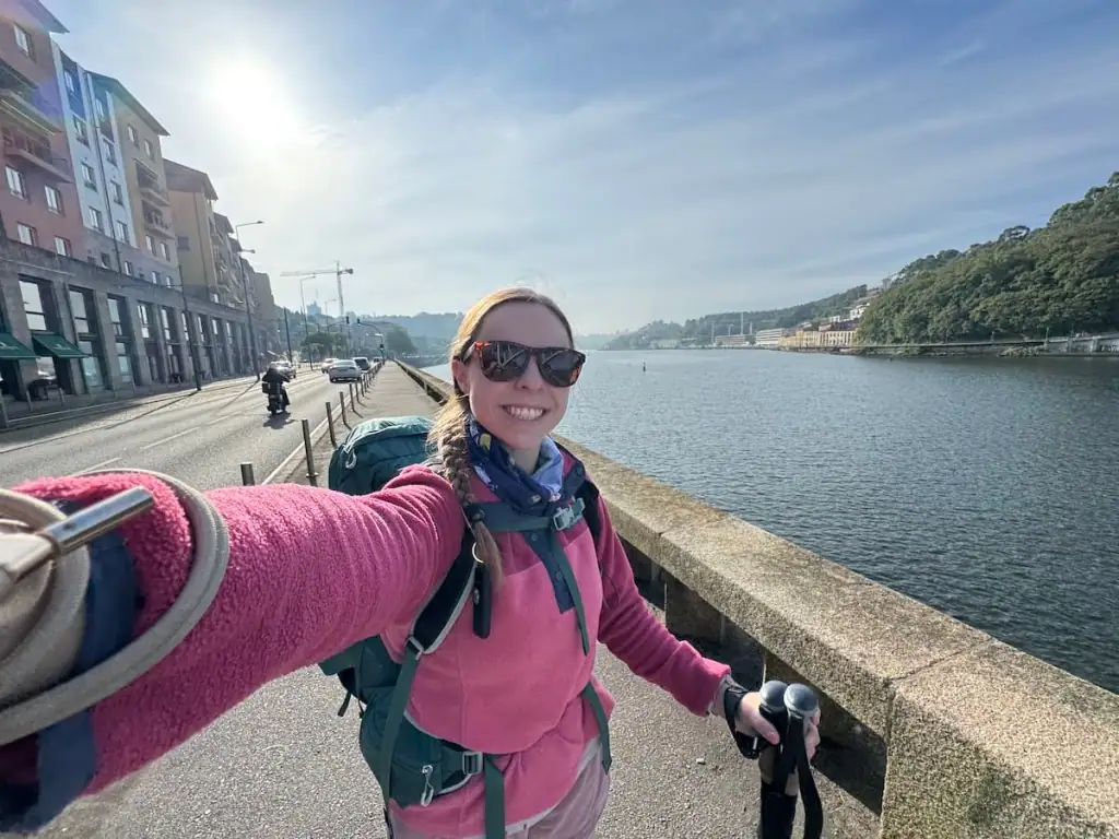
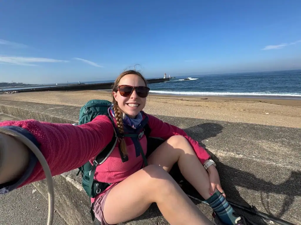
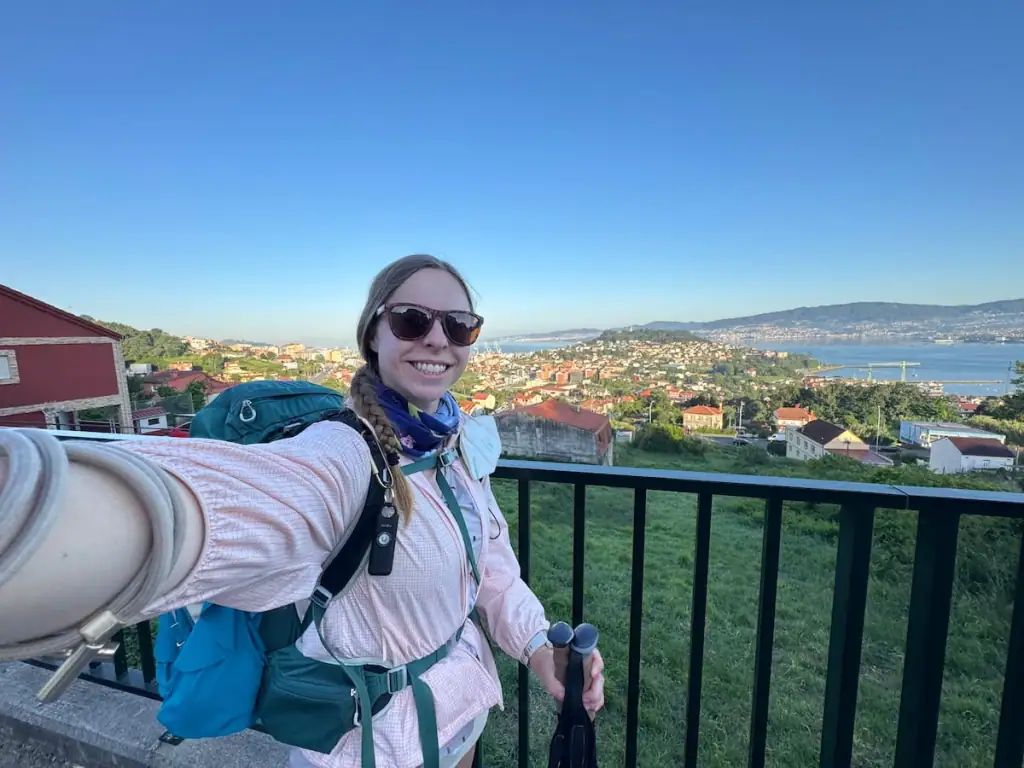
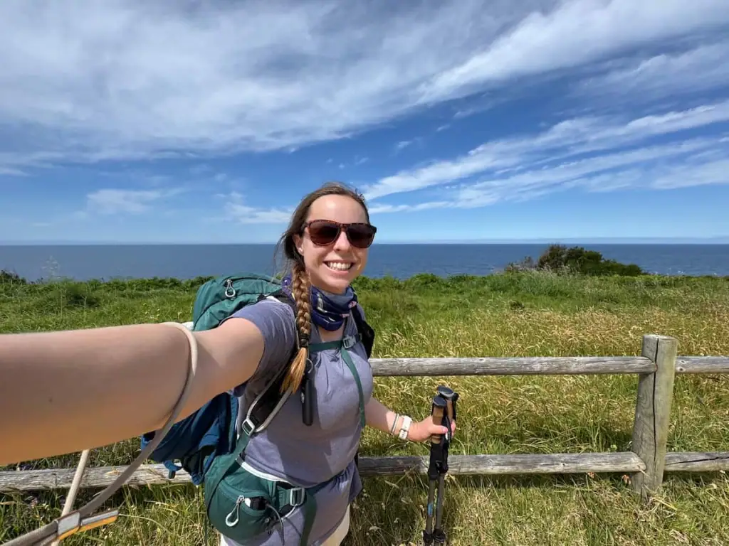
I walked the Portuguese Camino Coastal route solo in May 2025. It was my third Camino, and I left feeling absolutely blown away by the stunning ocean views along the whole route.
In this guide to the Portuguese Camino Coastal route stages (starting from Porto), I’ll share not just the distance and elevation for each stage, but also recommendations on places to stay, where to eat, and things to do all along the way.
My walking stages are for 12 days, but even if you’re planning more or fewer, I’ve built this article to be flexible and helpful either way. You’ll find alternate stopping points throughout so you can make this walk your own.

Camino Portugués Coastal Route Overview
For anyone looking for ocean views, the Camino Portugués Coastal route is a great choice. When compared to the Portuguese Central route or the Camino Francés, the Coastal route is the only one that offers magnificent views of the vibrant blue-green ocean.
Here's an overview of the route:
- Total distance: 170 miles (274 km)
- Average days to complete: 12-15 days
- Total elevation gain: 17,007 ft (5,184 m)
- Number of pilgrims who finished this route in 2024: 74,758 (15.3% of all pilgrims)
- Most popular starting points: 1) Porto (30%), 2) Vigo (20%), 3) Baiona (12%)
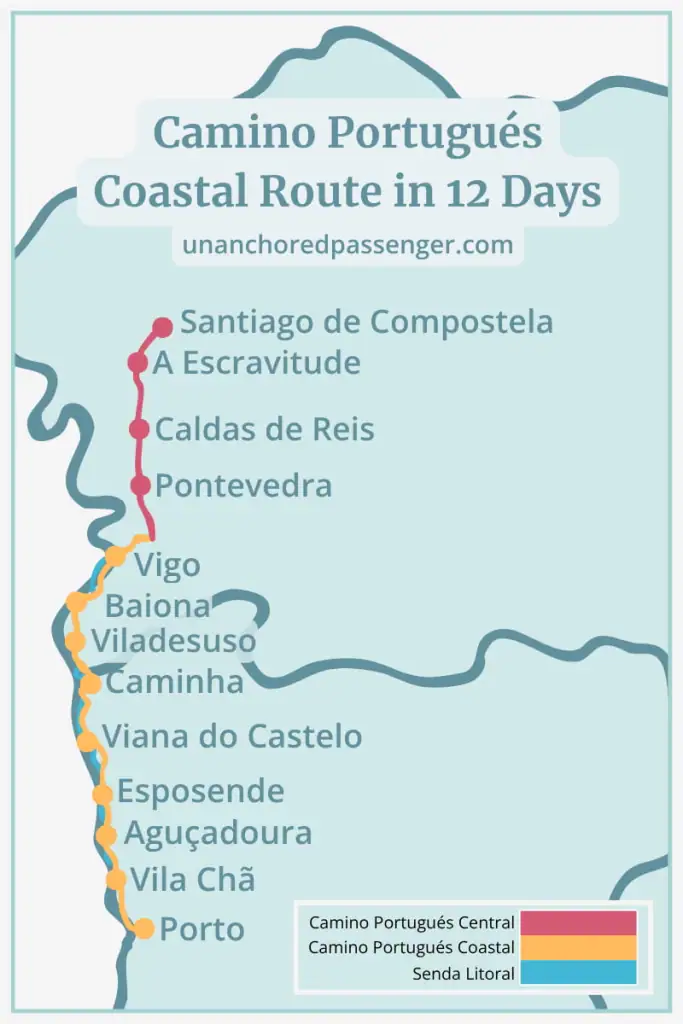
Portuguese Camino Coastal Route Stages Map
As you can see in the map above, the Portuguese Camino Coastal route stages start in Porto, Portugal, traveling north near the coast. After Vigo, the route cuts inland where it joins the Portuguese Camino Central route in Redondela, Spain.
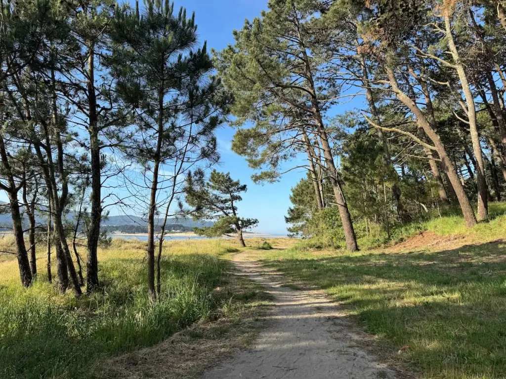
Along the way, there are also opportunities to walk along the Senda Litoral, or Litoral Way (more on that below).
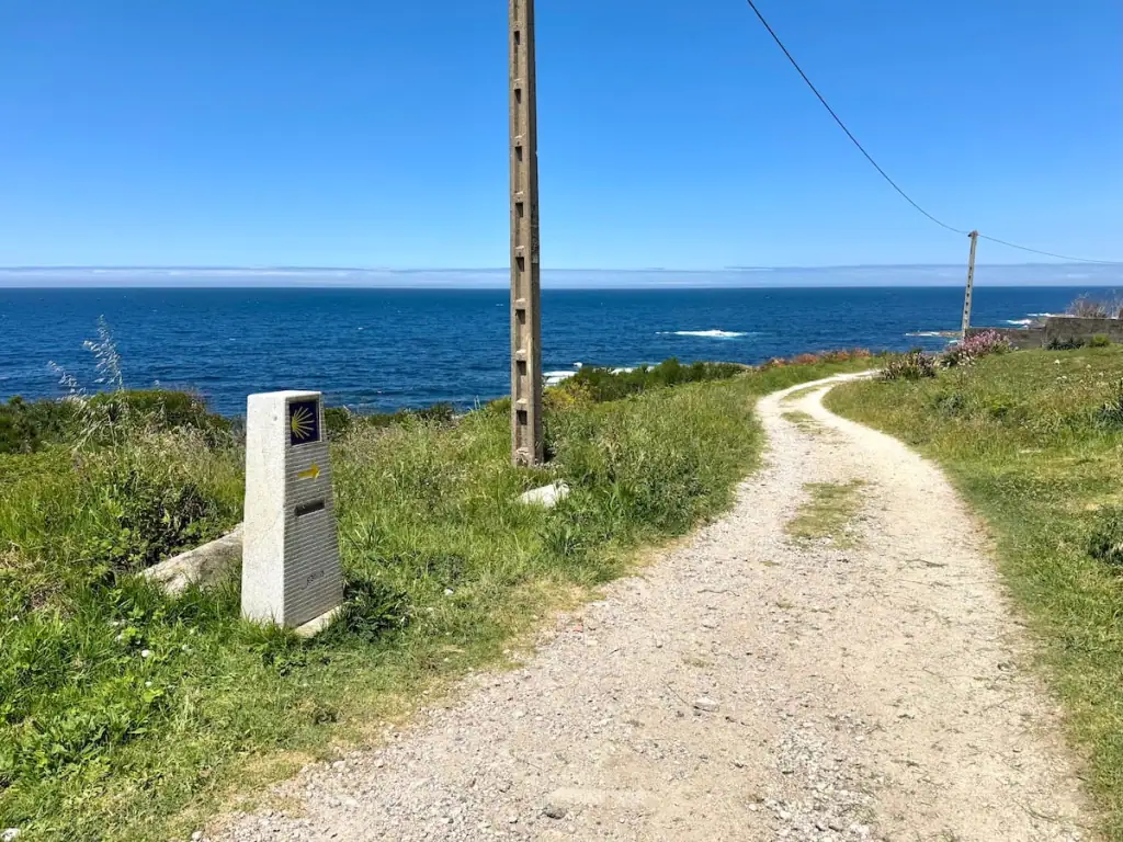
What is the Litoral Way in Portugal?
Before we dive into the route stages, it's important to note that there's a second route that hikers along the Portuguese Coastal Camino route can choose to walk along: the Litoral Way, also known as the Senda Litoral.
The Litoral Way more closely hugs the coastline, whereas the Camino Portugués Coastal–in spite of its name–sometimes runs more inland.
For much of the way, the Litoral Way is joined with the Coastal route. However, every so often, it will branch off from the main Coastal route for several kilometers before rejoining it again.
For the most part, the routes aren't separated long enough for you to have to worry about planning your stages any differently. You can more so just take a look at the map before you walk each day and make a decision in the moment.
The Senda Litoral, however, does tend to be slightly longer than the Coastal route of the Portuguese Way, so keep that in mind as you think about your stages. If you plan to always choose the Senda Litoral, then you may want to stop in earlier towns given the longer distance.
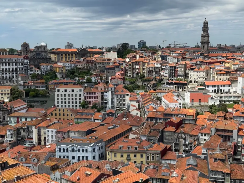
Starting Point for the Camino Portugués Coastal
The Coastal route starts in Porto, Portugal. Like the Camino Portugués Central, the Coastal route starts at the Sé Cathedral in Porto, but instead of traveling more inland, you follow the river out to the coast.
This way out of Porto is technically the Litoral Way, but it's become so popular that some maps may show it as the Coastal route. Everyone I know who started along the coast took the Litoral Way out of Porto first before joining the Coastal route.
Porto, designated a World Heritage site by UNESCO, offers much to do and is worth spending a few days exploring before the Camino if you have the time.
You don't have to start from Porto though. The beauty of the Camino is you can really start wherever you want, so feel free to skip on ahead in this article if you're not starting in Porto.
How to Get to Porto
As Portugal's second largest city, Porto has a decent sized airport. Flying there is the easiest option, but as you look at flights, take a look at Lisbon's airport as well in case you can get a better deal. From Lisbon, you can take the train or bus up to Porto.
I myself have taken the bus from Lisbon to Porto and found it to be pretty easy to navigate and fairly comfortable!

Where to Stay in Porto
Porto has so many places to stay and, honestly, I've been pretty disappointed with a lot of my stays there before. It can be hard to sift through everything and find something that's a good deal and good quality. Here are some options I recommend based on my experiences and talking with others:
📍Budget Option: Albergue de Peregrinos Porto is a little farther from the Porto cathedral, but it's a highly rated albergue and probably one of the best deals you can find in the city.
📍Mid-Range Option: Porto Wine Hostel has both shared dorms and private rooms right in the city center. I stayed here before my Coastal Camino and loved it. It's going to be my new go-to place to stay whenever I'm in Porto again.
📍Luxury Option: Torel Avantgarde offers a truly luxurious experience with its beautiful rooms and pool with views of the Douro River. If you want a really relaxing stay before starting your Camino, consider this hotel.

Where to Get Your Camino Passport
You'll want to carry a Camino passport with you, sometimes referred to as a pilgrim passport or credencial. This passport serves as proof that you're a pilgrim, allowing you to stay in pilgrim-only accommodations along the way. It also provides proof of your journey if you want to get a Compostela certificate at the end to commemorate your experience.
In Porto, you can get your passport for 2 euros at the cathedral entrance ticket desk. Look for a line coming out of the white painted building with steps.
At the ticket desk, you can also purchase a scallop shell for 2 euros for your pack and a ticket to visit the cathedral for 3 euros. If you have the time, I highly recommend a visit to the cathedral. You can see some incredibly detailed blue painted azulejo tiles and even go up in one of the towers for spectacular views of the city.
Keep in mind that the line for the cathedral entrance can be long at times. I recommend buffering in some extra time to be safe. You may also consider going shortly before the cathedral closes as I found the line to be shorter as it got later in the day.
Here are the hours for the cathedral:
- November to March: 9 a.m. to 5:30 p.m.
- April to October: 9 a.m. to 6:30 p.m.
- Daily mass at 11 a.m.
- Tower access closes 30 minutes before the cathedral closes

What to Do with Extra Baggage
You have a few options when it comes to dealing with extra baggage before your Portuguese Coastal Camino. If you'll be returning to Porto afterwards, you can store your luggage in the city.
I recommend Radical Storage for luggage storage. You can find locations all over Porto open at various hours. I personally used Radical Storage in New Zealand and had a great experience.
➡️ Book luggage storage in Porto here.
If you won't be returning to Porto, then you should ship any extra baggage to Santiago de Compostela for you to pick up when you finish. For shipping ahead, I recommend Pilbeo. You can message them over WhatsApp to make a booking: +34 670 64 80 78.
Pilbeo makes the process really easy, picking up your luggage from your accommodation in Porto and then dropping it off at your accommodation in Santiago de Compostela. I coordinated everything with them over WhatsApp, and they were very responsive and helpful. To ship a large checked size suitcase and a small personal item-sized bag, it cost me €104.54.
Portuguese Camino Coastal Route Stages for 12 Days
Most people complete this Camino in 12-14 days. I actually completed it in 14 days for a few reasons:
- I took a rest day since it was my second Camino in a row (started just two days after finishing the Camino Portugués Central route in 10 days)
- I did the Spiritual Variant, an alternate route between Pontevedra and Padrón, adding one more day
I'm not including those for the purposes of this article because I want to show you my walking stages for walking the standard Coastal route and then the Central route from Redondela onwards. I'll be writing a separate article on the Spiritual Variant, so you can stay tuned for more info to come there!
Know that even if you think you may hike this route in shorter or longer time, this itinerary should still be helpful for you! By no means do you have to follow these stages exactly. Throughout this article, I've noted other locations where you could consider staying so you can use this to build your own itinerary.
Now let's dive into the Portuguese Camino Coastal route stages for 12 days.
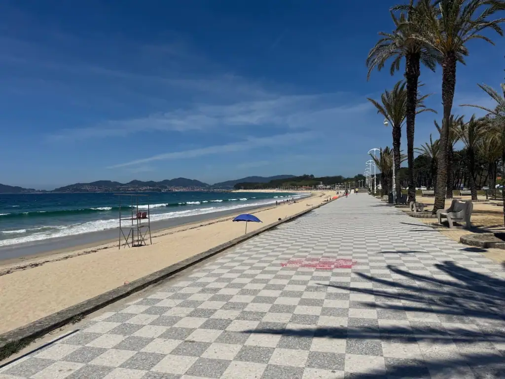
Stage 1: Porto to Vila Chã
Official Distance: 16.2 miles (26.0 km)
Elevation Gain: 669.6 ft (204.1 m)
Elevation Loss: 851.1 ft (259.4 m)
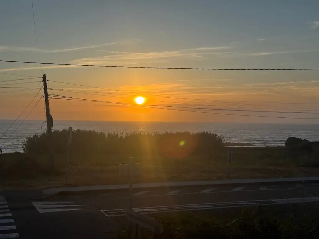
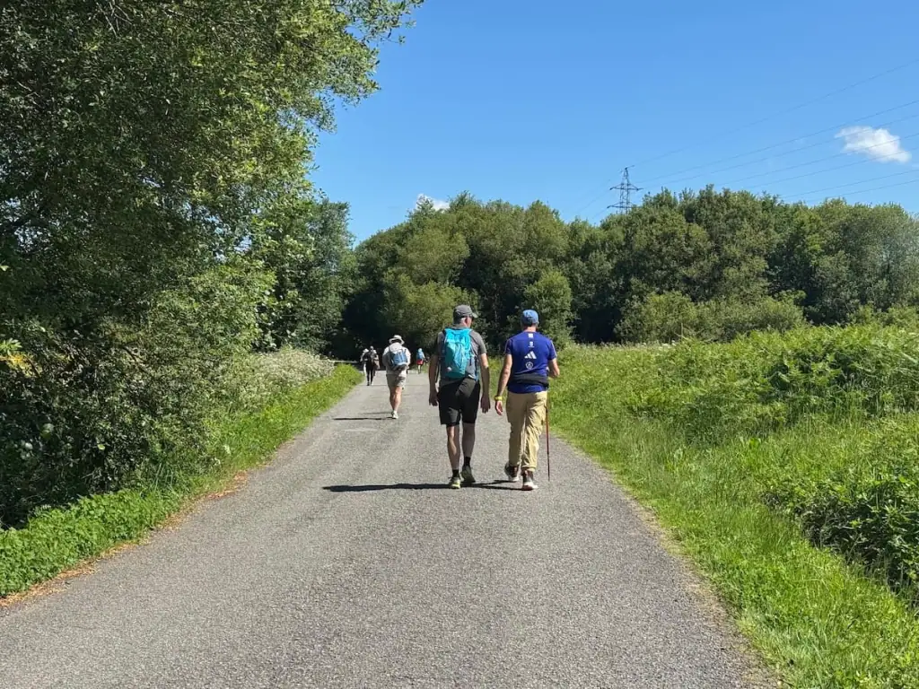
Leaving any big city often means walking along busy roads for a while and Porto is no different. The plus side is that taking the Litoral Way out of the city to the Coastal route involves following the Douro River out of the city until it meets the ocean, meaning you at least have lovely views along the way.
Note that this route of the Portuguese Way out of Porto is not very well marked, so I definitely recommend downloading a Camino app with a map, like Wise Pilgrim or Buen Camino. I didn't see a single Camino marker until I was almost in Matosinhos, about 6.6 miles (10.6 km) into my walk. That said, it is fairly easy to follow the river and then the coastline for a while.
Much of the way during this stage involves walking right along the coast next to a fairly busy road and through built up towns. The walking path tends to be busy along this stretch as well with many locals out walking along the route.
That night I stayed in the municipal albergue in Vila Chã, which turned out to be one of the nicest municipal albergues I’ve ever stayed in. Definitely don't expect all municipal albergues to be this nice!
Stops Along the Way*
- Foz do Douro (3.5 miles/5.7 km from previous stop)
- Matosinhos (3.3 miles/5.3 km from previous stop)–South of Matosinhos, iBar Praia do Aquário is a cafe with incredible ocean views (be prepared to pay extra though). Some people take the metro out of Porto to Matosinhos and start the Camino here. Caruma Surf Hostel here is highly rated.
- Boa Nova Lighthouse (2.4 miles/3.8 km from previous stop)
- Obelisco da Memória (2.4 miles/3.9 km from previous stop)–This obelisk stands in memory of the place where King Pedro IV and 7,500 men in his army landed before traveling to Porto and putting the city under a siege to end the absolutist regime as part of the “War of the Two Brothers.”
- Angeiras (2.3 miles/3.7 km from previous stop)–There are a number of great restaurants to stop for a bite in this fishing village.
- Río Onda (0.7 miles/1.2 km from previous stop)
- Labruge (0.1 miles/0.2 km from previous stop)–Some people stay here. People rave about Smiling Places guest house. There's a large municipal albergue here as well with about 100 beds.
- Castro de São Paio (0.7 miles/1.2 km from previous stop)
After Castro of Sampaio, it's 0.7 miles/1.2 km to Vila Chã.
*Please note that in this article I’ve listed all the places you’ll pass through according to the Wise Pilgrim app (Apple | Android). This does not necessarily mean every place listed will have accommodations or places to get food.
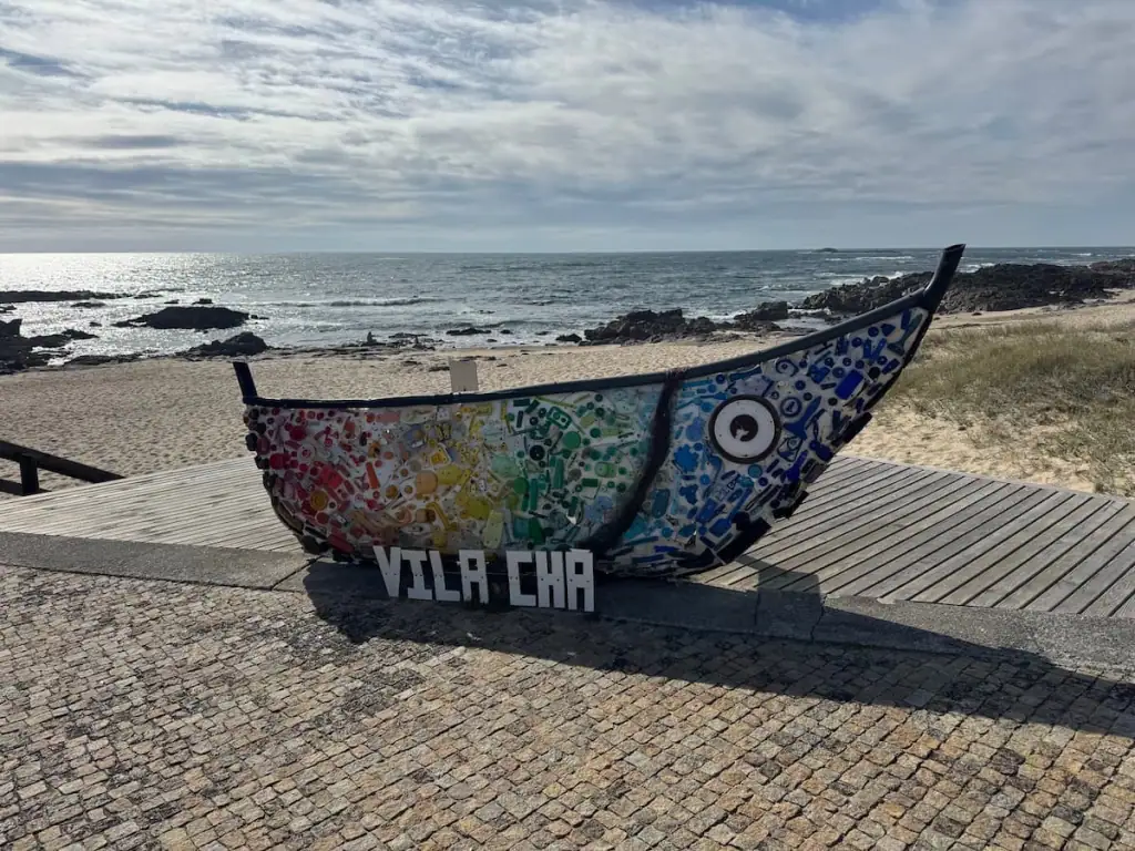
Guide to Vila Chã
- Where to Stay: Albergue São Mamede de Vila Chã (municipal albergue–shared rooms), Trendy Villas (private albergue–shared rooms), Mãe Maria House (guest house–shared and private rooms)
- Where to Eat: Pizzaria Ardéchoise for pizza, Estaleiro for meat and seafood dishes
- Things to Do: Visit the beach at Praia da Congreira
Connect with Other Women Hiking the Camino
Join my free Facebook group! We're building up a community of women who have hiked or are planning to hike the Camino there. You can also get personalized support from me!
Stage 2: Vila Chã to Aguçadoura
Official Distance: 11.2 miles (18.0 km)
Elevation Gain: 363.1 ft (110.7 m)
Elevation Loss: 365.5 ft (111.4 m)
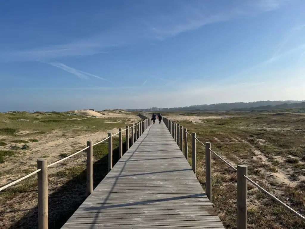
Similar to the first day, you'll continue up along the coast for much of the way. However, the path gets a bit quieter on this day as you get farther out from Porto.
There are a number of lovely boardwalks you walk along on this day. At one point I could hear a ton of frogs croaking. I stopped to listen and a sweet older Portuguese gentleman stopped to talk to me about the frogs—I didn’t really know what all he was saying, but he seemed really excited to tell me about them.
After Vila do Conde, you have the option of staying on the main route or diverting to the Senda Litoral, which follows more closely along the ocean. I stuck with the main route but wish I had taken the Senda Litoral because the main path was very urban for a while without much to see.
For the second day in a row, I was pleasantly surprised by how nice the municipal albergue here is. Note that it can fill up quickly sometimes, so you may want to make a reservation a couple days in advance by messaging them over WhatsApp: +351 962 601 239

Stops Along the Way
- Mindelo (1.6 miles/2.5 km from previous stop)
- Ávore (1.6 miles/2.5 km from previous stop)
- Azurara (1.1 miles/1.8 km from previous stop)
- Vila do Conde (0.5 miles/0.8 km from previous stop)–This is a cool town that some people choose to stay in–check out HI Vila do Conde. For a lovely breakfast, visit Humble Anchor Coffee Roasters. Note that this is one place where you can switch to the Central route.
- Povoa de Varzim (2.4 miles/3.8 km from previous stop)–On your way to Povoa de Varzim from Vila do Conde, I recommend taking the Litoral Way instead of staying on the Coastal route. Povoa de Varzim is a popular beach vacation spot for the Portuguese. Casa Fragosa is a nice albergue right by the beach.
- A Ver-O-Mar (2.4 miles/3.8 km from previous stop)
- Santo André (1.1 miles/1.8 km from previous stop)
After Santo André, it's 1.1 miles/1.7 km to Aguçadoura.
Guide to Aguçadoura
- Where to Stay: Albergue de Aguçadoura
- Where to Eat: Nortada Café for a quick bite, Café Maranhão for a pilgrim menu
- Things to Do: Visit the beach at the Praia da Aguçadoura
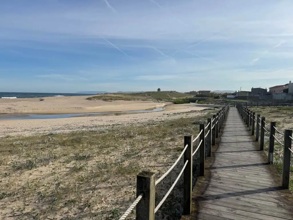
Stage 3: Aguçadoura to Esposende
Official Distance: 8.1 miles (13.0 km)
Elevation Gain: 966.6 ft (294.6 m)
Elevation Loss: 860.9 ft (262.4 m)
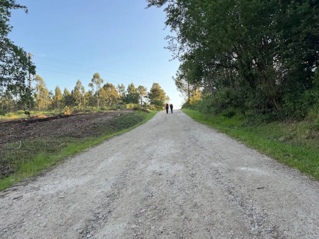
Day 3 has a nice change of scenery moving a bit more inland and into the woods for a bit. You can continue along the coast via the Litoral Way for this entire stage if you prefer, but I found the variety of landscapes to be refreshing, at least until my allergies started killing me and I switched back to the coastline.
Many people choose to walk a bit farther and stop in Marinhas. That was my initial plan, but as I looked into accommodation the night before, I didn’t find much that appeared available there.
Instead, I decided to stay in Esposende where I found such a lovely private albergue with a pool! It ended up being one of my favorite places I stayed on the route, so I'm glad I stopped there instead.
Stops Along the Way
- Apúlia (4.3 miles/7.0 km from previous stop)–South of Apúlia, you'll have the option to continue on the Coastal route through the woods or to take the Litoral Way more closely along the coast. Both are quite nice. In Apúlia, Cafetaria Pão Quente Feliz is a good place to stop for breakfast.
- Fão (2.3 miles/3.7 km from previous stop)–Family Coffee is a nice place to get a quick bite. People also rave about Café Sport.
After Fão, it's 1.4 miles/2.3 km to Esposende.

Guide to Esposende
- Where to Stay: Sea Soul (private albergue with a pool–shared and private rooms), Hostel Eleven (private albergue–shared rooms), Esposende Guesthouse (guesthouse–private rooms)
- Where to Eat: Salão de Chá e Pastelaria Rio Doce for a quick bite to eat, Marine Lounge for a meal or snack and craft beer
- Things to Do: Visit the lighthouse

Stage 4: Esposende to Viana do Castelo
Official Distance: 16.2 miles (26.0 km)
Elevation Gain: 1,253.7 ft (382.1 m)
Elevation Loss: 1,179.0 ft (359.4 m)
Initially I thought about doing the hike from Porto to Viana do Castelo in three days instead of four. The stages over four days were a little shorter at times. But then I thought, why rush?
I was tired from doing the Central Camino Portugués route before this and wanted to enjoy the coastline. I'm glad I did because walking along the coast here really is so lovely and it can be harder to enjoy if you have such long days.
On stage 4, there's another change in scenery as you walk through many quiet villages with the ocean off in the distance. There are some stretches that go through the woods as well.
It all feels very tranquil until you got closer to Viana do Castelo and have to walk along some busy roads.
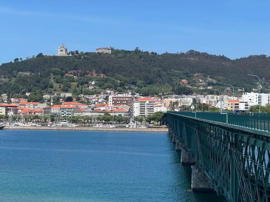
If you want an early rest day, Viana do Castelo could be a wonderful place to stop. There's a lookout point up on a big hill with a church that's supposed to be really nice. I really wanted to go up there but couldn't muster the energy.
Stops Along the Way
- Marinhas (2.9 miles/4.7 km from previous stop)–Initially I had planned to stay here but a lot of accommodations were booked up already. Hostel Costa Selvagem is supposed to be a nice albergue.
- Belinho (2.3 miles/3.7 km from previous stop)–Gato Guloso is a cute cafe with great food.
- Antas (0.5 miles/0.8 km from previous stop)
- Ponte do Sebastião (1.6 miles/2.6 km from previous stop)–From here it is possible to switch to the Litoral Way and follow the beach more closely, but this section is not well maintained and I've heard people recommend sticking to the regular Coastal route instead.
- Castelo do Neiva (1.2 miles/1.9 km from previous stop)
- Mosteiro de São Romão de Neiva (2.1 miles/3.4 km from previous stop)–This monastery looks really cool but didn't appear open when I walked by.
- Chafé (0.6 miles/1.0 km from previous stop)–Stop at Café/Pastelaria São Sebastião for a quick bite to eat. For a place to stay here, check out the highly rated Casa do Campo do Forno.
- Anha (1.5 miles/2.4 km from previous stop)–Igreja Matriz da Paróquia de São Tiago is a nice church with some Camino imagery that you can pop into. Casa de Carolina is a nice place to stay here.
- Ponte Eiffel (2.5 miles/4.0 km from previous stop)–This long bridge was designed by the maker of the Eiffel Tower. It can be quite busy with cars passing through and for me, it was slightly freaky as I'm scared of heights. The views are lovely though, and there is a sidewalk for pedestrians.
After Ponte Eiffel, it's 0.9 miles/1.5 km to Viana do Castelo.
Guide to Viana do Castelo
- Where to Stay: Albergue de Peregrinos Sao Joao dos Caminhos (municipal albergue–shared rooms), HI Viana do Castelo (private albergue–shared and private rooms), Hotel Fabrica do Chocolate (chocolate themed hotel–private rooms)
- Where to Eat: Viana Aromáticas & etc for a menu of the day, O Pescador for seafood, Ribeiro's Brewers for craft beer
- Things to Do: Take a cable car to the Miradouro de Santa Luzia for spectacular views of the city and ocean, visit the old fortress Forte de Santiago de Barra, enjoy the beach at Praia do Coral
Stage 5: Viana do Castelo to Caminha
Official Distance: 17.4 miles (28.0 km)
Elevation Gain: 1,342.2 ft (409.1 m)
Elevation Loss: 1,359.4 ft (414.3 m)
It takes a few miles to get out of the busy Viana do Castelo, but once you do, it's quite a lovely walk. You'll find yourself meandering through small villages with views of the ocean off in the distance if you stay on the Coastal route.
Alternatively, you can take the Litoral Way along the coastline all the way to Vila Praia de Âncora, and I've heard it's quite nice.
There aren't very many places to stop along the Coastal route, especially earlier in the day, so if you see somewhere, I recommend stopping and getting something to eat.
Once you reach Vila Praia de Âncora, you'll follow the coastline for a bit again until spending the last few miles alongside a busy road into Caminha.
If you're getting into Caminha in the afternoon and planning to continue on via the Coastal route, it's best to stop there for the night. To continue onwards, you'll have to take a water taxi and they don't typically run later in the day.
Stops Along the Way
- Areosa (3.0 miles/4.9 km from previous stop)–Leaving Viana do Castelo, you can either take the Litoral Way or continue via the Coastal. If you take the Litoral Way, you'll bypass these first few towns until the route reconnects with the Coastal in Vila Praia de Âncora.
- Carreço (2.2 miles/3.6 km from previous stop)–Bar Cafe Central is the first cafe I saw on this stage. It's a good place to stop for breakfast, and there's a small supermarket next door. Albergue Casa do Sardão here is highly rated.
- Cruzeiro (3.4 miles/5.4 km from previous stop)–A few kilometers before the cruzeiro (cross), you'll find Cafe de Cabanas, which has incredible baked goods and cooked dishes with a lovely outdoor area to sit and enjoy your food. As you approach the cross, there will be some uphill hiking in the woods.
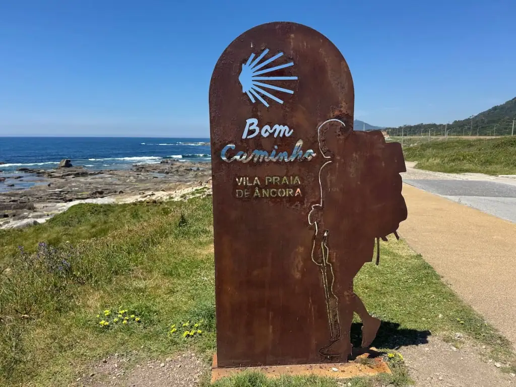
- Vila Praia de Âncora (2.5 miles/4.1 km from previous stop)–There are some bench swings here that are quite lovely for taking a break and taking in the ocean views.
- Moledo (3.0 miles/4.8 km from previous stop)
After Moledo, it's 2.2 miles/3.5 km to Caminha.

Guide to Caminha
- Where to Stay: Bom Caminha (private albergue–shared and private rooms), Arca Nova Hostel (private albergue–shared rooms), Design & Wine Hotel (hotel–private rooms)
- Where to Eat: Canto do Lobo for dinner, Sebastião for Italian food, Pastelaria Caminhense for breakfast
- Things to Do: Explore the old town, visit the Igreja Matriz de Caminha church, walk along the waterfront area
Stage 6: Caminha to Viladesuso (Crossing Into Spain)
Official Distance: 13.0 miles (21.0 km) + a boat ride
Elevation Gain: 924.0 ft (281.6 m)
Elevation Loss: 880.5 ft (268.4 m)
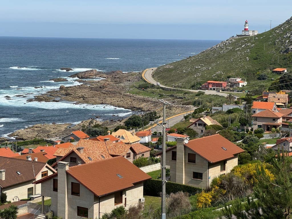
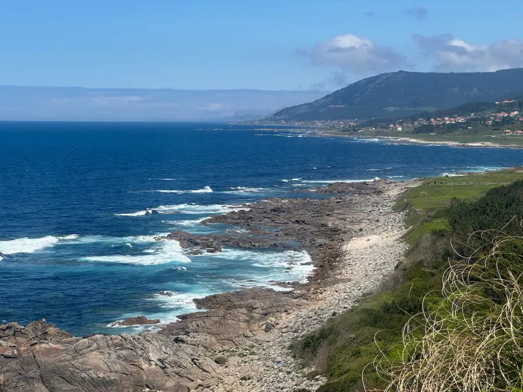
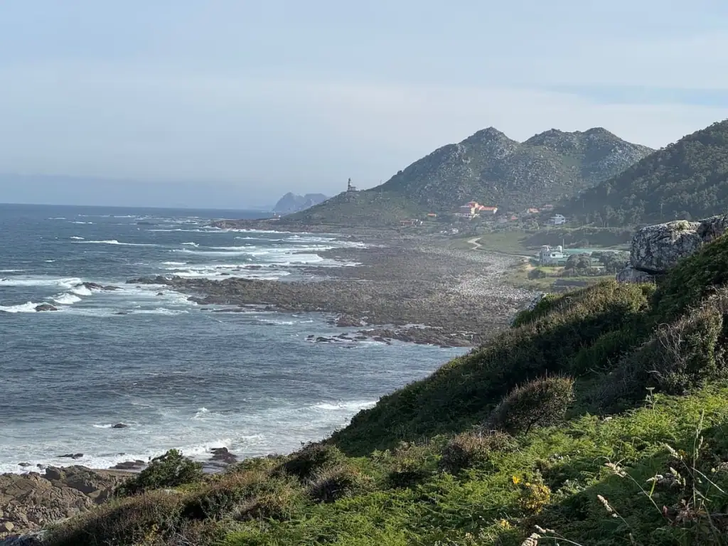
Stage 6 is my favorite of all the Portuguese Camino Coastal route stages. First off, you start the day by taking a little boat to cross into Spain. Then you spend much of the day hiking alongside but high up above the ocean.
Unfortunately, there is some walking alongside a major highway every so often, but the views make it so worth it.
Note that when you enter Spain, the time changes to one hour ahead. Keep that in mind as you're thinking about timing for your hike.

Stops Along the Way
- Water Taxi (0.5 miles/0.8 km from previous stop)–From Caminha, you have to take a water taxi if you want to continue along the Coastal route of the Portuguese Way. I recommend using the only official water taxi provider, Xacobeo Transfer (read about my experience here!).
- Camposancos (1.1 miles/1.7 km from previous stop)–Here you have the option to take the Litoral Way to follow the coastline to A Guarda. I decided to do that here per a local's recommendation and loved it. Stop at Cafetería Restaurante El Molino for a nice breakfast with views of the water.
- A Guarda (2.2 miles/3.5 km from previous stop + 2.5 miles/4 km via Litoral Way)–A Guarda is a lovely seaside town and could be a cool place to spend a night. Albergue O Peirao and Hotel Monumento Convento de San Benito are highly rated places to stay.
- Area Grande (0.7 miles/1.2 km from previous stop)
- Portecelo (3.5 miles/5.6 km from previous stop)–Explanada do Horizonte has good food and incredible ocean views. The fresh tortilla de patatas I had was to die for!
- Oia (3.7 miles/6.0 km from previous stop)–This town right on the water looks like such a cool place to stay or at least grab a bite to eat. La Cala Inn and Casa Picota are highly rated. The church here looked like it was open and probably neat to visit, but it's slightly off the Camino.
After Oia, it's 2.8 miles/4.5 km to Viladesuso.
Guide to Viladesuso
- Where to Stay: Albergue da Estrela (private albergue–shared rooms), Hotel Glasgow (hotel–private rooms)
- Where to Eat: Cafe-Bar Sal de Mar for a quick bite and drinks, Restaurante Lorena for a nice meal
Connect with Other Women Hiking the Camino
Join my free Facebook group! We're building up a community of women who have hiked or are planning to hike the Camino there. You can also get personalized support from me!
Stage 7: Viladesuso to Baiona
Official Distance: 8.3 miles (13.3 km)
Elevation Gain: 934.4 ft (284.8 m)
Elevation Loss: 916.0 ft (279.2 m)
You spend this day continuing to walk along a main highway or near it through some small villages. Again, the highway walking isn't so great, but the views continue to be spectacular. You spend some time walking in the forest as well before you get closer to Baiona.
Some pilgrims continue hiking on past Baiona because this isn't a very long day. However, I highly recommend stopping here. Baiona was my favorite stop on the Camino Portugués Coastal route.
Baiona is a beautiful town right on the water with a charming medieval city center. It's quite historic too as it was the first town in Europe to learn of Christopher Columbus's successful journey to the New World.
Visiting the old fortress in Baiona is a must, and you can even stay there if you want!
Stops Along the Way
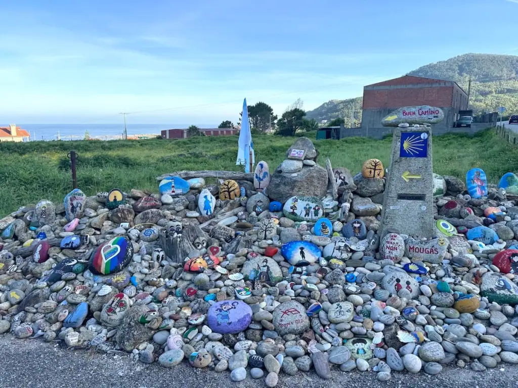
- Mougás (1.2 miles/2.0 km from previous stop)
- As Mariñas (3.3 miles/5.3 km from previous stop)
- Baredo (1.2 miles/1.9 km from previous stop)–Grab a quick bite to eat or a drink at A Casa do Peixe. As you leave Baredo, there will be some steep uphills but you'll be rewarded with amazing views.
After Baredo, it's 1.6 miles/2.5 km to Baiona.

Guide to Baiona
- Where to Stay: Hostel Albergue Baionamar (private albergue–shared rooms), Parador de Baiona (hotel in the old fortress–private rooms), Hotel Pinzon (hotel–private rooms)
- Where to Eat: A Taberna do Abrente for a menu of the day
- Things to Do: Walk around the old fortress Fortaleza de Monterreal, enjoy the beach at Praia da Barbeira, explore the old town
Stage 8: Baiona to Vigo
Official Distance: 16.8 miles (27.1 km)
Elevation Gain: 1,461.5 ft (445.5 m)
Elevation Loss: 1,422.5 ft (433.6 m)
It's a little urban for a while as you leave Baiona but gets quieter at times after Ramallosa. There are some stretches where you walk through forests and small villages.
The directions on this day can get a little confusing as there are so many different ways to go. My understanding is there is no “official way” to get to Vigo, which is why there are so many different options.
I continued along the Portuguese Coastal route for most of the way until I reached a river where I cut west to get to the beach in Samil. From there, I followed the coastline, walking along some of the nicest beaches in the area to Vigo. It's a lovely way to go until you get closer to Vigo where it gets more industrial.
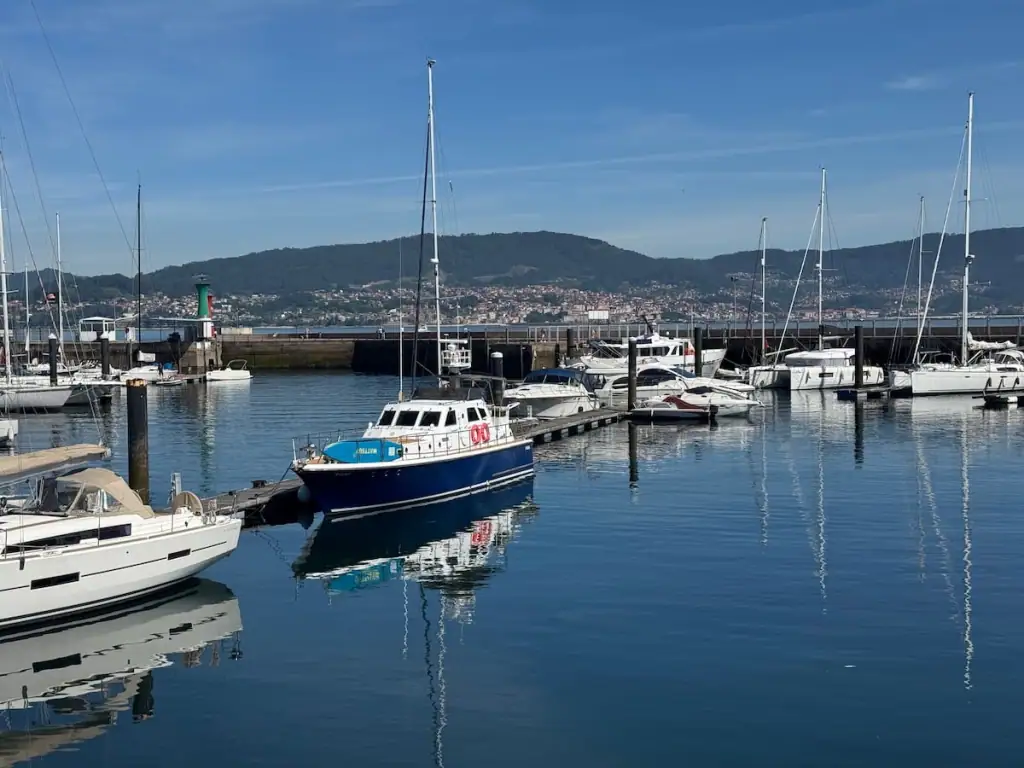
Vigo is one of Spain's largest cities and a great place to spend a rest day if you need one. I decided to take one here because I felt I could use the rest and after studying Spain for so long, I was excited to finally visit this city.
Stops Along the Way
- Sabarís (2.6 miles/4.2 km from previous stop)–Hotel Arce is highly rated. Panadaría Yajoma has great breakfast options.
- Ramallosa (0.3 miles/0.5 km from previous stop)–Here there's an option to switch to the Litoral Way, which you can take all the way to Vigo.
- Nigrán (2.4 miles/3.8 km from previous stop)–Keep an eye out for the “Banco do Peregrino del Paco” bench for pilgrims with a stamp somewhere in Nigrán. There's a cute little guest book you can sign too.
- Iglesia de San Salvador de Corujo (1.9 miles/3 km from previous stop)–Shortly after the church, grab a quick bite for lunch at Panaderia D'Casal. When you reach a river a bit after that, it's recommended to turn left and follow the coast into Vigo.
- Castrelos Park (9.2 miles/14.8 km from previous stop)–If you don't want to spend the night in Vigo, Hotel O'Pazo here is supposed to be quite nice.
After Castrelos Park, it's 2.4 miles/3.8 km to Vigo.
Guide to Vigo
- Where to Stay: Gran Hotel Nagari (hotel with a spa and rooftop hydrotherapy pool–private rooms), Albergue Público de Peregrinos de Vigo Juan Manuel López-Chaves (municipal albergue–shared rooms), Hotel Arsus (hotel–private rooms)
- Where to Eat: Mesón Compostela for seafood, Tapería Boas Tapas for tapas, La Artesata for some of Galicia's best sandwiches, 100 Montaditos for a quick bite, Around for breakfast
- Things to Do: Take a day trip to the Cíes Islands, visit the Castelo do Castro fortress ruins with views over the city, see the Concatedral – Basílica de Santa María de Vigo
Stage 9: Vigo to Pontevedra
Official Distance: 20.6 miles (33.2 km)
Elevation Gain: 2,623.0 ft (799.5 m)
Elevation Loss: 2,435.4 ft (742.3 m)
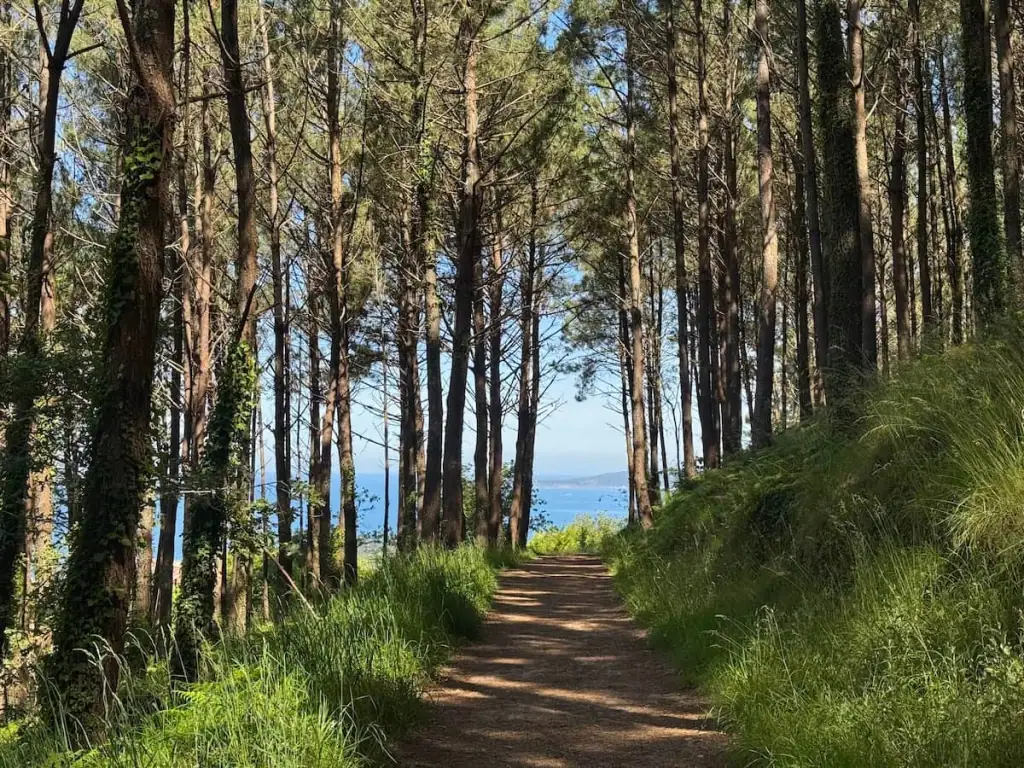
The first few miles out of Vigo are pretty urban walking alongside major roads. After you get out of the city, this stretch of the Camino is one of my favorites with some intense uphills but lots of time spent in the woods and with views of the water below you.
There are very few places to stop until you reach Redondela, so I recommend getting breakfast somewhere on your way out of Vigo. I stopped at a cafe called A Ponte.
After you ascend some of the big hills leaving Vigo, keep an eye out for El Mirador de Nerea. It's a cute little family run stop where you can get drinks, snacks, Camino shells, and bracelets for a donation.
Many pilgrims spend the night in Redondela, which I recommend you consider instead of going all the way to Pontevedra. While it's doable to do the full hike in one day, it's a really long day with a lot of elevation gain too. It was really hot the day I did it, and I was absolutely exhausted by the time I got in.
Plus, Pontevedra is a really special stop on this Camino, and it's nice to have more time and energy to explore all the city has to offer.
In Redondela the Coastal route joins the Camino Portugués Central route. With the joining of the two routes and reaching less than 100 km left to Santiago de Compostela, you'll likely find the trail getting much more crowded.
The best way to avoid crowds from here on out is to stay off stage–which means spending the night in towns not recommended by guidebooks–or to take the Spiritual Variant after Pontevedra.
Stops Along the Way
- Redondela (8.1 miles/13 km from previous stop)–Don Vinarius is a good spot to stop for a quick bite. Albergue Avoa Regina and Rubín 21 are highly rated places to stay here.
- Cesantes (2.2 miles/3.5 km from previous stop)–North of Cesantes, you'll have to cross a major highway at a crosswalk. A little bit farther past that, you'll turn onto a side road where there's a nice park called Parque Loureiro. With picnic tables and shade, it's a great place to take a break before you continue hiking uphill.
- Arcade (2.4 miles/3.9 km from previous stop)–This town sits right by the water and could be a great place to stay. I wanted to stay here initially but didn't find anything in my budget that was available when I looked just a few days before. On your way out of the town, be sure to stop at the Camiño dos Soños store for one of the coolest Camino stamps!
- Pontesampaio (0.9 miles/1.5 km from previous stop)–Here you cross over a medieval bridge to enter the town. As you walk through town, keep an eye out for tables set out by residents with Camino memorabilia for sale. I got a pin here that looks like a yellow arrow and says “Camino Portugués 2023.”
- Cacheiro (1.2 miles/1.9 km from previous stop)–Before you reach this town, the path gets a bit rocky and has some uphill sections. There's a lovely place to stop in the woods with tents (and sometimes sweet dogs!) called A Parada do Camiño. There you can purchase drinks, snacks, and even a Camino souvenir.
- O Pobo – Santa Marta (3.2 miles/5.2 km from previous stop)–Just south of O Pobo, you can take a short detour off the Camino for a quick bite at Bar Casa Fermín. Note that a little before you reach O Pobo, the trail splits–the left option is longer but much lovelier as it follows a stream through a forest for much of the way to Pontevedra whereas the other way follows semi-busy roads.
- Casal do Río (0.2 miles/0.4 km from previous stop)
- Lusquiños (0.6 miles/0.9 km from previous stop)
- O Marco (0.4 miles/0.7 km from previous stop)
After O Marco, it's 1.4 miles/2.2 km to Pontevedra.

Guide to Pontevedra
- Where to Stay: Bulezen Urban Hostel (private albergue–shared rooms), Hostel Charino (private albergue–shared and private rooms), Albergue Virxe Peregrina (municipal albergue-shared rooms)
- Where to Eat: Kamelia Taberna for Spanish tapas
- Things to Do: Attend pilgrims mass at Igrexa da Virxe Peregrina (Monday-Saturday at 7:30 p.m., Sunday at 1 p.m.), explore the Ruínas de San Domingos old ruins
Stage 10: Pontevedra to Caldas de Reis
Official Distance: 13.0 miles (21.0 km)
Elevation Gain: 3,361.2 ft (1,024.5 m)
Elevation Loss: 4,165.7 ft (1,269.7 m)
Note: After Pontevedra, you have the option to divert away from the Central route and take what's called the Spiritual Variant (Variante Espiritual).
The Spiritual Variant is special because it involves a boat ride that follows the same route as the boat that allegedly returned the remains of Saint James to Galicia. This route tends to be less traveled too, so it's a great for avoiding the crowds that are common as you get closer to Santiago.
This route also reminded me of my favorite parts of both the Central and Coastal routes, so if you're torn deciding between the two, it could be a good option for you.
This article does not include stages for the Spiritual Variant. Read this separate article for stages for that detour to Santiago de Compostela.
The scenery during this stage is quite nice with the path passing through the woods and along quiet roads passing farms and vineyards. However, this stage often gets quite crowded.
I myself felt a little frustrated with the crowds at times on this stretch. Usually crowds don't bother me much, but there were just SO many people and some completely ignored me when I said “Buen Camino.”

Stops Along the Way
- Alba (2.4 miles/3.9 km from previous stop)
- San Caetano (0.4 miles/0.6 km from previous stop)
- Leborei (0.4 miles/0.6 km from previous stop)
- O Castrado (0.5 miles/0.8 km from previous stop)
- San Amaro (1.8 miles/2.9 km from previous stop)–Stop at the most charming cafe A Pousada do Peregrino for breakfast.
- A Portela – Barro (0.6 miles/0.9 km from previous stop)–There's an optional detour here that takes you to some waterfall views. It's not well marked from the road and I unfortunately missed it myself, so keep a close eye on your map.
- Briallos (4.2 miles/6.8 km from previous stop)–Stop by Oasis for a quick bite to eat just south of Briallos. Albergue de Peregrinos de Briallos here is highly rated.
- Tivó (1.8 miles/2.9 km from previous stop)–Visit O Cuberto just south of Tivó for a quick bite.
After Tivó, it's 1.2 miles/1.9 km to Caldas de Reis.

Guide to Caldas de Reis
- Where to Stay: Albergue As Pozas Termais (private albergue–shared rooms), Albergue de Caldas de Reis Urraca (private albergue–shared rooms), Pensión Fornos (private pensión–private rooms)
- Where to Eat: Meson Bermaña or other nearby tapas bars for dinner
- Things to Do: Soak in the hot springs at Hotel Balneario Davila–it's discouraged to enjoy the hot springs in any of the public spaces, and this hotel experience is better and affordable (see pricing here)
Stage 11: Caldas de Reis to A Escravitude
Official Distance: 15.2 miles (24.5 km)
Elevation Gain: 1,488.1 ft (453.6 m)
Elevation Loss: 1,278.0 ft (389.5 m)
Day 11 involves walking through the woods and small villages until it gets more urban as you approach Padrón.
If it weren't for the chemical plant there, Padrón would be beautiful. Padrón is a prominent stop on the Camino since it's where the boat carrying Saint James's remains into Galicia allegedly docked. It's worth a visit to the church there that has the granite pillar where the boat supposedly docked.
I continued on past Padrón because I didn't want such a long day to Santiago de Compostela the next day. However, some pilgrims choose to spend the night there.
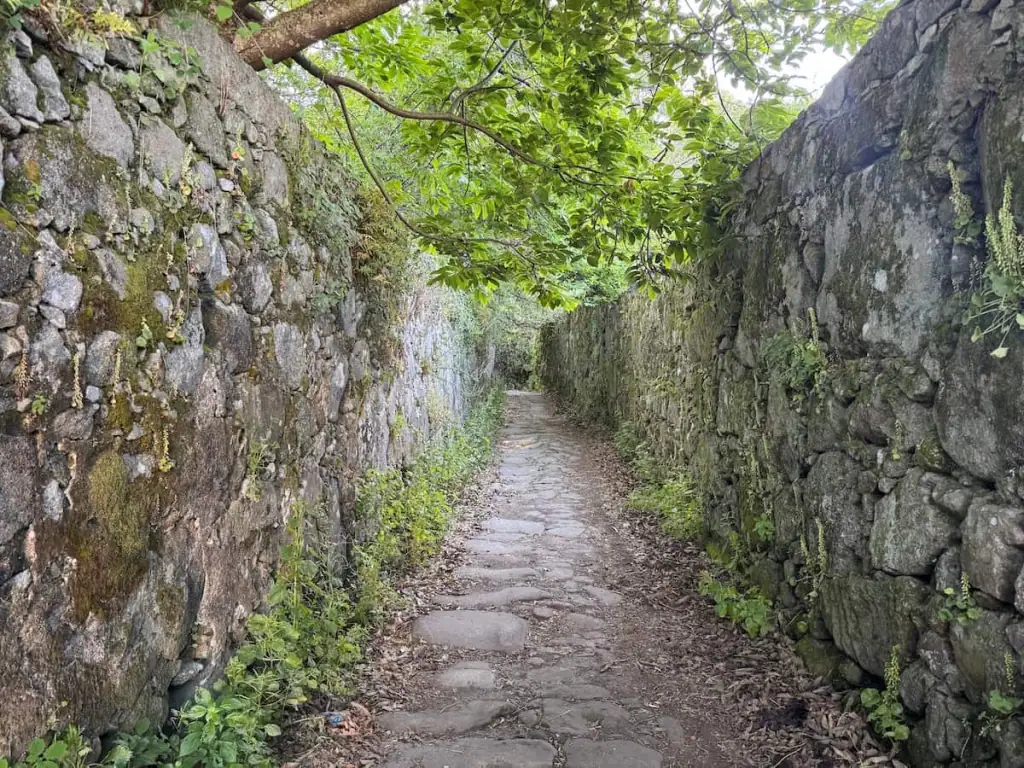
After leaving the city, you walk alongside some busy roads for a short while before turning off and walking through a series of small villages with stone walls along the narrow roads. It's so charming and one of my favorite sections of the trail.
A Escravitude doesn't have too much going on, but it has a really nice new albergue that opened in 2025 and has a pool. It was one of the best albergues on either Camino Portuguese route that I stayed in.

Stops Along the Way
- Santa Mariña de Carracedo (3.2 miles/5.2 km from previous stop)–You can get a great breakfast at Café-Bar Esperon.
- Casalderrique (1.1 miles/1.8 km from previous stop)–Fogar do Peregrino is a nice cafe here.
- O Pino (Valga) (1.6 miles/2.5 km from previous stop)–Albergue de Peregrinos de O Pino – Valga is highly rated.
- San Miguel de Valga (1.4 miles/2.3 km from previous stop)–There are two bars here that are well rated.
- Pontecesures (2.1 miles/3.3 km from previous stop)–Pilgrims who take the boat via the Spiritual Variant rejoin the Central route here.
- Herbón (1.7 miles/2.7 km from previous stop)–This is an optional detour that adds some distance, but people say the albergue at the Monastery of Herbón is incredible and one of their favorite albergues on the Camino.
- Aduana (0.9 miles/1.4 km from Pontecesures)–A Ponte do Peregrino is a great cafe for a quick bite right after the bridge.
- Padrón (1.2 miles/1.9 km from Aduana, 1.9 miles/3.0 km from Herbón)–Check out the Iglesia de Santiago Apóstol de Padrón church to see the pillar where legend says the boat that brought the remains of Saint James docked. Many pilgrims spend the night here and there are lots of places to stay.
- Iria Flavia (0.6 miles/0.9 km from previous stop)
- Pazos (1.2 miles/2.0 km from previous stop)–You can get a quick bite or a drink at Cafeteria Camiño Portugues. It's your last stop for a little while.
- Rueiro (0.4 miles/0.6 km from previous stop)
- Tarrio (0.6 miles/0.9 km from previous stop)
- Vilar (0.6 miles/0.9 km from previous stop)
After Vilar, it's 0.5 miles/0.8 km to A Escravitude.
Guide to A Escravitude
- Where to Stay: Albergue Villa Vieira (private albergue–shared and private rooms), Casa Grande de Capellania (hotel–private rooms), Camiño da Vieira (located in Angueira de Suso, private albergue–shared rooms)
- Where to Eat: Reina Lupa for dinner, Café – Bar Rianxeira for a quick bite or drink
- Things to Do: Visit Igrexa da Escravitude church

Stage 12: A Escravitude to Santiago de Compostela
Official Distance: 11.1 miles (17.8 km)
Elevation Gain: 1,554.8 ft (473.9 m)
Elevation Loss: 770.8 ft (234.9 m)
The last stage goes through the woods for a bit until going through town after town as you get closer to Santiago de Compostela. You will encounter some hills and may even spot the cathedral at a distance while you're still a few kilometers away.
When you arrive in Santiago, take some time to enjoy the moment. Capture photos in the cathedral square and take in the emotions of all the pilgrims around you.
When you're done, you may want to pick up your Compostela certificate at the pilgrim's office and visit the cathedral for pilgrim's mass. Outside of mass, it's worth checking out the cathedral as well for a closer look at everything inside. Entry is free, and you can see the alleged remains of Saint James and even hug a statue of him at the altar.
Stops Along the Way
- Angueira de Suso (1.2 miles/1.9 km from previous stop)–Albergue Camiño da Vieira is supposed to be quite a nice place to stay.
- Areal (0.4 miles/0.7 km from previous stop)
- Picaraña (0.2 miles/0.4 km from previous stop)
- O Faramello (0.8 miles/1.3 km from previous stop)–You can get a decent bite to eat at Lar, Breakfast & Meals.
- Rúa de Francos (0.6 miles/0.9 km from previous stop)
- Osebe – Casalonga – Pedreira (0.9 miles/1.4 km from previous stop)
- A Grela (2.4 miles/3.9 km from previous stop)
- O Milladoiro (0.4 miles/0.6 km from previous stop)–For an even shorter last day on the Camino de Santiago, consider stopping at Albergue Milladoiro. I stayed there after I did the Spiritual Variant. For a quick bite to eat, stop at O Camiño Milladoiro.
After O Milladoiro, it's 4.2 miles/6.7 km to Santiago de Compostela.
Guide to Santiago de Compostela
- Where to Stay: Hostal Real de Santiago de Compostela Parador Hotel (hotel–private rooms, such a treat if you want to splurge!), Santiago KM-0 (private albergue–shared rooms), Hostal Alda Catedral (hotel–private rooms); read this article for more about the best places to stay in Santiago
- Where to Eat: Cáscara Café for lunch or brunch, Abastos 2.0 for Michelin-recognized but affordable dining, Taberna O Gato Negro for tapas and Galician cuisine
- Things to Do: Check out this article on the top things to do in Santiago after the Camino
Conclusion: Stages for the Camino Portugués Coastal Route
There you have it! I hope you find this article helpful as you think about your Portuguese Camino Coastal route stages. Let this article be your guide, but don’t be afraid to make adjustments along the way based on what you want to get out of your journey!
Download Portuguese Camino Coastal Route Stages PDF
Want a condensed version of this 12-day Camino Portugués Coastal route itinerary that you can save and print out? Enter your name and email below to download it. This PDF also includes stages for the Spiritual Variant and the Central route.
Read About the Best Albergues on the Portuguese Camino Routes
Learn more about some of the best albergues along the Camino Portugués Coastal route based on my experience walking solo.


